How to get to Estrada Rio d'Ouro by bus?
Click on the bus route to see step by step directions with maps, line arrival times and updated time schedules.
From Shopping Nova América (Shopping Nova América Del Castilho), Del Castilho
46 minFrom Avenida Marechal Fontenelle, Campo Dos Afonsos
59 minFrom Aeroporto Galeão, Galeão
56 minFrom Avenida Itaóca, Bonsucesso
44 minFrom Morro da Caixa D'Agua, Belford Roxo
46 minFrom Brigadeiro Lima E Silva, Duque De Caxias
40 minFrom Hospital Estadual Carlos Chagas, Marechal Hermes
36 minFrom BRT - Estação Madureira, Madureira
33 minFrom Del Castilho, Del Castilho
40 minFrom Cachambi, Cachambi
60 min
How to get to Estrada Rio d'Ouro by train?
Click on the train route to see step by step directions with maps, line arrival times and updated time schedules.
From Shopping Nova América (Shopping Nova América Del Castilho), Del Castilho
70 minFrom Avenida Itaóca, Bonsucesso
97 minFrom Morro da Caixa D'Agua, Belford Roxo
62 minFrom Brigadeiro Lima E Silva, Duque De Caxias
117 minFrom Hospital Estadual Carlos Chagas, Marechal Hermes
88 minFrom BRT - Estação Madureira, Madureira
52 minFrom Del Castilho, Del Castilho
67 minFrom Cachambi, Cachambi
82 min
How to get to Estrada Rio d'Ouro by metro?
Click on the metro route to see step by step directions with maps, line arrival times and updated time schedules.
Bus stops near Estrada Rio d'Ouro in Acari
Metro station near Estrada Rio d'Ouro in Acari
- Engenheiro Rubens Paiva, 11 min walk,VIEW
Train station near Estrada Rio d'Ouro in Acari
- Costa Barros, 24 min walk,VIEW
Bus lines to Estrada Rio d'Ouro in Acari
- 428L, Nova Aurora,VIEW
- 665, Pavuna (Via Coelho Neto),VIEW
- SVA 685, Irajá,VIEW
- 687, Pavuna,VIEW
- 688, Méier,VIEW
- 713L, Cosmorama,VIEW
- 715L, Cascadura (Via Três Setas / Jardim Redentor),VIEW
- 720L, Cascadura,VIEW
- 729L, São Vicente,VIEW
- 734L, Vila Norma / Cosmorama,VIEW
- 736L, Cascadura,VIEW
- 738L, Jardim Metrópoles,VIEW
- 919, Maré (via Bonsucesso),VIEW
- SN 919, Pavuna (via Saída 7),VIEW
- 946, Engenho Da Rainha,VIEW
- 298, Castelo (Desvio Na Pça. Da Cruz Vermelha),VIEW
- SN 298, Castelo,VIEW
- 785, Marechal Hermes,VIEW
- SVA 665, Saens Peña,VIEW
- 362, Honório (Área De Lazer),VIEW
What are the closest stations to Estrada Rio d'Ouro?
The closest stations to Estrada Rio d'Ouro are:
- Metrô Acari/Fazenda Botafogo (Sentido Pavuna) is 324 meters away, 5 min walk.
- Antigo Ponto Final Do 298 is 543 meters away, 7 min walk.
- Rua Embaú, 381-389 is 611 meters away, 8 min walk.
- Avenida Pastor Martin Luther King Junior, 10771 is 614 meters away, 8 min walk.
- Rua Embaú, 380 is 624 meters away, 8 min walk.
- Engenheiro Rubens Paiva is 806 meters away, 11 min walk.
- Costa Barros is 1820 meters away, 24 min walk.
Which bus lines stop near Estrada Rio d'Ouro?
These bus lines stop near Estrada Rio d'Ouro: 665, 687, 688, 729L, 736L, 946.
Which metro line stops near Estrada Rio d'Ouro?
L2 (Pavuna)
Which train line stops near Estrada Rio d'Ouro?
RAMAL BELFORD ROXO (Belford Roxo)
What’s the nearest metro station to Estrada Rio d'Ouro in Acari?
The nearest metro station to Estrada Rio d'Ouro in Acari is Engenheiro Rubens Paiva. It’s a 11 min walk away.
What’s the nearest train station to Estrada Rio d'Ouro in Acari?
The nearest train station to Estrada Rio d'Ouro in Acari is Costa Barros. It’s a 24 min walk away.
What’s the nearest bus station to Estrada Rio d'Ouro in Acari?
The nearest bus station to Estrada Rio d'Ouro in Acari is Metrô Acari/Fazenda Botafogo (Sentido Pavuna). It’s a 5 min walk away.
What time is the first metro to Estrada Rio d'Ouro in Acari?
The L2 is the first metro that goes to Estrada Rio d'Ouro in Acari. It stops nearby at 5:01 AM.
What time is the last metro to Estrada Rio d'Ouro in Acari?
The L2 is the last metro that goes to Estrada Rio d'Ouro in Acari. It stops nearby at 12:49 AM.
What time is the first train to Estrada Rio d'Ouro in Acari?
The RAMAL BELFORD ROXO is the first train that goes to Estrada Rio d'Ouro in Acari. It stops nearby at 5:04 AM.
What time is the last train to Estrada Rio d'Ouro in Acari?
The RAMAL BELFORD ROXO is the last train that goes to Estrada Rio d'Ouro in Acari. It stops nearby at 10:12 PM.
What time is the first bus to Estrada Rio d'Ouro in Acari?
The SN 298 is the first bus that goes to Estrada Rio d'Ouro in Acari. It stops nearby at 3:01 AM.
What time is the last bus to Estrada Rio d'Ouro in Acari?
The SN 298 is the last bus that goes to Estrada Rio d'Ouro in Acari. It stops nearby at 3:08 AM.
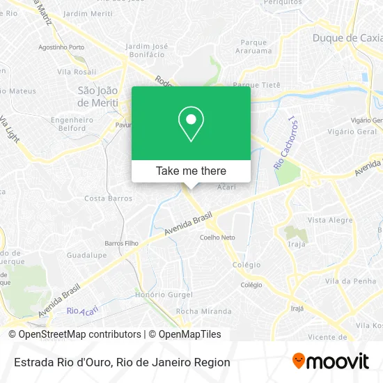
See Estrada Rio d'Ouro, Acari, on the map
Public Transit to Estrada Rio d'Ouro in Acari
Wondering how to get to Estrada Rio d'Ouro in Acari? Moovit helps you find the best way to get to Estrada Rio d'Ouro with step-by-step directions from the nearest public transit station.
Moovit provides free maps and live directions to help you navigate through your city. View schedules, routes, timetables, and find out how long does it take to get to Estrada Rio d'Ouro in real time.
Looking for the nearest stop or station to Estrada Rio d'Ouro? Check out this list of stops closest to your destination: Metrô Acari/Fazenda Botafogo (Sentido Pavuna); Antigo Ponto Final Do 298; Rua Embaú; Avenida Pastor Martin Luther King Junior; Rua Embaú; Engenheiro Rubens Paiva; Costa Barros.
Bus: 665, 687, 688, 729L, 736L, 946, 428L, SVA 685, 298, SN 298, 785, SVA 665, 362, SR 362, 920.Metro: L2.Train: RAMAL BELFORD ROXO.
Want to see if there’s another route that gets you there at an earlier time? Moovit helps you find alternative routes or times. Get directions from and directions to Estrada Rio d'Ouro easily from the Moovit App or Website.
We make riding to Estrada Rio d'Ouro easy, which is why over 1.5 million users, including users in Acari, trust Moovit as the best app for public transit. You don’t need to download an individual bus app or train app, Moovit is your all-in-one transit app that helps you find the best bus time or train time available.
For information on prices of bus, metro and train, costs and ride fares to Estrada Rio d'Ouro, please check the Moovit app.
Use the app to navigate to popular places including to the airport, hospital, stadium, grocery store, mall, coffee shop, school, college, and university.
Estrada Rio d'Ouro Address: Acari Rio de Janeiro-RJ street in Acari
- Rua Matura,
- O Guloso,
- Beira Rio - Rua Matura (Ra - Pavuna),
- Loba Comercio Produtos de Sorvetes,
- Polo Norte De Acari Dist.E Comercio De Gelo,
- Avenida Pastor Martin Luther King Júnior, 91,
- MetrôRio-Acari / Fazenda Botafogo,
- Avenida Prefeito Sá Lessa,
- Avenida Pastor Martin Luther king Jr. 10184,
- Kaila e Paula Representacoes,
- Praça Acari,
- Rose Roupas e Acessorios,
- Ciep Rainha Nzinga Angola,
- Jvs Eletricista,
- Pws Instalacoes Eletricas,
- Solotec Assistencia Tecnica e Manutencao,
- Granes Quilombo,
- Avenida Prefeito Sá Lessa / RJ-085,
- Bar e Pensao Espalha a Brasa,
- MetrôRio - Estação Acari / Fazenda Botafogo
Places Near Estrada Rio d'Ouro (Acari)
- Rio De Janeiro,
- Feira Livre da Gloria, Glória,
- Shopping Rio Sul, Botafogo,
- Rua Ulysses Guimarães 16, Cidade Nova,
- Hospital Pedro Ernesto, Vila Isabel,
- Niterói, Niterói,
- Hospital Federal Do Andaraí, Andaraí,
- Hospital Municipal Ronaldo Gazolla, Acari,
- Norte Shopping, Cachambi,
- Avenida Venezuela 134, Saúde,
- Hospital Federal Cardoso Fontes, Jacarepaguá,
- Rodoviária Novo Rio (Rodoviária do Rio de Janeiro), Santo Cristo,
- Shopping Downtown, Barra Da Tijuca,
- Praia do Arpoador, Ipanema,
- Rua Licínio Cardoso, São Francisco Xavier,
- Shopping Nova América, Del Castilho,
- Shopping RioSul, Botafogo,
- Feirão De Malhas, Duque De Caxias,
- Museu Do Amanhã, Centro,
- Avenida Rio Branco, Centro
How to get to popular places in Rio de Janeiro Region with public transit
Get around Acari by public transit!
Traveling around Acari has never been so easy. See step by step directions as you travel to any attraction, street or major public transit station. View bus and train schedules, arrival times, service alerts and detailed routes on a map, so you know exactly how to get to anywhere in Acari.
When traveling to any destination around Acari use Moovit's Live Directions with Get Off Notifications to know exactly where and how far to walk, how long to wait for your line, and how many stops are left. Moovit will alert you when it's time to get off — no need to constantly re-check whether yours is the next stop.
Wondering how to use public transit in Acari or how to pay for public transit in Acari? Moovit public transit app can help you navigate your way with public transit easily, and at minimum cost. It includes public transit fees, ticket prices, and costs. Looking for a map of Acari public transit lines? Moovit public transit app shows all public transit maps in Acari with all Bus, Train, Metro, Light Rail, Ferry, Cable Car, Gondola and Funicular routes and stops on an interactive map.
Rio de Janeiro Region has 8 transit type(s), including: Bus, Train, Metro, Light Rail, Ferry, Cable Car, Gondola and Funicular, operated by several transit agencies, including TrensRJ, Metrô Rio, VLT Carioca, Barcas Rio, BRT MOBI-Rio, Auto Viação Alpha, Auto Viação Tijuca, Gire Transportes, Transurb, Viação Nossa Senhora das Graças, Consórcio INTERSUL, Braso Lisboa (Municipal), Caprichosa Auto Ônibus, Auto Viação Três Amigos and Rodoviária Âncora Matias