Directions to Estrada Visconde de Lamare, 161 (Cacuia) with public transportation
The following transit lines have routes that pass near Estrada Visconde de Lamare, 161
 Bus: 2343, 325, 634, 324, SN 324.
- Ferry: ILHA DO GOVERNADOR - PRAÇA XV, COCOTÁ - PRAÇA XV.
How to get to Estrada Visconde de Lamare, 161 by bus?
Click on the bus route to see step by step directions with maps, line arrival times and updated time schedules.
From Avenida Erasmo Braga, Centro
49 minFrom Tribunal de Justiça do Estado do Rio de Janeiro (TJRJ), Centro
49 minFrom Rua dos Andradas, Centro
47 minFrom Rio Imagem, Centro
43 minFrom Bonsucesso, Bonsucesso
47 minFrom rua senador alencar, Imperial De São Cristóvão
70 minFrom Rua da Quitanda 191, Centro
50 minFrom MetrôRio-Central do Brasil (Estação de Metrô Central), Centro
45 minFrom Forum, Centro
49 minFrom Terminal Menezes Côrtes, Centro
53 min
How to get to Estrada Visconde de Lamare, 161 by ferry?
Click on the ferry route to see step by step directions with maps, line arrival times and updated time schedules.
Bus stops near Estrada Visconde de Lamare, 161 in Cacuia
Ferry stations near Estrada Visconde de Lamare, 161 in Cacuia
Bus lines to Estrada Visconde de Lamare, 161 in Cacuia
- 324, Ribeira - Candelária (Brs 4 - Via Jardim Guanabara / Av. Brasil),VIEW
- SN 324, Ribeira - Candelária (Brs 4 - Via Aeroporto ✈),VIEW
- 325, Ribeira - Castelo (Brs 4 - Via Jardim Guanabara / Linha Vermelha),VIEW
- 901, Bananal - Bonsucesso (via Ribeira / Jardim Guanabara),VIEW
- 921, Ribeira - Bancários (via Cocotá),VIEW
- SV 921, Ribeira - Bancários (via Barcas),VIEW
- 2343, Ribeira - Castelo (Brs 4 - Via Linha Vermelha),VIEW
- 696, Praia do Dendê - Méier (Via Av. Brasil),VIEW
- SN 696, Praia do Dendê - Meier (Via Praia do Rosa / Bancários),VIEW
- 925, Bancários - Aeroporto ✈ (Via Área de Apoio - Circular),VIEW
- 739L, Vilar Dos Teles (Via Av. Brasil),VIEW
- 323, Bananal - Castelo (Brs 4 - via Linha Vermelha),VIEW
- 327, Ribeira - Castelo (Brs 4 - via Linha Vermelha),VIEW
- 328, Bananal - Candelária (Brs 4 - via Av. Brasil),VIEW
- SN 328, Bananal - Candelária (Brs 4 - via Aeroporto / Av. Brasil),VIEW
- SP 328, Bananal - BRT Fundão (via Cocotá / Cacuia),VIEW
- SR 328, Bananal - Candelária (Brs 4 - Expresso),VIEW
- 634, Bananal - Saens Peña (Brs 6 - via Bonsucesso),VIEW
- SN 634, Bananal - Saens Peña (Brs 6 - via Aeroporto / Bonsucesso),VIEW
- 635, Bananal - Saens Peña (Brs 6 - via Linha Vermelha / São Cristóvão),VIEW
What are the closest stations to Estrada Visconde de Lamare, 161?
The closest stations to Estrada Visconde de Lamare, 161 are:
- Estrada Do Rio Jequiá, 1546 is 209 meters away, 3 min walk.
- Estrada Da Bica, 575 is 419 meters away, 6 min walk.
- Estrada Do Galeão, 55-63 is 423 meters away, 6 min walk.
- Estrada Da Cacuia, 786 is 608 meters away, 9 min walk.
- Rua Tenente Cleto Campelo, 27 is 674 meters away, 9 min walk.
- Terminal De Barcas - Cocotá ⛴ is 1861 meters away, 24 min walk.
- Praia Da Bica - Ilha Do Governador is 2590 meters away, 33 min walk.
Which bus lines stop near Estrada Visconde de Lamare, 161?
These bus lines stop near Estrada Visconde de Lamare, 161: 2343, 325, 634.
Which ferry line stops near Estrada Visconde de Lamare, 161?
ILHA DO GOVERNADOR - PRAÇA XV (Ilha Do Governador (Praia Da Bica))
What’s the nearest bus station to Estrada Visconde de Lamare, 161 in Cacuia?
The nearest bus station to Estrada Visconde de Lamare, 161 in Cacuia is Estrada Do Rio Jequiá, 1546. It’s a 3 min walk away.
What’s the nearest ferry station to Estrada Visconde de Lamare, 161 in Cacuia?
The nearest ferry station to Estrada Visconde de Lamare, 161 in Cacuia is Terminal De Barcas - Cocotá ⛴. It’s a 24 min walk away.
What time is the first bus to Estrada Visconde de Lamare, 161 in Cacuia?
The SN 696 is the first bus that goes to Estrada Visconde de Lamare, 161 in Cacuia. It stops nearby at 3:00 AM.
What time is the last bus to Estrada Visconde de Lamare, 161 in Cacuia?
The SN 634 is the last bus that goes to Estrada Visconde de Lamare, 161 in Cacuia. It stops nearby at 3:42 AM.
What time is the first ferry to Estrada Visconde de Lamare, 161 in Cacuia?
The COCOTÁ - PRAÇA XV is the first ferry that goes to Estrada Visconde de Lamare, 161 in Cacuia. It stops nearby at 7:00 AM.
What time is the last ferry to Estrada Visconde de Lamare, 161 in Cacuia?
The COCOTÁ - PRAÇA XV is the last ferry that goes to Estrada Visconde de Lamare, 161 in Cacuia. It stops nearby at 8:45 PM.
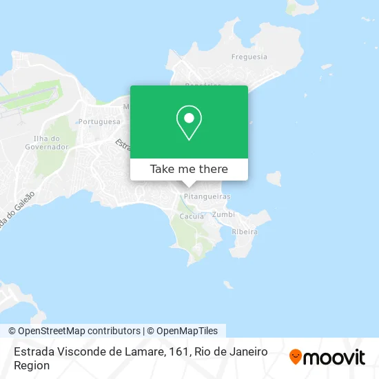
See Estrada Visconde de Lamare, 161, Cacuia, on the map
Public Transit to Estrada Visconde de Lamare, 161 in Cacuia
Wondering how to get to Estrada Visconde de Lamare, 161 in Cacuia? Moovit helps you find the best way to get to Estrada Visconde de Lamare, 161 with step-by-step directions from the nearest public transit station.
Moovit provides free maps and live directions to help you navigate through your city. View schedules, routes, timetables, and find out how long does it take to get to Estrada Visconde de Lamare, 161 in real time.
Looking for the nearest stop or station to Estrada Visconde de Lamare, 161? Check out this list of stops closest to your destination: Estrada Do Rio Jequiá; Estrada Da Bica; Estrada Do Galeão; Estrada Da Cacuia; Rua Tenente Cleto Campelo; Terminal De Barcas - Cocotá ⛴; Praia Da Bica - Ilha Do Governador.
Bus: 2343, 325, 634, 324, SN 324, 901, 921, 696, SN 696, 925, 739L, 323, 327, 328, SN 328, SP 328, 913.Ferry: ILHA DO GOVERNADOR - PRAÇA XV, COCOTÁ - PRAÇA XV.
Want to see if there’s another route that gets you there at an earlier time? Moovit helps you find alternative routes or times. Get directions from and directions to Estrada Visconde de Lamare, 161 easily from the Moovit App or Website.
We make riding to Estrada Visconde de Lamare, 161 easy, which is why over 1.5 million users, including users in Cacuia, trust Moovit as the best app for public transit. You don’t need to download an individual bus app or train app, Moovit is your all-in-one transit app that helps you find the best bus time or train time available.
For information on prices of bus and ferry, costs and ride fares to Estrada Visconde de Lamare, 161, please check the Moovit app.
Use the app to navigate to popular places including to the airport, hospital, stadium, grocery store, mall, coffee shop, school, college, and university.
Estrada Visconde de Lamare, 161 Address: Cacuia Rio de Janeiro-RJ street in Cacuia
- Ilha do governador,
- Rua Ibatuba / Rua Nossa Senhora das Graças,
- Rua Dante Santoro, 51,
- Rua Cachoeira do Mato / Rua Floresta Azul,
- Bairro Nossa Senhora Das Graças,
- Rua Feira Grande / Estrada Visconde de Lamare,
- Rua Floresta Azul, 100,
- Rua Feira Grande,
- Rua Ibatuba, 23,
- Maria de Lourdes Magalhaes da Silva,
- Estrada Do Rio Jequia,
- Rua Visconde DeLamare,
- C. I. E. P. Olga Benario Prestes,
- Associação de Moradores do Boogie Woogie,
- Hospital de Eletrodomesticos Brubilei,
- Homephisio Servicos de Fisioterapia,
- Portão de Oração,
- Avenida Coronel Luiz de Oliveira Sampaio,
- Praia da Guanabara Freguesia Bananal Ilha do Governador Rio de Janeiro RJ,
- Estrada do Rio Jequia Próximo ao 1674
Places Near Estrada Visconde de Lamare, 161 (Cacuia)
- Rodoviária Novo Rio (Rodoviária do Rio de Janeiro), Santo Cristo,
- Hospital Pedro Ernesto, Vila Isabel,
- Feirão De Malhas, Duque De Caxias,
- Hospital Federal Do Andaraí, Andaraí,
- Praia do Arpoador, Ipanema,
- Shopping Rio Sul, Botafogo,
- Museu Do Amanhã, Centro,
- Niterói, Niterói,
- Norte Shopping, Cachambi,
- Rua Licínio Cardoso, São Francisco Xavier,
- Avenida Rio Branco, Centro,
- Shopping Downtown, Barra Da Tijuca,
- Rio De Janeiro,
- Hospital Federal Cardoso Fontes, Jacarepaguá,
- Avenida Venezuela 134, Saúde,
- Hospital Municipal Ronaldo Gazolla, Acari,
- Shopping Nova América, Del Castilho,
- Shopping RioSul, Botafogo,
- Rua Ulysses Guimarães 16, Cidade Nova,
- Feira Livre da Gloria, Glória
How to get to popular places in Rio de Janeiro Region with public transit
Get around Cacuia by public transit!
Traveling around Cacuia has never been so easy. See step by step directions as you travel to any attraction, street or major public transit station. View bus and train schedules, arrival times, service alerts and detailed routes on a map, so you know exactly how to get to anywhere in Cacuia.
When traveling to any destination around Cacuia use Moovit's Live Directions with Get Off Notifications to know exactly where and how far to walk, how long to wait for your line, and how many stops are left. Moovit will alert you when it's time to get off — no need to constantly re-check whether yours is the next stop.
Wondering how to use public transit in Cacuia or how to pay for public transit in Cacuia? Moovit public transit app can help you navigate your way with public transit easily, and at minimum cost. It includes public transit fees, ticket prices, and costs. Looking for a map of Cacuia public transit lines? Moovit public transit app shows all public transit maps in Cacuia with all Bus, Train, Metro, Light Rail, Ferry, Cable Car, Gondola and Funicular routes and stops on an interactive map.
Rio de Janeiro Region has 8 transit type(s), including: Bus, Train, Metro, Light Rail, Ferry, Cable Car, Gondola and Funicular, operated by several transit agencies, including TrensRJ, Metrô Rio, VLT Carioca, Barcas Rio, BRT MOBI-Rio, Auto Viação Alpha, Auto Viação Tijuca, Gire Transportes, Transurb, Viação Nossa Senhora das Graças, Consórcio INTERSUL, Braso Lisboa (Municipal), Caprichosa Auto Ônibus, Auto Viação Três Amigos and Rodoviária Âncora Matias