How to get to Etech Data by bus?
Click on the bus route to see step by step directions with maps, line arrival times and updated time schedules.
From Forest Hill Community High School, West Palm Beach
64 minFrom Singer Island, Riviera Beach
65 minFrom Lake Worth, FL, Lake Worth
73 minFrom Greenacres, FL, Lake Worth
58 minFrom Lake Worth Tri Rail Station, Lake Worth
94 minFrom South Florida Fairgrounds, Royal Palm Beach-West Jupiter
49 minFrom Palm Beach State College, Lake Worth
81 minFrom John I. Leonard High School, Lake Worth
68 minFrom 1661B South Congress Avenue, Lake Worth
75 minFrom Saint Marys Hospital, West Palm Beach
37 min
Bus stop near Etech Data in West Palm Beach
- PALM BCH LAKES BLVD at ROBBINS DR, 4 min walk,VIEW
Train stations near Etech Data in West Palm Beach
Bus lines to Etech Data in West Palm Beach
- 33, Rt 33 Northbound,VIEW
What are the closest stations to Etech Data?
The closest stations to Etech Data are:
- PALM BCH LAKES BLVD at ROBBINS DR is 279 yards away, 4 min walk.
- West Palm Beach Station is 3280 yards away, 39 min walk.
- West Palm Beach Amtrak Station is 3349 yards away, 40 min walk.
Which bus lines stop near Etech Data?
These bus lines stop near Etech Data: 20, 33, 43.
What’s the nearest bus station to Etech Data in West Palm Beach?
The nearest bus station to Etech Data in West Palm Beach is PALM BCH LAKES BLVD at ROBBINS DR. It’s a 4 min walk away.
What time is the first train to Etech Data in West Palm Beach?
The TRIRAIL is the first train that goes to Etech Data in West Palm Beach. It stops nearby at 3:56 AM.
What time is the last train to Etech Data in West Palm Beach?
The FLORIDIAN is the last train that goes to Etech Data in West Palm Beach. It stops nearby at 4:16 PM.
What time is the first bus to Etech Data in West Palm Beach?
The 33 is the first bus that goes to Etech Data in West Palm Beach. It stops nearby at 5:38 AM.
What time is the last bus to Etech Data in West Palm Beach?
The 33 is the last bus that goes to Etech Data in West Palm Beach. It stops nearby at 9:31 PM.
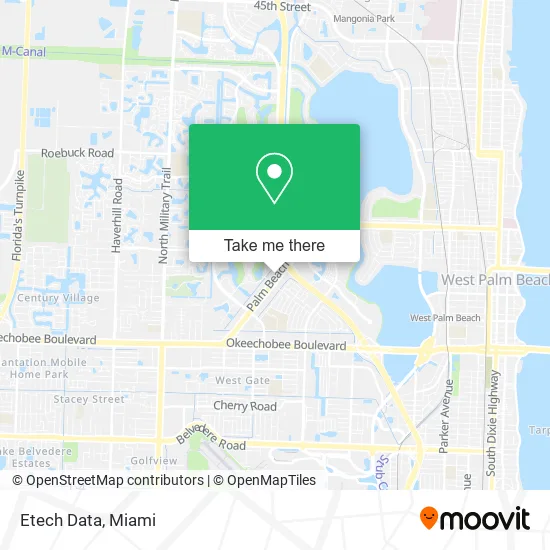
See Etech Data, West Palm Beach, on the map
Public Transit to Etech Data in West Palm Beach
Wondering how to get to Etech Data in West Palm Beach? Moovit helps you find the best way to get to Etech Data with step-by-step directions from the nearest public transit station.
Moovit provides free maps and live directions to help you navigate through your city. View schedules, routes, timetables, and find out how long does it take to get to Etech Data in real time.
Looking for the nearest stop or station to Etech Data? Check out this list of stops closest to your destination: PALM BCH LAKES BLVD at ROBBINS DR; West Palm Beach Station; West Palm Beach Amtrak Station.
Bus: 20, 33, 43.Train: TRIRAIL, FLORIDIAN, SILVER METEOR.
Want to see if there’s another route that gets you there at an earlier time? Moovit helps you find alternative routes or times. Get directions from and directions to Etech Data easily from the Moovit App or Website.
We make riding to Etech Data easy, which is why over 1.5 million users, including users in West Palm Beach, trust Moovit as the best app for public transit. You don’t need to download an individual bus app or train app, Moovit is your all-in-one transit app that helps you find the best bus time or train time available.
For information on prices of bus and train, costs and ride fares to Etech Data, please check the Moovit app.
Use the app to navigate to popular places including to the airport, hospital, stadium, grocery store, mall, coffee shop, school, college, and university.
Etech Data Address: 1897 Palm Beach Lakes Blvd West Palm Beach, FL 33409 street in West Palm Beach
- Palm Bea Delivery Dude,
- Mothers Against Murderers Association Inc.,
- Ambar Financial Services,
- Luxury Maids,
- Natural Hair Serenity,
- Embler, Kenneth B,
- The Meeting Place,
- Masters Real Estate,
- Ruisi Vincent LCSW,
- Right at Home,
- David R Meeker, DMD,
- Allure Massage,
- Amara Temple Holding Corporation,
- Amara Shriners,
- Ramada by Wyndham West Palm Beach Airport,
- Terminix,
- Clarke & Platt PA,
- Peduzzi & Peduzzi, P.A.,
- South Florida Clinical Treatment Centers,
- Sandra Caico Facials
Places Near Etech Data (West Palm Beach)
- Miami-Dade County Courthouse, Miami,
- Dolphin Mall, Miami,
- Little Havana, Miami,
- Hard Rock Stadium, Miami Gardens,
- Marlins Park, Miami,
- Richard E. Gerstein Justice Building, Miami,
- Aventura Mall, Miami Beach,
- Miami Design District, Miami,
- Brickell City Centre, Miami,
- Bayside Marketplace, Miami,
- Wynwood, Miami,
- Sawgrass Mall, Miami,
- Sawgrass mall ( FL ), Miami Beach,
- Aventura Mall, Miami,
- Port of Miami Cruise Terminal, Miami,
- Zoo Miami, Miami,
- Dolphin Mall Bus, Miami,
- Keiser University Flagship Campus, West Palm Beach,
- 1351 NW 12th St, Miami,
- Miami Freedom Park, Miami
How to get to popular places in Miami with public transit
Get around West Palm Beach by public transit!
Traveling around West Palm Beach has never been so easy. See step by step directions as you travel to any attraction, street or major public transit station. View bus and train schedules, arrival times, service alerts and detailed routes on a map, so you know exactly how to get to anywhere in West Palm Beach.
When traveling to any destination around West Palm Beach use Moovit's Live Directions with Get Off Notifications to know exactly where and how far to walk, how long to wait for your line, and how many stops are left. Moovit will alert you when it's time to get off — no need to constantly re-check whether yours is the next stop.
Wondering how to use public transit in West Palm Beach or how to pay for public transit in West Palm Beach? Moovit public transit app can help you navigate your way with public transit easily, and at minimum cost. It includes public transit fees, ticket prices, and costs. Looking for a map of West Palm Beach public transit lines? Moovit public transit app shows all public transit maps in West Palm Beach with all Bus, Train, Light Rail and Ferry routes and stops on an interactive map.
Miami has 4 transit type(s), including: Bus, Train, Light Rail and Ferry, operated by several transit agencies, including Broward County Transit, Miami-Dade Transit, Metrorail, Palm Tran, Tri-Rail, Brightline, MARTY, City of Homestead Trolley, Key West Transit, Treasure Coast Connector, GoLine IRT, Amtrak, Greyhound-us, FlixBus-us and Aventura Express Shuttle Bus