How to get to Euro Lab by bus?
Click on the bus route to see step by step directions with maps, line arrival times and updated time schedules.
From NE 125th St / N Miami Ave, Miami
61 minFrom Hialeah, FL, Hialeah
82 minFrom En La Playa, Miami Beach
47 minFrom Sheraton Miami Airport Hotel and Executive Meeting Center, Miami
50 minFrom Faena Hotel Miami Beach, Miami Beach
43 minFrom Waterford Business District, Miami
72 minFrom Miami Springs Senior High School, Miami
83 minFrom Hotel Croydon Miami Beach, Miami Beach
40 minFrom Hampton Inn by Hilton Coconut Grove Coral Gables Miami, Miami
64 minFrom Le Jeune Rd / E 49th St, Hialeah
74 min
How to get to Euro Lab by train?
Click on the train route to see step by step directions with maps, line arrival times and updated time schedules.
Bus stops near Euro Lab in Miami
Light Rail stations near Euro Lab in Miami
- School Board, 18 min walk,VIEW
Train station near Euro Lab in Miami
- Santa Clara, 34 min walk,VIEW
Bus lines to Euro Lab in Miami
What are the closest stations to Euro Lab?
The closest stations to Euro Lab are:
- Nw 2 Av & Nw 24 St is 147 yards away, 2 min walk.
- Nw 2 Av @ Nw 25 St is 245 yards away, 3 min walk.
- Nw 20 St @ Nw 2 Av is 629 yards away, 8 min walk.
- Nw 20 St & Nw 3 Av is 807 yards away, 10 min walk.
- School Board is 1492 yards away, 18 min walk.
- Santa Clara is 2836 yards away, 34 min walk.
Which bus lines stop near Euro Lab?
These bus lines stop near Euro Lab: 2, 20, 32, 77, MIAALP.
Which train line stops near Euro Lab?
ORANGE (MIA Southbound→Dadeland South Stat.rail Southbound)
What’s the nearest light rail station to Euro Lab in Miami?
The nearest light rail station to Euro Lab in Miami is School Board. It’s a 18 min walk away.
What’s the nearest bus station to Euro Lab in Miami?
The nearest bus station to Euro Lab in Miami is Nw 2 Av & Nw 24 St. It’s a 2 min walk away.
What time is the first light rail to Euro Lab in Miami?
The MMO is the first light rail that goes to Euro Lab in Miami. It stops nearby at 5:32 AM.
What time is the last light rail to Euro Lab in Miami?
The MMO is the last light rail that goes to Euro Lab in Miami. It stops nearby at 10:10 PM.
What time is the first train to Euro Lab in Miami?
The ORANGE is the first train that goes to Euro Lab in Miami. It stops nearby at 5:10 AM.
What time is the last train to Euro Lab in Miami?
The GREEN is the last train that goes to Euro Lab in Miami. It stops nearby at 12:34 AM.
What time is the first bus to Euro Lab in Miami?
The 20 is the first bus that goes to Euro Lab in Miami. It stops nearby at 4:22 AM.
What time is the last bus to Euro Lab in Miami?
The 32 is the last bus that goes to Euro Lab in Miami. It stops nearby at 12:16 AM.
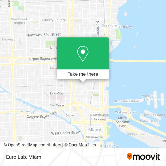
See Euro Lab, Miami, on the map
Public Transit to Euro Lab in Miami
Wondering how to get to Euro Lab in Miami? Moovit helps you find the best way to get to Euro Lab with step-by-step directions from the nearest public transit station.
Moovit provides free maps and live directions to help you navigate through your city. View schedules, routes, timetables, and find out how long does it take to get to Euro Lab in real time.
Looking for the nearest stop or station to Euro Lab? Check out this list of stops closest to your destination: Nw 2 Av & Nw 24 St; Nw 2 Av @ Nw 25 St; Nw 20 St @ Nw 2 Av; Nw 20 St & Nw 3 Av; School Board; Santa Clara.
Bus: 2, 20, 32, 77, MIAALP, MIAWYNW.Train: ORANGE, GREEN.
Want to see if there’s another route that gets you there at an earlier time? Moovit helps you find alternative routes or times. Get directions from and directions to Euro Lab easily from the Moovit App or Website.
We make riding to Euro Lab easy, which is why over 1.5 million users, including users in Miami, trust Moovit as the best app for public transit. You don’t need to download an individual bus app or train app, Moovit is your all-in-one transit app that helps you find the best bus time or train time available.
For information on prices of bus and train, costs and ride fares to Euro Lab, please check the Moovit app.
Use the app to navigate to popular places including to the airport, hospital, stadium, grocery store, mall, coffee shop, school, college, and university.
Euro Lab Address: 250 NW 23rd St Miami, FL 33127 street in Miami
- Houston Endowment Headquarters,
- MWD Group,
- Image First Studios,
- Seth Jason Beitler Fine Arts,
- Miami Glamour Photography, Photo Studio in Miami,
- Fashion District Wynwood,
- Bubble Wynwood,
- La Santa Taqueria,
- 305 Degrees Burgers,
- 225 NW 22nd Ln Parking,
- A E R Towing,
- Direct Auto Towing,
- 111aa 24h Towing Miami,
- Auto Key & Towing,
- RNR Towing & Recovery,
- Towing Vehicles,
- Alpine Towing,
- Heartbeat Towing,
- Reliable Towing,
- Madrigal Express
Places Near Euro Lab (Miami)
- Sawgrass Mall, Miami,
- Miami Freedom Park, Miami,
- Dolphin Mall Bus, Miami,
- Miami Design District, Miami,
- Miami VA Hospital, Miami,
- Port of Miami Cruise Terminal, Miami,
- Keiser University Flagship Campus, West Palm Beach,
- Hard Rock Stadium, Miami Gardens,
- Aventura Mall, Miami Beach,
- Richard E. Gerstein Justice Building, Miami,
- Little Havana, Miami,
- Marlins Park, Miami,
- Miami-Dade County Courthouse, Miami,
- Sawgrass mall ( FL ), Miami Beach,
- Zoo Miami, Miami,
- Aventura Mall, Miami,
- Wynwood, Miami,
- Bayside Marketplace, Miami,
- Brickell City Centre, Miami,
- Dolphin Mall, Miami
How to get to popular places in Miami with public transit
Get around Miami by public transit!
Traveling around Miami has never been so easy. See step by step directions as you travel to any attraction, street or major public transit station. View bus and train schedules, arrival times, service alerts and detailed routes on a map, so you know exactly how to get to anywhere in Miami.
When traveling to any destination around Miami use Moovit's Live Directions with Get Off Notifications to know exactly where and how far to walk, how long to wait for your line, and how many stops are left. Moovit will alert you when it's time to get off — no need to constantly re-check whether yours is the next stop.
Wondering how to use public transit in Miami or how to pay for public transit in Miami? Moovit public transit app can help you navigate your way with public transit easily, and at minimum cost. It includes public transit fees, ticket prices, and costs. Looking for a map of Miami public transit lines? Moovit public transit app shows all public transit maps in Miami with all Bus, Train, Light Rail and Ferry routes and stops on an interactive map.
Miami has 4 transit type(s), including: Bus, Train, Light Rail and Ferry, operated by several transit agencies, including Broward County Transit, Miami-Dade Transit, Metrorail, Palm Tran, Tri-Rail, Brightline, MARTY, City of Homestead Trolley, Key West Transit, Treasure Coast Connector, GoLine IRT, Amtrak, Greyhound-us, FlixBus-us and Aventura Express Shuttle Bus