How to get to Eurolines by bus?
Click on the bus route to see step by step directions with maps, line arrival times and updated time schedules.
From Au Vieux Campeur, Paris
50 minFrom Quai De Grenelle, Paris
85 minFrom Rue Nicolo, Paris
85 minFrom centre CIFA, Aubervilliers
87 minFrom Air Algérie, Paris
67 minFrom Palais Brongniart, Paris
63 minFrom Hôpital Cognac-Jay, Paris
89 minFrom 16 Rue Spontini, Paris
102 minFrom Primark, Creteil
91 minFrom Clinique Hartmann, Neuilly-Sur-Seine
99 min
How to get to Eurolines by metro?
Click on the metro route to see step by step directions with maps, line arrival times and updated time schedules.
From Au Vieux Campeur, Paris
40 minFrom Quai De Grenelle, Paris
49 minFrom Rue Nicolo, Paris
49 minFrom centre CIFA, Aubervilliers
64 minFrom Air Algérie, Paris
32 minFrom Palais Brongniart, Paris
25 minFrom Hôpital Cognac-Jay, Paris
56 minFrom 16 Rue Spontini, Paris
46 minFrom Primark, Creteil
55 minFrom Clinique Hartmann, Neuilly-Sur-Seine
49 min
Bus stops near Eurolines in Bagnolet
- Gallieni, 1 min walk,VIEW
Light Rail stations near Eurolines in Bagnolet
- Adrienne Bolland, 6 min walk,VIEW
Bus lines to Eurolines in Bagnolet
What are the closest stations to Eurolines?
The closest stations to Eurolines are:
- Gallieni is 3 meters away, 1 min walk.
- Saint-Fargeau is 284 meters away, 4 min walk.
- Adrienne Bolland is 437 meters away, 6 min walk.
Which metro line stops near Eurolines?
3 (Pont de Levallois-Bécon)
Which bus lines stop near Eurolines?
These bus lines stop near Eurolines: 102, 20, 318, 351, 57, 76.
What’s the nearest light rail station to Eurolines in Bagnolet?
The nearest light rail station to Eurolines in Bagnolet is Adrienne Bolland. It’s a 6 min walk away.
What’s the nearest metro station to Eurolines in Bagnolet?
The nearest metro station to Eurolines in Bagnolet is Gallieni. It’s a 1 min walk away.
What’s the nearest bus station to Eurolines in Bagnolet?
The nearest bus station to Eurolines in Bagnolet is Gallieni. It’s a 1 min walk away.
What time is the first light rail to Eurolines in Bagnolet?
The T3B is the first light rail that goes to Eurolines in Bagnolet. It stops nearby at 5:13 AM.
What time is the last light rail to Eurolines in Bagnolet?
The T3B is the last light rail that goes to Eurolines in Bagnolet. It stops nearby at 1:34 AM.
What time is the first metro to Eurolines in Bagnolet?
The 3B is the first metro that goes to Eurolines in Bagnolet. It stops nearby at 5:28 AM.
What time is the last metro to Eurolines in Bagnolet?
The 3 is the last metro that goes to Eurolines in Bagnolet. It stops nearby at 1:15 AM.
What time is the first bus to Eurolines in Bagnolet?
The 351 is the first bus that goes to Eurolines in Bagnolet. It stops nearby at 5:14 AM.
What time is the last bus to Eurolines in Bagnolet?
The 76 is the last bus that goes to Eurolines in Bagnolet. It stops nearby at 1:48 AM.
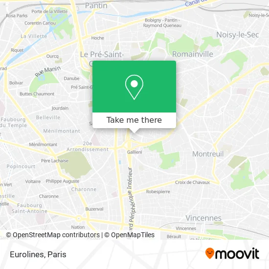
See Eurolines, Bagnolet, on the map
Public Transit to Eurolines in Bagnolet
Wondering how to get to Eurolines in Bagnolet? Moovit helps you find the best way to get to Eurolines with step-by-step directions from the nearest public transit station.
Moovit provides free maps and live directions to help you navigate through your city. View schedules, routes, timetables, and find out how long does it take to get to Eurolines in real time.
Looking for the nearest stop or station to Eurolines? Check out this list of stops closest to your destination: Gallieni; Saint-Fargeau; Adrienne Bolland.
Metro: 3, 3B.Bus: 102, 20, 318, 351, 57, 76, 122, 221.
Want to see if there’s another route that gets you there at an earlier time? Moovit helps you find alternative routes or times. Get directions from and directions to Eurolines easily from the Moovit App or Website.
We make riding to Eurolines easy, which is why over 1.5 million users, including users in Bagnolet, trust Moovit as the best app for public transit. You don’t need to download an individual bus app or train app, Moovit is your all-in-one transit app that helps you find the best bus time or train time available.
For information on prices of metro and bus, costs and ride fares to Eurolines, please check the Moovit app.
Use the app to navigate to popular places including to the airport, hospital, stadium, grocery store, mall, coffee shop, school, college, and university.
Eurolines Address: Rue Adelaïde Lahaye street in Bagnolet
- 40 Rue Jean Jaurès,
- Tours Mercuriales,
- HEBEX Bagnolet - Portail Orange France,
- Lidl,
- Les Mercuriales,
- Île Saint Louis,
- Mairie de Bagnolet,
- Place Salvador Allende,
- Hôtel Ibis,
- Boucherie Chevaline,
- Le Cin'Hoche,
- 2 Avenue du Général de Gaulle,
- Hôtel Reseda,
- Hotel Reseda Bagnolet,
- Auchan,
- 28 Avenue du Général de Gaulle,
- centre commercial bel est bagnolet,
- Auchan Bagnolet,
- CRE RATP,
- Centre commercial Bel Est
Places Near Eurolines (Bagnolet)
- Hopital Foch, Suresnes,
- Hôpital Cochin, Paris,
- Hôpital Beaujon, Clichy,
- Institut Curie, Paris,
- Galeries Lafayette, Paris,
- Théâtre Mogador, Paris,
- Créteil Soleil, Creteil,
- Galeries Lafayette Haussmann, Paris,
- Hôpital de la Pitié-Salpêtrière, Paris,
- Atelier Des Lumieres, Paris,
- Centre Hospitalier des 15/20, Paris,
- Gare Routière Flixbus, Paris,
- Fondation Louis Vuitton, Paris,
- Hopital Lariboisière, Paris,
- Hôpital Saint-Joseph, Paris,
- Hôpital Necker, Paris,
- Marché Saint-Pierre, Paris,
- Hôpital Pitié Salpêtrière, Paris,
- 29 Rue Manin, Paris,
- Hôpital Henri Mondor, Creteil
How to get to popular places in Paris with public transit
Get around Bagnolet by public transit!
Traveling around Bagnolet has never been so easy. See step by step directions as you travel to any attraction, street or major public transit station. View bus and train schedules, arrival times, service alerts and detailed routes on a map, so you know exactly how to get to anywhere in Bagnolet.
When traveling to any destination around Bagnolet use Moovit's Live Directions with Get Off Notifications to know exactly where and how far to walk, how long to wait for your line, and how many stops are left. Moovit will alert you when it's time to get off — no need to constantly re-check whether yours is the next stop.
Wondering how to use public transit in Bagnolet or how to pay for public transit in Bagnolet? Moovit public transit app can help you navigate your way with public transit easily, and at minimum cost. It includes public transit fees, ticket prices, and costs. Looking for a map of Bagnolet public transit lines? Moovit public transit app shows all public transit maps in Bagnolet with all Bus, Train, Metro, Light Rail, RER, Funicular and Gondola routes and stops on an interactive map.
Paris has 7 transit type(s), including: Bus, Train, Metro, Light Rail, RER, Funicular and Gondola, operated by several transit agencies, including RATP, RER, RER Bus de remplacement, Train, Train Bus de remplacement, Tramway Bus de remplacement, TER, ADP, Magical Shuttle, Argenteuil - Boucles de Seine, Autocars Dominique, Bièvre, Brie et 2 Morin, Le Bus - C.C. du Clermontois and Cœur d’Essonne