Evanston (Davis St.) station - Tuesday schedule
| Line | Direction | Time |
|---|---|---|
| UP-NW | Chicago OTC | 5:55 AM |
| UP-NW | Harvard/McHenry | 5:58 AM |
| UP-NW | Chicago OTC | 6:25 AM |
| UP-NW | Harvard/McHenry | 6:28 AM |
| UP-NW | Chicago OTC | 6:55 AM |
| UP-NW | Harvard/McHenry | 6:58 AM |
| UP-NW | Harvard/McHenry | 7:06 AM |
| UP-NW | Chicago OTC | 7:11 AM |
| UP-NW | Chicago OTC | 7:27 AM |
| UP-NW | Harvard/McHenry | 7:28 AM |
| UP-NW | Chicago OTC | 7:41 AM |
| UP-NW | Chicago OTC | 7:57 AM |
| UP-NW | Harvard/McHenry | 7:58 AM |
| UP-NW | Chicago OTC | 8:05 AM |
| UP-NW | Chicago OTC | 8:11 AM |
| UP-NW | Chicago OTC | 8:27 AM |
| UP-NW | Harvard/McHenry | 8:28 AM |
| UP-NW | Chicago OTC | 8:41 AM |
| UP-NW | Chicago OTC | 8:57 AM |
| UP-NW | Harvard/McHenry | 8:58 AM |
| UP-NW | Chicago OTC | 9:11 AM |
| UP-NW | Chicago OTC | 9:27 AM |
| UP-NW | Harvard/McHenry | 9:58 AM |
| UP-NW | Chicago OTC | 10:20 AM |
| UP-NW | Harvard/McHenry | 10:28 AM |
Directions to Evanston (Davis St.) station with public transit
The following transit lines have routes that pass near Evanston (Davis St.)
 Bus: 201, 208, 213, 93, PULSE DEMPSTER LINE.
- Train: UP-N.
- Chicago 'L': PURPLE LINE.
How to get to Evanston (Davis St.) station by bus?
Click on the bus route to see step by step directions with maps, line arrival times and updated time schedules.
How to get to Evanston (Davis St.) station by train?
Click on the train route to see step by step directions with maps, line arrival times and updated time schedules.
How to get to Evanston (Davis St.) station by Chicago 'L'?
Click on the Chicago 'L' route to see step by step directions with maps, line arrival times and updated time schedules.
Bus stops near Evanston (Davis St.) stop
- Davis & Benson, 1 min walk,
- Davis St & Benson Ave, 1 min walk,
- Oak & Church, 2 min walk,
- Oak Ave & Church St, 2 min walk,
- Davis St & Maple Ave, 3 min walk,
- Davis Cta Station, 3 min walk,
Chicago 'L' stations near Evanston (Davis St.) station
- Davis, 3 min walk,
Train stations near Evanston (Davis St.) station
- Main St., 21 min walk,
Bus lines to Evanston (Davis St.) station
- 201, Central Street & Cowper,
- 213, Highland Park Metra Station,
- 93, Logan Square Blue Line Station (South),
- 250, Davis Cta Station,
- 208, 900 Northwest Hwy,
- PULSE DEMPSTER LINE, O'Hare Mmf Bay 9,
What are the closest stations to Evanston (Davis St.)?
The closest stations to Evanston (Davis St.) are:
- Davis & Benson stop is 55 yards away, 1 min walk.
- Davis St & Benson Ave stop is 63 yards away, 1 min walk.
- Oak & Church stop is 104 yards away, 2 min walk.
- Oak Ave & Church St stop is 128 yards away, 2 min walk.
- Davis station is 175 yards away, 3 min walk.
- Davis St & Maple Ave stop is 177 yards away, 3 min walk.
- Davis Cta Station is 226 yards away, 3 min walk.
- Main St. station is 1787 yards away, 21 min walk.
Which bus lines stop near Evanston (Davis St.)?
These bus lines stop near Evanston (Davis St.): 201, 208, 213, 93, PULSE DEMPSTER LINE.
Which train line stops near Evanston (Davis St.)?
UP-N (Kenosha/Waukegan)
Which Chicago 'L' line stops near Evanston (Davis St.)?
PURPLE LINE (Linden)
What’s the nearest Chicago 'L' station to Evanston (Davis St.)?
The nearest Chicago 'L' station to Evanston (Davis St.) is Davis. It’s a 3 min walk away.
What’s the nearest train station to Evanston (Davis St.)?
The nearest train station to Evanston (Davis St.) is Main St.. It’s a 21 min walk away.
What’s the nearest bus station to Evanston (Davis St.)?
The nearest bus stations to Evanston (Davis St.) are Davis & Benson and Davis St & Benson Ave. The closest one is a 1 min walk away.
What time is the first Chicago 'L' to Evanston (Davis St.)?
The PURPLE LINE is the first Chicago 'L' that goes to Evanston (Davis St.). It stops nearby at 4:39 AM.
What time is the last Chicago 'L' to Evanston (Davis St.)?
The PURPLE LINE is the last Chicago 'L' that goes to Evanston (Davis St.). It stops nearby at 1:48 AM.
What time is the first train to Evanston (Davis St.)?
The UP-N is the first train that goes to Evanston (Davis St.). It stops nearby at 4:57 AM.
What time is the last train to Evanston (Davis St.)?
The UP-N is the last train that goes to Evanston (Davis St.). It stops nearby at 12:55 AM.
What time is the first bus to Evanston (Davis St.)?
The PULSE DEMPSTER LINE is the first bus that goes to Evanston (Davis St.). It stops nearby at 4:30 AM.
What time is the last bus to Evanston (Davis St.)?
The PULSE DEMPSTER LINE is the last bus that goes to Evanston (Davis St.). It stops nearby at 1:02 AM.
Evanston (Davis St.) station
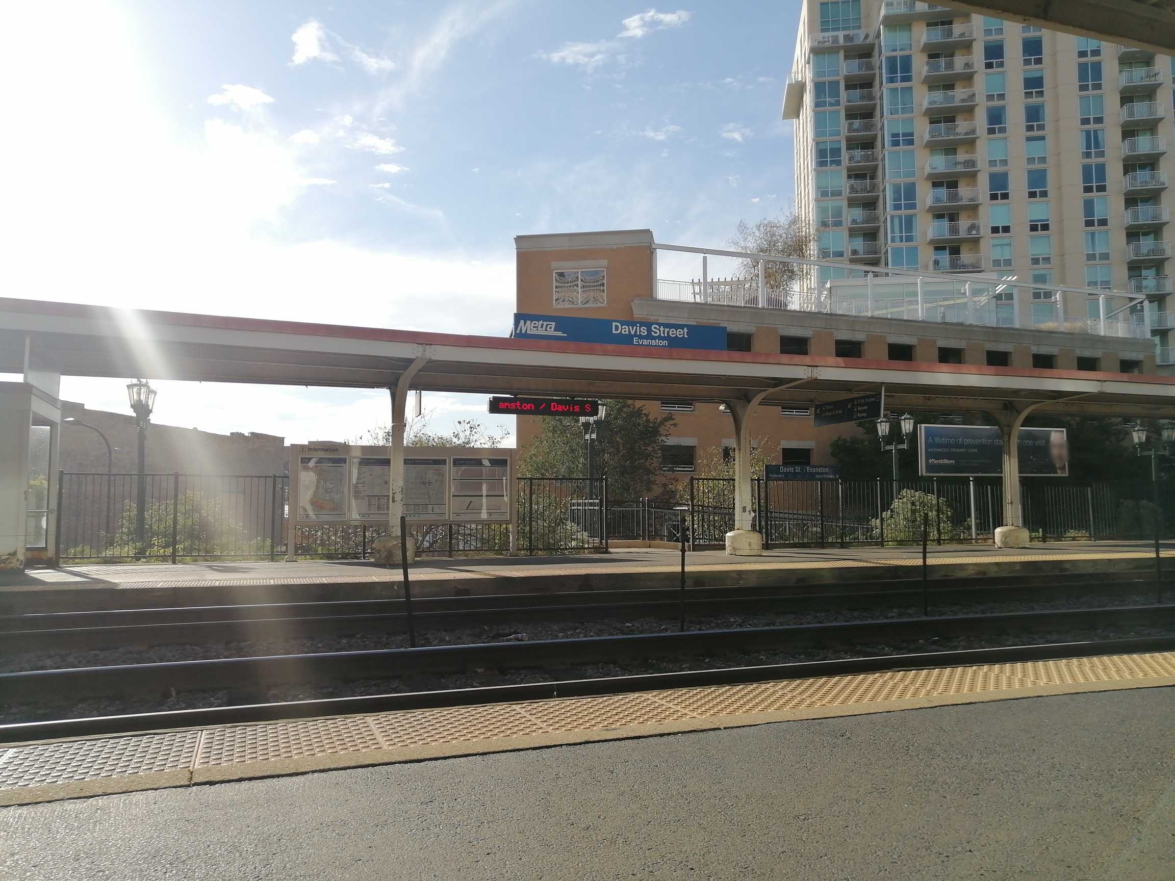 Taken by Anonymous
See Evanston (Davis St.) station on the map
Public transit to Evanston (Davis St.) station
Looking for directions to Evanston (Davis St.) in Evanston, United States?
Download the Moovit App to find the current schedule and step-by-step directions for Bus, Chicago 'L' or Train routes that pass through Evanston (Davis St.).
Looking for the nearest stops closest to Evanston (Davis St.) ? Check out this list of closest stops to your destination: Davis & Benson; Davis St & Benson Ave; Oak & Church; Oak Ave & Church St; Davis; Davis St & Maple Ave; Davis Cta Station; Main St..
Bus: 201, 208, 213, 93, PULSE DEMPSTER LINE, 250.Train: UP-N.Chicago 'L': PURPLE LINE.
We make riding on public transit to Evanston (Davis St.) easy, which is why over 1.7 billion users, including users in Evanston trust Moovit as the best app for public transit.
Use the app to navigate to popular places including to the airport, hospital, stadium, grocery store, mall, coffee shop, school, college, and university.
The station has the following entrances: Davis St
The first line to this station is UP-NW, at 5:55 AM, and the last line is UP-NW at 4:55 AM.
915 Davis St, Evanston, IL, USA
This station serves Metra’s lines
Popular routes from Evanston (Davis St.) station
- Davis & Benson,
- Davis St & Benson Ave,
- Oak & Church,
- Oak Ave & Church St,
- Davis St & Maple Ave,
- Davis Cta Station
Bus stops near Evanston (Davis St.) stop
- Davis
Chicago 'L' station near Evanston (Davis St.) station
- Main St.
Train station near Evanston (Davis St.) station
- River Rd & Irving Park Rd,
- Pulaski & Harrison (Blue Line) (North),
- Fox River Grove,
- Marine Drive & Irving Park (North),
- Union Station Transit Center (East),
- Cermak/Austin,
- 95th Street & Loomis,
- Mt. Prospect,
- Ashland & Division (Blue Line) (South),
- Fullerton Red/Brown/Purple Line Station (West),
- 26th Street & California Avenue (West),
- Great Lakes,
- 159th St & Cicero Ave (Metra Station),
- 95th St & Central Ave,
- Ikea,
- Michigan & 26th Street (South),
- Vincennes & 95th Street (South),
- Belmont & Narragansett (West),
- Downers Grove,
- Halsted & 122nd Street
Popular public transit stations in Evanston
Get around Evanston by public transit!
Traveling around Evanston has never been so easy. See step by step directions as you travel to any attraction, street or major public transit station. View bus and train schedules, arrival times, service alerts and detailed routes on a map, so you know exactly how to get to anywhere in Evanston.
When traveling to any destination around Evanston use Moovit's Live Directions with Get Off Notifications to know exactly where and how far to walk, how long to wait for your line, and how many stops are left. Moovit will alert you when it's time to get off — no need to constantly re-check whether yours is the next stop.
Wondering how to use public transit in Evanston or how to pay for public transit in Evanston? Moovit public transit app can help you navigate your way with public transit easily, and at minimum cost. It includes public transit fees, ticket prices, and costs. Looking for a map of Evanston public transit lines? Moovit public transit app shows all public transit maps in Evanston with all Bus, Train and Chicago 'L' routes and stops on an interactive map.
Chicago has 3 transit type(s), including: Bus, Train and Chicago 'L', operated by several transit agencies, including CTA 'L', Metra, Northern Indiana Commuter Transportation District, CTA, PACE, O'Hare International Airport Shuttle Bus, Gary Public Transit, Amtrak, River Valley Metro, Valpo Transit, DeKalb Public Transit, FlixBus-us, Greyhound-us, Van Galder (Coach USA) and Wisconsin Coach Lines