Directions to Event Zone (Roanoke) with public transportation
The following transit lines have routes that pass near Event Zone
 Bus: GREYHOUND US0600, 56, 62, 42, TROLLEY.
- Train: NORTHEAST REGIONAL.
How to get to Event Zone by bus?
Click on the bus route to see step by step directions with maps, line arrival times and updated time schedules.
How to get to Event Zone by train?
Click on the train route to see step by step directions with maps, line arrival times and updated time schedules.
Bus stops near Event Zone in Roanoke
- Franklin Nb at Day, 3 min walk,VIEW
- Elm Ave at 2nd St Wb, 4 min walk,VIEW
- Jefferson & Bullitt (Northbound), 4 min walk,VIEW
- Jefferson Sb at Bullitt, 4 min walk,VIEW
- Elm Ave at 2nd St, 5 min walk,VIEW
- Jefferson Sb at Luck, 5 min walk,VIEW
- Jefferson & Luck, 5 min walk,VIEW
- Franklin Sb at Day, 5 min walk,VIEW
- Franklin Wb at Jefferson, 6 min walk,VIEW
Train station near Event Zone in Roanoke
- Roanoke, 41 min walk,VIEW
Bus lines to Event Zone in Roanoke
- 56, 3rd St Station Slip P,VIEW
- 62, 3rd St Station Slip O,VIEW
- 42, 3rd St Station Slip K,VIEW
- TROLLEY, Downtown Market,VIEW
- 51, Tanglewood Mall (Barnes And Noble),VIEW
- 41, 11th Sb at Jamison,VIEW
- 35, 35 - Third Street Station To Vinton,VIEW
- 52, 3rd St Station Slip Q,VIEW
- 55, Tanglewood Mall (Barnes And Noble),VIEW
- 61, Red Rock Nb at Brambleton (Shell Station),VIEW
- 36, 3rd St Station Slip L,VIEW
What are the closest stations to Event Zone?
The closest stations to Event Zone are:
- Franklin Nb at Day is 243 yards away, 3 min walk.
- Elm Ave at 2nd St Wb is 276 yards away, 4 min walk.
- Jefferson & Bullitt (Northbound) is 307 yards away, 4 min walk.
- Jefferson Sb at Bullitt is 319 yards away, 4 min walk.
- Elm Ave at 2nd St is 329 yards away, 5 min walk.
- Jefferson Sb at Luck is 350 yards away, 5 min walk.
- Jefferson & Luck is 358 yards away, 5 min walk.
- Franklin Sb at Day is 394 yards away, 5 min walk.
- Franklin Wb at Jefferson is 468 yards away, 6 min walk.
- Roanoke is 3469 yards away, 41 min walk.
Which bus line stops near Event Zone?
GREYHOUND US0600 (Nashville Bus Station)
Which train line stops near Event Zone?
NORTHEAST REGIONAL (Roanoke)
What’s the nearest bus station to Event Zone in Roanoke?
The nearest bus station to Event Zone in Roanoke is Franklin Nb at Day. It’s a 3 min walk away.
What time is the first train to Event Zone in Roanoke?
The NORTHEAST REGIONAL is the first train that goes to Event Zone in Roanoke. It stops nearby at 9:35 AM.
What time is the last train to Event Zone in Roanoke?
The NORTHEAST REGIONAL is the last train that goes to Event Zone in Roanoke. It stops nearby at 10:13 PM.
What time is the first bus to Event Zone in Roanoke?
The 42 is the first bus that goes to Event Zone in Roanoke. It stops nearby at 6:05 AM.
What time is the last bus to Event Zone in Roanoke?
The 55 is the last bus that goes to Event Zone in Roanoke. It stops nearby at 8:19 PM.
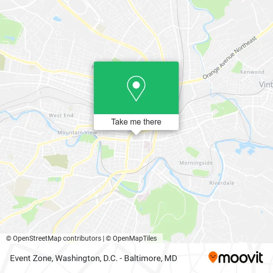
See Event Zone, Roanoke, on the map
Public Transit to Event Zone in Roanoke
Wondering how to get to Event Zone in Roanoke? Moovit helps you find the best way to get to Event Zone with step-by-step directions from the nearest public transit station.
Moovit provides free maps and live directions to help you navigate through your city. View schedules, routes, timetables, and find out how long does it take to get to Event Zone in real time.
Looking for the nearest stop or station to Event Zone? Check out this list of stops closest to your destination: Franklin Nb at Day; Elm Ave at 2nd St Wb; Jefferson & Bullitt (Northbound); Jefferson Sb at Bullitt; Elm Ave at 2nd St; Jefferson Sb at Luck; Jefferson & Luck; Franklin Sb at Day; Franklin Wb at Jefferson; Roanoke.
Bus: GREYHOUND US0600, 56, 62, 42, TROLLEY, 51, 41.Train: NORTHEAST REGIONAL.
Want to see if there’s another route that gets you there at an earlier time? Moovit helps you find alternative routes or times. Get directions from and directions to Event Zone easily from the Moovit App or Website.
We make riding to Event Zone easy, which is why over 1.5 million users, including users in Roanoke, trust Moovit as the best app for public transit. You don’t need to download an individual bus app or train app, Moovit is your all-in-one transit app that helps you find the best bus time or train time available.
For information on prices of bus and train, costs and ride fares to Event Zone, please check the Moovit app.
Use the app to navigate to popular places including to the airport, hospital, stadium, grocery store, mall, coffee shop, school, college, and university.
Event Zone Address: 115 Day Ave SW Roanoke, VA 24016 street in Roanoke
- Festival in the Park,
- Building Specialists,
- Repairs Plus,
- Deel Financial PLLC,
- Support Systems,
- Bsi Team,
- Renavative Properties,
- Johnson Law,
- Michie Hamlett Lowry Rasmussen & Tweel,
- Mattern & Craig Consulting Engineers-Surveyors,
- Vannoy Joseph F Attorney at Law,
- Federal Lot,
- Commonwealth of Virginia,
- Veteran's Services Department,
- Virginia Dept of Veterans' Affairs,
- United States Government Regional Office,
- United States Government General Services Administration,
- Poff Federal Building,
- ATM,
- Disabled American Veterans
Places Near Event Zone (Roanoke)
- Washington DC VA Medical Center, Washington,
- National Zoo, Washington,
- PG Mall, Prince George's County,
- Sibley Memorial Hospital, Washington,
- The Anthem, Washington,
- Marriott Marquis Washington, DC, Washington,
- Westfield Montgomery Mall, Montgomery County,
- Capital One Arena, Washington,
- Camden Yards, Baltimore,
- Basilica of the National Shrine, Washington,
- Georgetown, Washington,
- National Theatre, Washington,
- Rock Creek Tennis Center, Washington,
- Warner Theatre, Washington,
- National Museum of African American History and Culture, Washington,
- Museum Of The Bible, Washington,
- Pennsylvania Ave NW (3rd st and pennsylvania), Washington,
- Washington National Cathedral, Washington,
- M&T Bank Stadium, Baltimore,
- Amazon Hq2, Arlington County
How to get to popular places in Washington, D.C. - Baltimore, MD with public transit
Get around Roanoke by public transit!
Traveling around Roanoke has never been so easy. See step by step directions as you travel to any attraction, street or major public transit station. View bus and train schedules, arrival times, service alerts and detailed routes on a map, so you know exactly how to get to anywhere in Roanoke.
When traveling to any destination around Roanoke use Moovit's Live Directions with Get Off Notifications to know exactly where and how far to walk, how long to wait for your line, and how many stops are left. Moovit will alert you when it's time to get off — no need to constantly re-check whether yours is the next stop.
Wondering how to use public transit in Roanoke or how to pay for public transit in Roanoke? Moovit public transit app can help you navigate your way with public transit easily, and at minimum cost. It includes public transit fees, ticket prices, and costs. Looking for a map of Roanoke public transit lines? Moovit public transit app shows all public transit maps in Roanoke with all Bus, Train, Metro, Light Rail and Ferry routes and stops on an interactive map.
Washington, D.C. - Baltimore, MD has 5 transit type(s), including: Bus, Train, Metro, Light Rail and Ferry, operated by several transit agencies, including WMATA, Montgomery County Ride On, Fairfax Connector, TheBus, PRTC, DASH - Alexandria, Arlington Transit (ART), RTA of Central Maryland, MDOT MTA, MDOT MTA Light RailLink, MDOT MTA Commuter Bus, MDOT MTA Local Bus, FXBGO!, Virginia Railway Express (VRE) and MARC