How to get to Excel Brokerage Insurance Co by bus?
Click on the bus route to see step by step directions with maps, line arrival times and updated time schedules.
From Paterson, NJ, Paterson
47 minFrom King Spa, Palisades Park
51 minFrom Passaic, NJ, Passaic
39 minFrom MetLife Stadium, East Rutherford
58 minFrom Hackensack, NJ, Hackensack
26 minFrom BAPS Shri Swaminarayan Mandir, Clifton
53 minFrom Holy Name Hospital, Teaneck
34 minFrom Englewood, NJ, Englewood
38 minFrom Totowa, NJ, Totowa
63 minFrom Teaneck, NJ, Teaneck
37 min
How to get to Excel Brokerage Insurance Co by train?
Click on the train route to see step by step directions with maps, line arrival times and updated time schedules.
Bus stops near Excel Brokerage Insurance Co in Fair Lawn
Train station near Excel Brokerage Insurance Co in Fair Lawn
- Radburn, 45 min walk,VIEW
Bus lines to Excel Brokerage Insurance Co in Fair Lawn
- 144, Elmwood Park Express,VIEW
- 164, E Hackensack Express Midland Pk,VIEW
- 171, New York Gw Bridge Bus Station Ikea & Garden State Plaza,VIEW
- 770, Hackensack Bus Terminal,VIEW
- 707, Paterson City Hall,VIEW
- 758, Paramus Park Mall,VIEW
- 163, Ridgewood Terminal Via Murray Hill Parkway,VIEW
- 175, New York Bergen Comm College & Garden State Plaza,VIEW
- 751, Paramus Bergen Comcol Via Bogota & Fairview,VIEW
- 755, Edgewater Via Fort Lee & Cedar Lane,VIEW
- 162, Paramus Express Via Prospect Ave,VIEW
What are the closest stations to Excel Brokerage Insurance Co?
The closest stations to Excel Brokerage Insurance Co are:
- Rt-4 at Blue Hill Ave is 205 yards away, 3 min walk.
- Saddle River Rd at Wyckoff Terrace is 287 yards away, 4 min walk.
- Paramus Rd at Arcadian Ave (Rt 4) is 585 yards away, 7 min walk.
- Paramus Rd at Exit Ramp From Rt. 4# is 646 yards away, 8 min walk.
- Paramus Rd at Arcadian Ave (Rt 4)# is 684 yards away, 9 min walk.
- Radburn is 3770 yards away, 45 min walk.
Which bus lines stop near Excel Brokerage Insurance Co?
These bus lines stop near Excel Brokerage Insurance Co: 171, 175, 758, 770.
Which train line stops near Excel Brokerage Insurance Co?
MCL (Hoboken)
What’s the nearest bus station to Excel Brokerage Insurance Co in Fair Lawn?
The nearest bus station to Excel Brokerage Insurance Co in Fair Lawn is Rt-4 at Blue Hill Ave. It’s a 3 min walk away.
What time is the first train to Excel Brokerage Insurance Co in Fair Lawn?
The PJL is the first train that goes to Excel Brokerage Insurance Co in Fair Lawn. It stops nearby at 5:32 AM.
What time is the last train to Excel Brokerage Insurance Co in Fair Lawn?
The PJL is the last train that goes to Excel Brokerage Insurance Co in Fair Lawn. It stops nearby at 1:16 AM.
What time is the first bus to Excel Brokerage Insurance Co in Fair Lawn?
The 163 is the first bus that goes to Excel Brokerage Insurance Co in Fair Lawn. It stops nearby at 4:18 AM.
What time is the last bus to Excel Brokerage Insurance Co in Fair Lawn?
The 163 is the last bus that goes to Excel Brokerage Insurance Co in Fair Lawn. It stops nearby at 2:06 AM.
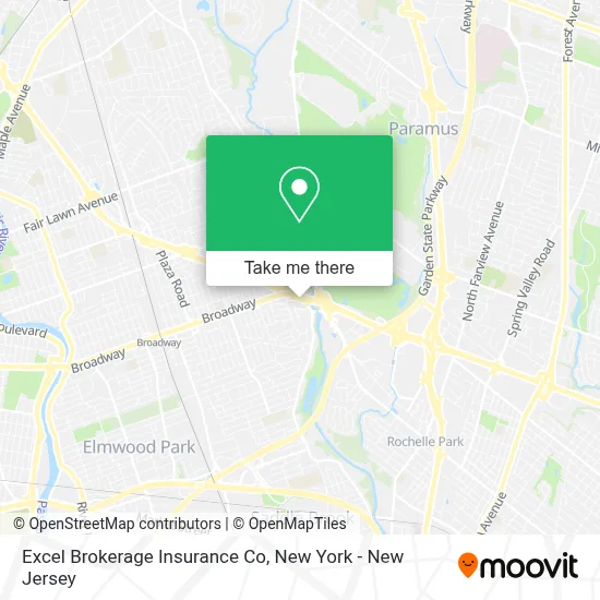
See Excel Brokerage Insurance Co, Fair Lawn, on the map
Public Transit to Excel Brokerage Insurance Co in Fair Lawn
Wondering how to get to Excel Brokerage Insurance Co in Fair Lawn? Moovit helps you find the best way to get to Excel Brokerage Insurance Co with step-by-step directions from the nearest public transit station.
Moovit provides free maps and live directions to help you navigate through your city. View schedules, routes, timetables, and find out how long does it take to get to Excel Brokerage Insurance Co in real time.
Looking for the nearest stop or station to Excel Brokerage Insurance Co? Check out this list of stops closest to your destination: Rt-4 at Blue Hill Ave; Saddle River Rd at Wyckoff Terrace; Paramus Rd at Arcadian Ave (Rt 4); Paramus Rd at Exit Ramp From Rt. 4#; Paramus Rd at Arcadian Ave (Rt 4)#; Radburn.
Bus: 171, 175, 758, 770, 144, 164, 707, 163, 751, 755, 162.Train: MCL, PJL.
Want to see if there’s another route that gets you there at an earlier time? Moovit helps you find alternative routes or times. Get directions from and directions to Excel Brokerage Insurance Co easily from the Moovit App or Website.
We make riding to Excel Brokerage Insurance Co easy, which is why over 1.5 million users, including users in Fair Lawn, trust Moovit as the best app for public transit. You don’t need to download an individual bus app or train app, Moovit is your all-in-one transit app that helps you find the best bus time or train time available.
For information on prices of bus and train, costs and ride fares to Excel Brokerage Insurance Co, please check the Moovit app.
Use the app to navigate to popular places including to the airport, hospital, stadium, grocery store, mall, coffee shop, school, college, and university.
Excel Brokerage Insurance Co Address: 26-02 Broadway street in Fair Lawn
- Hyatt Place Fair Lawn/Paramus,
- D and D Oriental Rug Gallery-Nj,
- RT 4 RT 208,
- RT-4 (4 broadway),
- Hyatt Place,
- La-Z-Boy Of Paramus,
- Route 4 Auto Group,
- Safesplash Swim School- Paramus,
- Shoprite,
- Atm Shoprite,
- Usps,
- Charlie's Kids Salon,
- Miramar Insurance,
- Megagen America,
- Red Mill Paramus,
- Rick Helman,
- All Us Doors NJ Llc,
- Paramus,Nj Best Businesses,
- North Jersey Youth Cricket Academy,
- Tiger Schulman's
Places Near Excel Brokerage Insurance Co (Fair Lawn)
- 911 Memorial, Manhattan,
- 26 Federal Plaza, Manhattan,
- Wall Street, Manhattan,
- 1 Police Plaza, Manhattan,
- qqqq, Manhattan,
- Pier 83, Manhattan,
- San Gennaro Feast, Manhattan,
- Times Square, Manhattan,
- SoHo, Manhattan,
- Katz's Deli, Manhattan,
- Hudson Yards, Manhattan,
- Mountainside Hospital, Glen Ridge,
- 111 Centre New York City Supreme Court, Manhattan,
- Chinatown, Manhattan,
- Rockefeller Center, Manhattan,
- 66 John Street, Manhattan,
- 376 Hudson Street, Manhattan,
- Bellevue Hospital, Manhattan,
- 3 Stone St, Manhattan,
- Queens Center Mall, Queens
How to get to popular places in New York - New Jersey with public transit
Get around Fair Lawn by public transit!
Traveling around Fair Lawn has never been so easy. See step by step directions as you travel to any attraction, street or major public transit station. View bus and train schedules, arrival times, service alerts and detailed routes on a map, so you know exactly how to get to anywhere in Fair Lawn.
When traveling to any destination around Fair Lawn use Moovit's Live Directions with Get Off Notifications to know exactly where and how far to walk, how long to wait for your line, and how many stops are left. Moovit will alert you when it's time to get off — no need to constantly re-check whether yours is the next stop.
Wondering how to use public transit in Fair Lawn or how to pay for public transit in Fair Lawn? Moovit public transit app can help you navigate your way with public transit easily, and at minimum cost. It includes public transit fees, ticket prices, and costs. Looking for a map of Fair Lawn public transit lines? Moovit public transit app shows all public transit maps in Fair Lawn with all Bus, Train, Subway, Light Rail, Ferry and Cable Car routes and stops on an interactive map.
New York - New Jersey has 6 transit type(s), including: Bus, Train, Subway, Light Rail, Ferry and Cable Car, operated by several transit agencies, including MTA Subway, Metro-North Railroad, LIRR, PATH, MTA New York City Transit - Express routes, MTA Bus, NJ Transit, NYC Ferry, NICE bus, Bee-Line Bus, NJ Transit Rail, Norwalk Transit District, Hartford Line, River Valley Transit and HART