How to get to Excot by bus?
Click on the bus route to see step by step directions with maps, line arrival times and updated time schedules.
From Hospital Montepríncipe, Área Metropolitana De Madrid Y Corredor Del Henares
97 minFrom rio alberche, Madrid
55 minFrom Nexum Retail Park, Fuenlabrada
26 minFrom Leganes, Leganés
61 minFrom Kinepolis Madrid Ciudad de la Imagen, Pozuelo De Alarcón
71 minFrom Loranca, Área Metropolitana De Madrid Y Corredor Del Henares
87 minFrom Recinto Ferial de Fuenlabrada, Fuenlabrada
40 minFrom Cuatro Vientos, Madrid
74 minFrom Avenida de las Águilas, Madrid
58 minFrom Universidad Rey Juan Carlos (Campus Fuenlabrada), Fuenlabrada
56 min
How to get to Excot by train?
Click on the train route to see step by step directions with maps, line arrival times and updated time schedules.
How to get to Excot by metro?
Click on the metro route to see step by step directions with maps, line arrival times and updated time schedules.
Bus stops near Excot in Móstoles
Metro station near Excot in Móstoles
- Hospital De Móstoles, 9 min walk,VIEW
Train station near Excot in Móstoles
- Móstoles, 13 min walk,VIEW
Bus lines to Excot in Móstoles
- 1, Estación FF.CC. (Móstoles),VIEW
- 2, Cementerio Nuevo,VIEW
- 3, Pol. Ind. Las Nieves,VIEW
- 519, Tera - Centro Comercial,VIEW
- 520, P.º Arroyomolinos - E Polígono Industrial 1,VIEW
- 521, Glorieta San Vicente,VIEW
- 5, Móstoles FF.CC.,VIEW
- 535, Urb. Calypo Fado - Toledo,VIEW
- N501, Av. Portugal - Rio Duero,VIEW
- VAC082, Fuensalida - Alcabón,VIEW
- VAC226, El Casar de Escalona,VIEW
- 498, Móstoles - Arroyomolinos - Moraleja de Enmedio,VIEW
- 499, Móstoles - Arroyomolinos,VIEW
- 529, Móstoles (Hospital Rey Juan Carlos) - Navalcarnero - El Álamo,VIEW
- 531, Móstoles (Hospital Rey Juan Carlos) - Navalcarnero - Sevilla la Nueva,VIEW
- 498A, Móstoles (Móstoles - Central) - Arroyomolinos (Parque de Nieve),VIEW
- 529A, Móstoles (Hospital Rey Juan Carlos) - Navalcarnero - Batres,VIEW
- 531A, Móstoles (Hospital Rey Juan Carlos) - Navalcarnero - Villamantilla,VIEW
- 529H, Móstoles (Hospital Rey Juan Carlos) - Navalcarnero,VIEW
- N505, Madrid (Príncipe Pío) - Navalcarnero - El Álamo,VIEW
What are the closest stations to Excot?
The closest stations to Excot are:
- Av. Dos De Mayo - Huesca is 287 meters away, 4 min walk.
- Av. Portugal - Granada is 499 meters away, 7 min walk.
- Av. Portugal - Parque Finca Liana is 501 meters away, 7 min walk.
- Hospital De Móstoles is 664 meters away, 9 min walk.
- Pintor Murillo - Colegio is 802 meters away, 11 min walk.
- Móstoles is 936 meters away, 13 min walk.
Which bus lines stop near Excot?
These bus lines stop near Excot: 519, 521, 526.
Which train line stops near Excot?
C5 (Móstoles - El Soto)
Which metro line stops near Excot?
M-12 (MetroSur Andén 1)
What’s the nearest metro station to Excot in Móstoles?
The nearest metro station to Excot in Móstoles is Hospital De Móstoles. It’s a 9 min walk away.
What’s the nearest train station to Excot in Móstoles?
The nearest train station to Excot in Móstoles is Móstoles. It’s a 13 min walk away.
What’s the nearest bus station to Excot in Móstoles?
The nearest bus station to Excot in Móstoles is Av. Dos De Mayo - Huesca. It’s a 4 min walk away.
What time is the first metro to Excot in Móstoles?
The M-12 is the first metro that goes to Excot in Móstoles. It stops nearby at 6:05 AM.
What time is the last metro to Excot in Móstoles?
The M-12 is the last metro that goes to Excot in Móstoles. It stops nearby at 2:15 AM.
What time is the first train to Excot in Móstoles?
The C5 is the first train that goes to Excot in Móstoles. It stops nearby at 5:18 AM.
What time is the last train to Excot in Móstoles?
The C5 is the last train that goes to Excot in Móstoles. It stops nearby at 12:36 AM.
What time is the first bus to Excot in Móstoles?
The N501 is the first bus that goes to Excot in Móstoles. It stops nearby at 3:00 AM.
What time is the last bus to Excot in Móstoles?
The N501 is the last bus that goes to Excot in Móstoles. It stops nearby at 2:59 AM.
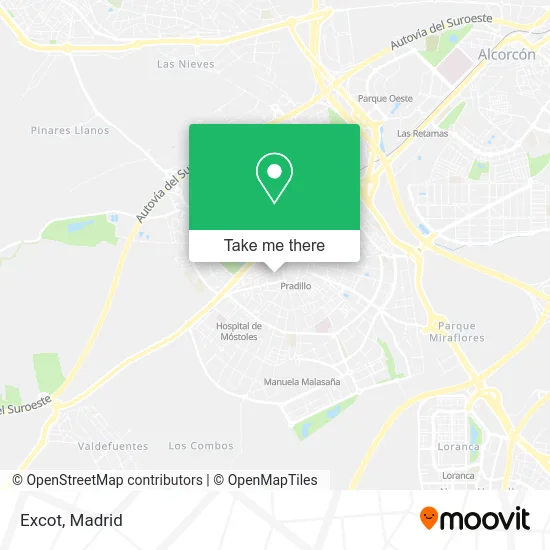
See Excot, Móstoles, on the map
Public Transit to Excot in Móstoles
Wondering how to get to Excot in Móstoles? Moovit helps you find the best way to get to Excot with step-by-step directions from the nearest public transit station.
Moovit provides free maps and live directions to help you navigate through your city. View schedules, routes, timetables, and find out how long does it take to get to Excot in real time.
Looking for the nearest stop or station to Excot? Check out this list of stops closest to your destination: Av. Dos De Mayo - Huesca; Av. Portugal - Granada; Av. Portugal - Parque Finca Liana; Hospital De Móstoles; Pintor Murillo - Colegio; Móstoles.
Bus: 519, 521, 526, 1, 2, 3, 520, 5, 535, N501, VAC082, VAC226, 498, 499, 529, 531, 498A.Train: C5.Metro: M-12.
Want to see if there’s another route that gets you there at an earlier time? Moovit helps you find alternative routes or times. Get directions from and directions to Excot easily from the Moovit App or Website.
We make riding to Excot easy, which is why over 1.5 million users, including users in Móstoles, trust Moovit as the best app for public transit. You don’t need to download an individual bus app or train app, Moovit is your all-in-one transit app that helps you find the best bus time or train time available.
For information on prices of bus, metro, train and light rail, costs and ride fares to Excot, please check the Moovit app.
Use the app to navigate to popular places including to the airport, hospital, stadium, grocery store, mall, coffee shop, school, college, and university.
Excot Address: Plaza Fuensanta, 10 28934 Móstoles street in Móstoles
- Pinturas Roma,
- Jiménez Maroto e,
- Sanz Corcoles Maria Concepción,
- Newtabi,
- Cars Marobe S.L.,
- Garcia Fernández M. Inmaculada,
- Osma-Control de Plagas,
- Natursol Ingeniería,
- Cárnicas Trebol,
- Bombeos del Centro,
- Instalaciones Alfar,
- Restaurante Cocina Asiática Wang Fu Móstoles,
- Pollos Asados Máximo Sabor,
- Casco antiguo de Móstoles,
- Reformas Tito,
- Gimnasio Miguel Abad,
- Minimarket Violeta,
- Tribanda Comunicaciones,
- DHL,
- Amazon Counter-Tribanda Comunicaciones m C
Places Near Excot (Móstoles)
- Estadio Wanda Metropolitano, Área Metropolitana De Madrid Y Corredor Del Henares,
- Hospital Universitario La Paz, Madrid,
- Rastro De Madrid, Área Metropolitana De Madrid Y Corredor Del Henares,
- Palacio De Vistalegre, Área Metropolitana De Madrid Y Corredor Del Henares,
- Mendez Alvaro, Madrid,
- Centro Comercial Islazul, Área Metropolitana De Madrid Y Corredor Del Henares,
- Wizink Center, Madrid,
- Hospital Clínico Universitario San Carlos, Madrid,
- Hospital Universitario Ramón y Cajal, Madrid,
- Tres Aguas, Alcorcón,
- Calle de López de Hoyos 169, Madrid,
- Centro Comercial Oasiz Madrid, Área Metropolitana De Madrid Y Corredor Del Henares,
- Mercadillo de Majadahonda, Majadahonda,
- Nassica, Área Metropolitana De Madrid Y Corredor Del Henares,
- Plaza Mayor, Madrid,
- Centro Comercial La Vaguada, Área Metropolitana De Madrid Y Corredor Del Henares,
- Sala La Riviera, Madrid,
- Plenilunio, Área Metropolitana De Madrid Y Corredor Del Henares,
- Centro Comercial La Gavia, Área Metropolitana De Madrid Y Corredor Del Henares,
- Estacion de Chamartin, Madrid
How to get to popular places in Madrid with public transit
Get around Móstoles by public transit!
Traveling around Móstoles has never been so easy. See step by step directions as you travel to any attraction, street or major public transit station. View bus and train schedules, arrival times, service alerts and detailed routes on a map, so you know exactly how to get to anywhere in Móstoles.
When traveling to any destination around Móstoles use Moovit's Live Directions with Get Off Notifications to know exactly where and how far to walk, how long to wait for your line, and how many stops are left. Moovit will alert you when it's time to get off — no need to constantly re-check whether yours is the next stop.
Wondering how to use public transit in Móstoles or how to pay for public transit in Móstoles? Moovit public transit app can help you navigate your way with public transit easily, and at minimum cost. It includes public transit fees, ticket prices, and costs. Looking for a map of Móstoles public transit lines? Moovit public transit app shows all public transit maps in Móstoles with all Bus, Train, Metro and Light Rail routes and stops on an interactive map.
Madrid has 4 transit type(s), including: Bus, Train, Metro and Light Rail, operated by several transit agencies, including Metro de Madrid, Metro Ligero, Tranvía de Parla, Renfe Cercanías - Servicios de Autobús especiales, Renfe Cercanias, Renfe Cercanías, EMT, Interurbanos, Urbanos de Alcalá de Henares, Urbanos de Alcobendas, Urbanos de Alcorcón, Urbanos de Algete, Urbanos de Aranjuez, Urbanos de Arganda del Rey and Urbanos de Arroyomolinos