How to get to Exep by bus?
Click on the bus route to see step by step directions with maps, line arrival times and updated time schedules.
From I&M Fachkliniken Hohenurach Haus 2, Gemeindeverwaltungsverband Bad Urach
169 minFrom Kaufland Geislingen, Vereinbarte Verwaltungsgemeinschaft Der Stadt Geislingen An Der Steige
205 minFrom Parkplatz Ratiopharm Arena, Neu-Ulm
94 minFrom Uracher Wasserfall, Gemeindeverwaltungsverband Bad Urach
178 minFrom Kloster Untermarchtal, Verwaltungsgemeinschaft Munderkingen
58 minFrom Reha-klinik Schwäbische Alb, Gemeindeverwaltungsverband Bad Urach
172 minFrom Alb Thermen Bad Urach, Gemeindeverwaltungsverband Bad Urach
167 minFrom M&I Fachkliniken Hohenurach, Gemeindeverwaltungsverband Bad Urach
173 min
How to get to Exep by train?
Click on the train route to see step by step directions with maps, line arrival times and updated time schedules.
From I&M Fachkliniken Hohenurach Haus 2, Gemeindeverwaltungsverband Bad Urach
171 minFrom Parkplatz Ratiopharm Arena, Neu-Ulm
72 minFrom Uracher Wasserfall, Gemeindeverwaltungsverband Bad Urach
163 minFrom Reha-klinik Schwäbische Alb, Gemeindeverwaltungsverband Bad Urach
167 minFrom Oh VV, Leutkirch
131 minFrom Alb Thermen Bad Urach, Gemeindeverwaltungsverband Bad Urach
166 minFrom M&I Fachkliniken Hohenurach, Gemeindeverwaltungsverband Bad Urach
169 min
Bus stops near Exep in Gemeindeverwaltungsverband Laupheim
Train stations near Exep in Gemeindeverwaltungsverband Laupheim
Bus lines to Exep in Gemeindeverwaltungsverband Laupheim
- 222, Schemmerberg Bahnhof,VIEW
- 240, Bühl Dorfstraße,VIEW
- 226, Schönebürg Raiba,VIEW
- 212, Laupheim Rabenstraße Bstg 2 - Dellmensingen Kirche,VIEW
- 225, Ehingen Busbahnhof Bstg 7 - Laupheim ZOB/Stadtbahnhof Bstg 2,VIEW
- 227, Bihlafingen Schule - Laupheim Rabenstraße Bstg 5,VIEW
- 229, Laupheim ZOB/Stadtbahnhof Bstg 1 - Schemmerberg Bahnhof,VIEW
- 223, Laupheim Zob/Stadtbahnhof,VIEW
What are the closest stations to Exep?
The closest stations to Exep are:
- Laupheim Zeppelinstraße is 316 meters away, 5 min walk.
- Laupheim Zob/Stadtbahnhof is 517 meters away, 7 min walk.
- Laupheim Wfbm is 633 meters away, 9 min walk.
- Laupheim Ulmer Str./Ekz is 730 meters away, 10 min walk.
- Laupheim Weldenstraße is 872 meters away, 12 min walk.
- Laupheim West is 3240 meters away, 42 min walk.
- Laupheim Westbahnhof is 3253 meters away, 42 min walk.
Which train lines stop near Exep?
These train lines stop near Exep: RE5, RS21.
Which bus lines stop near Exep?
These bus lines stop near Exep: 212, 222, 223, 225, 24.
What’s the nearest train station to Exep in Gemeindeverwaltungsverband Laupheim?
The nearest train station to Exep in Gemeindeverwaltungsverband Laupheim is Laupheim Zob/Stadtbahnhof. It’s a 7 min walk away.
What’s the nearest bus station to Exep in Gemeindeverwaltungsverband Laupheim?
The nearest bus station to Exep in Gemeindeverwaltungsverband Laupheim is Laupheim Zeppelinstraße. It’s a 5 min walk away.
What time is the first train to Exep in Gemeindeverwaltungsverband Laupheim?
The RS21 is the first train that goes to Exep in Gemeindeverwaltungsverband Laupheim. It stops nearby at 4:54 AM.
What time is the last train to Exep in Gemeindeverwaltungsverband Laupheim?
The RE3 is the last train that goes to Exep in Gemeindeverwaltungsverband Laupheim. It stops nearby at 12:34 AM.
What time is the first bus to Exep in Gemeindeverwaltungsverband Laupheim?
The 222 is the first bus that goes to Exep in Gemeindeverwaltungsverband Laupheim. It stops nearby at 4:52 AM.
What time is the last bus to Exep in Gemeindeverwaltungsverband Laupheim?
The 240 is the last bus that goes to Exep in Gemeindeverwaltungsverband Laupheim. It stops nearby at 11:44 PM.
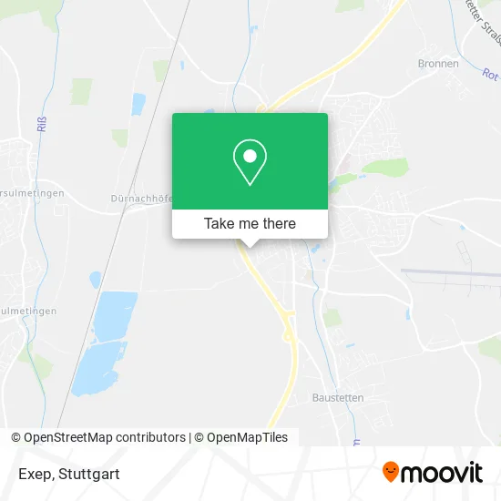
See Exep, Gemeindeverwaltungsverband Laupheim, on the map
Public Transit to Exep in Gemeindeverwaltungsverband Laupheim
Wondering how to get to Exep in Gemeindeverwaltungsverband Laupheim? Moovit helps you find the best way to get to Exep with step-by-step directions from the nearest public transit station.
Moovit provides free maps and live directions to help you navigate through your city. View schedules, routes, timetables, and find out how long does it take to get to Exep in real time.
Looking for the nearest stop or station to Exep? Check out this list of stops closest to your destination: Laupheim Zeppelinstraße; Laupheim Zob/Stadtbahnhof; Laupheim Wfbm; Laupheim Ulmer Str./Ekz; Laupheim Weldenstraße; Laupheim West; Laupheim Westbahnhof.
Train: RE5, RS21, RS2, RE3.Bus: 212, 222, 223, 225, 24, 240, 226, 227, 229.
Want to see if there’s another route that gets you there at an earlier time? Moovit helps you find alternative routes or times. Get directions from and directions to Exep easily from the Moovit App or Website.
We make riding to Exep easy, which is why over 1.5 million users, including users in Gemeindeverwaltungsverband Laupheim, trust Moovit as the best app for public transit. You don’t need to download an individual bus app or train app, Moovit is your all-in-one transit app that helps you find the best bus time or train time available.
For information on prices of train and bus, costs and ride fares to Exep, please check the Moovit app.
Use the app to navigate to popular places including to the airport, hospital, stadium, grocery store, mall, coffee shop, school, college, and university.
Exep Address: Liegnitzer Weg 4 88471 Laupheim street in Gemeindeverwaltungsverband Laupheim
- Michael Apfel Natursteine,
- Fahrschule E. Huchler,
- Jagd und Sport Knab,
- Cafe Restaurant Bar Maximilian,
- Ev. Kindergarten Regenbogen,
- Süd-Planken,
- Zeppelinstraße,
- Neuapostolische Kirche Laupheim,
- Neuapostolische Kirche,
- Valentino,
- Indian Grillhaus,
- Kreissparkasse Biberach Geldautomat,
- Amigo S Pizza Grill,
- KC Kitersclub,
- DHL,
- Surfshop Laupheim,
- Kitecity Sportreisen,
- Seifert,
- GS Danziger VR Bank Laupheim,
- Typo Print
Places Near Exep (Gemeindeverwaltungsverband Laupheim)
- Hanns-Martin-Schleyer-Halle (Stuttgart Hans-Martin-Schleyerhalle), Bad Cannstatt,
- Mercedes-Benz Museum (Mercedes Museum Stuttgart), Bad Cannstatt,
- SI-Centrum, Möhringen,
- Porsche Museum, Zuffenhausen,
- Pariser Platz Stuttgart, Stuttgart-Mitte,
- Mercedes-Benz Museum, Bad Cannstatt,
- Wilhelma (U-Bahn Wilhelma), Bad Cannstatt,
- Waldfriedhof, Degerloch,
- Geilhaus Haus 33a, Reutlingen-Betzingen,
- FlixBus Haltestelle, Stuttgart,
- Klinikum Stuttgart - Katharinenhospital, Stuttgart-Mitte,
- Hauptbahnhof Stuttgart, Stuttgart-Mitte,
- Gleis 101/102 (tief), Stuttgart-Mitte,
- Mettingen Eros-Center Puff Laufhaus, Esslingen Am Neckar,
- Porsche-Arena, Bad Cannstatt,
- Im Wizemann (Halle), Bad Cannstatt,
- Marmorsaal Im Weissenburgpark, Stuttgart-Süd,
- Schleyerhalle, Bad Cannstatt,
- Gasometer Pforzheim, Pforzheim,
- Hanns-Martin-Schleyer-Halle, Bad Cannstatt
How to get to popular places in Stuttgart with public transit
Get around Gemeindeverwaltungsverband Laupheim by public transit!
Traveling around Gemeindeverwaltungsverband Laupheim has never been so easy. See step by step directions as you travel to any attraction, street or major public transit station. View bus and train schedules, arrival times, service alerts and detailed routes on a map, so you know exactly how to get to anywhere in Gemeindeverwaltungsverband Laupheim.
When traveling to any destination around Gemeindeverwaltungsverband Laupheim use Moovit's Live Directions with Get Off Notifications to know exactly where and how far to walk, how long to wait for your line, and how many stops are left. Moovit will alert you when it's time to get off — no need to constantly re-check whether yours is the next stop.
Wondering how to use public transit in Gemeindeverwaltungsverband Laupheim or how to pay for public transit in Gemeindeverwaltungsverband Laupheim? Moovit public transit app can help you navigate your way with public transit easily, and at minimum cost. It includes public transit fees, ticket prices, and costs. Looking for a map of Gemeindeverwaltungsverband Laupheim public transit lines? Moovit public transit app shows all public transit maps in Gemeindeverwaltungsverband Laupheim with all Bus, Train, Subway, Light Rail, Ferry, S-Bahn and Funicular routes and stops on an interactive map.
Stuttgart has 7 transit type(s), including: Bus, Train, Subway, Light Rail, Ferry, S-Bahn and Funicular, operated by several transit agencies, including SSB - Stadtbahn, SSB, SSB - Seilbahn / Zacke, S-Bahn Stuttgart, Rhein-Neckar-Verkehr GmbH (rnv), Karlsruher Verkehrsverbund, DB AG, DB Regiobus BW, Arverio Baden-Württemberg GmbH, DB RegioNetz Verkehrs GmbH Westfrankenbahn, DB Regio AG Baden-Württemberg, Südwestdeutsche Verkehrs-AG, DB Regio AG Mitte Region Hessen, DB and Bodensee-Oberschwaben-Bahn