How to get to Exit 220/Mitchell Rd/N by bus?
Click on the bus route to see step by step directions with maps, line arrival times and updated time schedules.
Bus stops near Exit 220/Mitchell Rd/N in Modesto
Bus lines to Exit 220/Mitchell Rd/N in Modesto
What are the closest stations to Exit 220/Mitchell Rd/N?
The closest stations to Exit 220/Mitchell Rd/N are:
- Mitchell Rd & Rhode Rd is 861 yards away, 10 min walk.
- Service Rd & Mitchell Rd is 1050 yards away, 13 min walk.
Which bus lines stop near Exit 220/Mitchell Rd/N?
These bus lines stop near Exit 220/Mitchell Rd/N: 29T, 61.
What’s the nearest bus station to Exit 220/Mitchell Rd/N in Modesto?
The nearest bus station to Exit 220/Mitchell Rd/N in Modesto is Mitchell Rd & Rhode Rd. It’s a 10 min walk away.
What time is the first bus to Exit 220/Mitchell Rd/N in Modesto?
The 29 is the first bus that goes to Exit 220/Mitchell Rd/N in Modesto. It stops nearby at 5:44 AM.
What time is the last bus to Exit 220/Mitchell Rd/N in Modesto?
The 29 is the last bus that goes to Exit 220/Mitchell Rd/N in Modesto. It stops nearby at 11:03 PM.
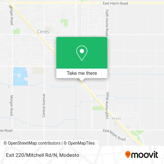
See Exit 220/Mitchell Rd/N, Modesto, on the map
Public Transit to Exit 220/Mitchell Rd/N in Modesto
Wondering how to get to Exit 220/Mitchell Rd/N in Modesto? Moovit helps you find the best way to get to Exit 220/Mitchell Rd/N with step-by-step directions from the nearest public transit station.
Moovit provides free maps and live directions to help you navigate through your city. View schedules, routes, timetables, and find out how long does it take to get to Exit 220/Mitchell Rd/N in real time.
Looking for the nearest stop or station to Exit 220/Mitchell Rd/N? Check out this list of stops closest to your destination: Mitchell Rd & Rhode Rd; Service Rd & Mitchell Rd.
Bus: 29T, 61, 29, 42, 47.
Want to see if there’s another route that gets you there at an earlier time? Moovit helps you find alternative routes or times. Get directions from and directions to Exit 220/Mitchell Rd/N easily from the Moovit App or Website.
We make riding to Exit 220/Mitchell Rd/N easy, which is why over 1.5 million users, including users in Modesto, trust Moovit as the best app for public transit. You don’t need to download an individual bus app or train app, Moovit is your all-in-one transit app that helps you find the best bus time or train time available.
For information on prices of bus, costs and ride fares to Exit 220/Mitchell Rd/N, please check the Moovit app.
Use the app to navigate to popular places including to the airport, hospital, stadium, grocery store, mall, coffee shop, school, college, and university.
Exit 220/Mitchell Rd/N Address: CA-99 Ceres, CA 95307 street in Modesto
- Romall Industries,
- Fight. A Coalition Against Evil,
- Popeyes Louisiana Kitchen,
- Fresh Fork Grill,
- Fashions & Clothing,
- Ledbetter & Associates, Inc.,
- La Monarca Michoacana,
- Trinity Dental & Implant Center,
- Central Valley Business & Tax Services,
- Navy Federal Credit Union,
- 3000 Service Rd Parking,
- Amazon Locker-Terrific,
- Jim Wyatt,
- Central Valley Virsa Group,
- Chadha Construction,
- Ono - 227 (Ceres),
- Coinstar,
- Ifixandrepair - Ceres,
- Western Union,
- La Mesa Redonda
Places Near Exit 220/Mitchell Rd/N (Modesto)
- Vintage Faire Mall,
- Amazon Fulfillment Center,
- Walmart,
- Black Oak Casino,
- Modesto Junior College - West Campus, Modesto,
- Modesto, ca,
- Kaiser Permanente Modesto Medical Center,
- Modesto, Ca,
- Highway 99 South -Traffic,
- Ceres CA USA, Ceres,
- Modesto Amtrak (MOD),
- Walmart,
- Newman CA USA, Newman,
- Salida, Ca, Salida,
- Modesto Junior College,
- Turlock, CA, Turlock,
- Patterson,
- Tesla,
- Costco Wholesale, Turlock,
- DMV
How to get to popular places in Modesto with public transit
Get around Modesto by public transit!
Traveling around Modesto has never been so easy. See step by step directions as you travel to any attraction, street or major public transit station. View bus and train schedules, arrival times, service alerts and detailed routes on a map, so you know exactly how to get to anywhere in Modesto.
When traveling to any destination around Modesto use Moovit's Live Directions with Get Off Notifications to know exactly where and how far to walk, how long to wait for your line, and how many stops are left. Moovit will alert you when it's time to get off — no need to constantly re-check whether yours is the next stop.
Wondering how to use public transit in Modesto or how to pay for public transit in Modesto? Moovit public transit app can help you navigate your way with public transit easily, and at minimum cost. It includes public transit fees, ticket prices, and costs. Looking for a map of Modesto public transit lines? Moovit public transit app shows all public transit maps in Modesto with all bus routes and stops on an interactive map.
Modesto has 1 transit type(s), including: bus, operated by several transit agencies, including The S, Turlock Transit, Greyhound-us and FlixBus-us