How to get to Express Locksmith by bus?
Click on the bus route to see step by step directions with maps, line arrival times and updated time schedules.
From I-65 & E Raymond St, Indianapolis City (Balance)
42 minFrom Law Office of Aftin R Brown, Indianapolis City (Balance)
59 minFrom USPS Collection Box - Blue Box, Indianapolis City (Balance)
63 minFrom N Franklin Rd / E 56th St, Lawrence
70 minFrom I-65 and Michigan, Indianapolis City (Balance)
52 minFrom Emergency Dentist Indianapolis 24/7, Indianapolis City (Balance)
46 minFrom Dina Varano Ma LMHC, Indianapolis City (Balance)
64 minFrom Lilly Corp Center - Bldg 48, Indianapolis City (Balance)
44 minFrom WING STOP, Beech Grove
66 minFrom Rainbowshops, Indianapolis City (Balance)
57 min
Bus stops near Express Locksmith in Indianapolis City (Balance)
Bus lines to Express Locksmith in Indianapolis City (Balance)
What are the closest stations to Express Locksmith?
The closest stations to Express Locksmith are:
- 10th St & Olney St is 257 yards away, 4 min walk.
- 16th St & Denny St is 359 yards away, 5 min walk.
Which bus lines stop near Express Locksmith?
These bus lines stop near Express Locksmith: 10, 11.
What’s the nearest bus station to Express Locksmith in Indianapolis City (Balance)?
The nearest bus station to Express Locksmith in Indianapolis City (Balance) is 10th St & Olney St. It’s a 4 min walk away.
What time is the first bus to Express Locksmith in Indianapolis City (Balance)?
The 11 is the first bus that goes to Express Locksmith in Indianapolis City (Balance). It stops nearby at 5:12 AM.
What time is the last bus to Express Locksmith in Indianapolis City (Balance)?
The 10 is the last bus that goes to Express Locksmith in Indianapolis City (Balance). It stops nearby at 11:59 PM.
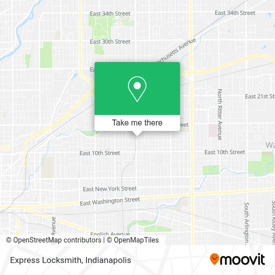
See Express Locksmith, Indianapolis City (Balance), on the map
Public Transit to Express Locksmith in Indianapolis City (Balance)
Wondering how to get to Express Locksmith in Indianapolis City (Balance)? Moovit helps you find the best way to get to Express Locksmith with step-by-step directions from the nearest public transit station.
Moovit provides free maps and live directions to help you navigate through your city. View schedules, routes, timetables, and find out how long does it take to get to Express Locksmith in real time.
Looking for the nearest stop or station to Express Locksmith? Check out this list of stops closest to your destination: 10th St & Olney St; 16th St & Denny St.
Bus: 10, 11.
Want to see if there’s another route that gets you there at an earlier time? Moovit helps you find alternative routes or times. Get directions from and directions to Express Locksmith easily from the Moovit App or Website.
We make riding to Express Locksmith easy, which is why over 1.5 million users, including users in Indianapolis City (Balance), trust Moovit as the best app for public transit. You don’t need to download an individual bus app or train app, Moovit is your all-in-one transit app that helps you find the best bus time or train time available.
For information on prices of bus, costs and ride fares to Express Locksmith, please check the Moovit app.
Use the app to navigate to popular places including to the airport, hospital, stadium, grocery store, mall, coffee shop, school, college, and university.
Express Locksmith Address: 1313 N Sherman Dr Indianapolis, IN 46201 street in Indianapolis City (Balance)
- The Hardware,
- Gabriel,
- Indy Quality Meats,
- Klosterman Baking,
- Little Booda's Daycare,
- Day Care,
- Charles C. Brandt Construction Co.,
- Just Pizza,
- Mirabella Cosmetics,
- Glamazon Body & Beauty Wellness Studio,
- Alexandria Community Anderson Community,
- Firstlady Boutique & Printshop,
- VP Exteriors,
- African Hairbraiding,
- Rivoli Park Labyrinth,
- Capitol City Family Education Services,
- Alloyd Co,
- Good Nature,
- Beach,
- Gardner Construction Services
Places Near Express Locksmith (Indianapolis City (Balance))
- Lucas Oil Stadium, Indianapolis City (Balance),
- Castleton Square Mall, Indianapolis,
- Jersey Barn, Indianapolis City (Balance),
- Gainbridge Fieldhouse, Indianapolis City (Balance),
- Methodist Hospital of Indianapolis, Indianapolis City (Balance),
- Indiana Convention Center, Indianapolis City (Balance),
- I U Health Methodist Hospital, Indianapolis City (Balance),
- Indianapolis Motor Speedway, Speedway,
- Eskenazi Hospital, Indianapolis City (Balance),
- Indiana, Indianapolis City (Balance),
- THE BALT, Indianapolis City (Balance),
- I-465 / I-65 Interchange, Indianapolis City (Balance),
- Plainfield, IN, Plainfield,
- St. Vincent Hospital - Indianapolis, Indianapolis City (Balance),
- 119 W 19th St Parking, Indianapolis City (Balance),
- Train Ride At Castleton Mall, Indianapolis City (Balance),
- Cotter's Massage Parlor With Happy Endings, Indianapolis City (Balance),
- St. Vincent entrance #1, Indianapolis City (Balance),
- Indianapolis Airport Zone 2, Indianapolis City (Balance),
- Lilly Corporate Center (Eli Lilly & Co), Indianapolis City (Balance)
How to get to popular places in Indianapolis with public transit
Get around Indianapolis City (Balance) by public transit!
Traveling around Indianapolis City (Balance) has never been so easy. See step by step directions as you travel to any attraction, street or major public transit station. View bus and train schedules, arrival times, service alerts and detailed routes on a map, so you know exactly how to get to anywhere in Indianapolis City (Balance).
When traveling to any destination around Indianapolis City (Balance) use Moovit's Live Directions with Get Off Notifications to know exactly where and how far to walk, how long to wait for your line, and how many stops are left. Moovit will alert you when it's time to get off — no need to constantly re-check whether yours is the next stop.
Wondering how to use public transit in Indianapolis City (Balance) or how to pay for public transit in Indianapolis City (Balance)? Moovit public transit app can help you navigate your way with public transit easily, and at minimum cost. It includes public transit fees, ticket prices, and costs. Looking for a map of Indianapolis City (Balance) public transit lines? Moovit public transit app shows all public transit maps in Indianapolis City (Balance) with all bus routes and stops on an interactive map.
Indianapolis has 1 transit type(s), including: bus, operated by several transit agencies, including IndyGo, FlixBus-us and Greyhound-us