How to get to Extra Space Storage by bus?
Click on the bus route to see step by step directions with maps, line arrival times and updated time schedules.
From The Lucerne Hotel, Manhattan
66 minFrom Memorial Sloan-Kettering Cancer Center, Manhattan
61 minFrom Lenox Hill Hospital, Manhattan
62 minFrom Metro North - Harlem - 125th Street Station, Manhattan
35 minFrom City Island, Bronx
57 minFrom 31st St (astoria blvd & 31st street), Queens
69 minFrom East 80th Street, Manhattan
60 minFrom Co-op City, Bronx
47 minFrom E 77th St / Lexington Ave, Manhattan
61 minFrom Holy Name Hospital, Teaneck
59 min
How to get to Extra Space Storage by train?
Click on the train route to see step by step directions with maps, line arrival times and updated time schedules.
How to get to Extra Space Storage by subway?
Click on the subway route to see step by step directions with maps, line arrival times and updated time schedules.
From The Lucerne Hotel, Manhattan
47 minFrom Memorial Sloan-Kettering Cancer Center, Manhattan
45 minFrom Lenox Hill Hospital, Manhattan
43 minFrom Metro North - Harlem - 125th Street Station, Manhattan
37 minFrom 31st St (astoria blvd & 31st street), Queens
58 minFrom East 80th Street, Manhattan
46 minFrom Co-op City, Bronx
73 minFrom E 77th St / Lexington Ave, Manhattan
41 min
Bus stops near Extra Space Storage in Bronx
Subway stations near Extra Space Storage in Bronx
Train station near Extra Space Storage in Bronx
- Tremont, 7 min walk,VIEW
Bus lines to Extra Space Storage in Bronx
What are the closest stations to Extra Space Storage?
The closest stations to Extra Space Storage are:
- Webster Av/E 180 St is 37 yards away, 1 min walk.
- Burnside Av is 393 yards away, 5 min walk.
- Tremont is 541 yards away, 7 min walk.
- 3 Av/E 180 St is 603 yards away, 8 min walk.
- 182-183 Sts is 632 yards away, 8 min walk.
Which bus lines stop near Extra Space Storage?
These bus lines stop near Extra Space Storage: BX36, BX41, BX41-SBS, BXM4.
Which train line stops near Extra Space Storage?
2 (513#| North White Plains)
Which subway lines stop near Extra Space Storage?
These subway lines stop near Extra Space Storage: 4, D.
What’s the nearest subway station to Extra Space Storage in Bronx?
The nearest subway station to Extra Space Storage in Bronx is Burnside Av. It’s a 5 min walk away.
What’s the nearest train station to Extra Space Storage in Bronx?
The nearest train station to Extra Space Storage in Bronx is Tremont. It’s a 7 min walk away.
What’s the nearest bus station to Extra Space Storage in Bronx?
The nearest bus station to Extra Space Storage in Bronx is Webster Av/E 180 St. It’s a 1 min walk away.
What time is the first subway to Extra Space Storage in Bronx?
The D is the first subway that goes to Extra Space Storage in Bronx. It stops nearby at 3:03 AM.
What time is the last subway to Extra Space Storage in Bronx?
The D is the last subway that goes to Extra Space Storage in Bronx. It stops nearby at 4:25 AM.
What time is the first train to Extra Space Storage in Bronx?
The 2 is the first train that goes to Extra Space Storage in Bronx. It stops nearby at 5:20 AM.
What time is the last train to Extra Space Storage in Bronx?
The 2 is the last train that goes to Extra Space Storage in Bronx. It stops nearby at 2:12 AM.
What time is the first bus to Extra Space Storage in Bronx?
The BX15 is the first bus that goes to Extra Space Storage in Bronx. It stops nearby at 3:03 AM.
What time is the last bus to Extra Space Storage in Bronx?
The BX41 is the last bus that goes to Extra Space Storage in Bronx. It stops nearby at 3:07 AM.
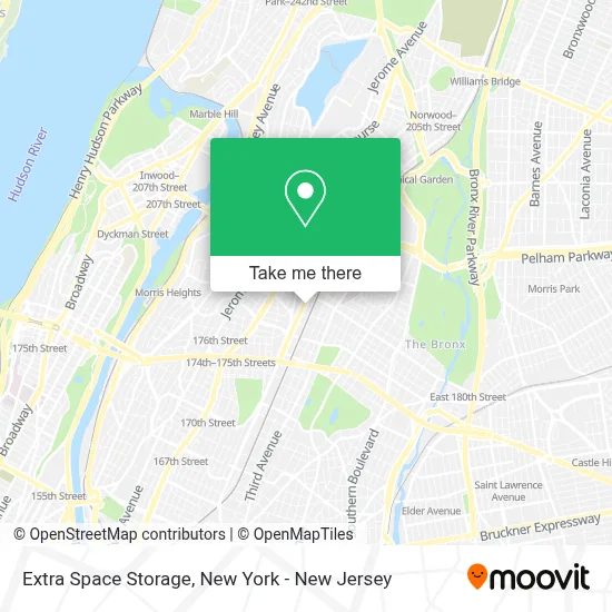
See Extra Space Storage, Bronx, on the map
Public Transit to Extra Space Storage in Bronx
Wondering how to get to Extra Space Storage in Bronx? Moovit helps you find the best way to get to Extra Space Storage with step-by-step directions from the nearest public transit station.
Moovit provides free maps and live directions to help you navigate through your city. View schedules, routes, timetables, and find out how long does it take to get to Extra Space Storage in real time.
Looking for the nearest stop or station to Extra Space Storage? Check out this list of stops closest to your destination: Webster Av/E 180 St; Burnside Av; Tremont; 3 Av/E 180 St; 182-183 Sts.
Bus: BX36, BX41, BX41-SBS, BXM4, BX40, BX42.Train: 2.Subway: 4, D, B.
Want to see if there’s another route that gets you there at an earlier time? Moovit helps you find alternative routes or times. Get directions from and directions to Extra Space Storage easily from the Moovit App or Website.
We make riding to Extra Space Storage easy, which is why over 1.5 million users, including users in Bronx, trust Moovit as the best app for public transit. You don’t need to download an individual bus app or train app, Moovit is your all-in-one transit app that helps you find the best bus time or train time available.
For information on prices of bus, subway and train, costs and ride fares to Extra Space Storage, please check the Moovit app.
Use the app to navigate to popular places including to the airport, hospital, stadium, grocery store, mall, coffee shop, school, college, and university.
Extra Space Storage Address: 2036 Webster Ave street in Bronx
- Grace Beauty Care,
- Western Beef,
- Zen Lighting,
- Coinstar,
- Int2k Auto Collision,
- Tania Hair Nail Salon,
- E 179th St (179th webster ave),
- E 180th St (east 180th / webster ave),
- Gwb Hotel,
- Abundant Life Baptist Church,
- The Good Samaritan Center Monastery Church,
- E 180th and Tiebout,
- Evolution Auto Inc.,
- Alexa Spa Salon Unisex,
- Monopoly Collision,
- Fountain Of Love Fellowship Church, Inc.,
- Soninkara Multi Service,
- Super Mega Automobile Center,
- Virginia Quizhpi,
- Central Jet Charter Inc.,
Places Near Extra Space Storage (Bronx)
- Katz's Deli, Manhattan,
- 376 Hudson Street, Manhattan,
- 3 Stone St, Manhattan,
- Wall Street, Manhattan,
- Rockefeller Center, Manhattan,
- Hudson Yards, Manhattan,
- Chinatown, Manhattan,
- 911 Memorial, Manhattan,
- 111 Centre New York City Supreme Court, Manhattan,
- 1 Police Plaza, Manhattan,
- SoHo, Manhattan,
- 66 John Street, Manhattan,
- Queens Center Mall, Queens,
- San Gennaro Feast, Manhattan,
- Pier 83, Manhattan,
- Times Square, Manhattan,
- qqqq, Manhattan,
- Bellevue Hospital, Manhattan,
- 26 Federal Plaza, Manhattan,
- Mountainside Hospital, Glen Ridge
How to get to popular places in New York - New Jersey with public transit
Get around Bronx by public transit!
Traveling around Bronx has never been so easy. See step by step directions as you travel to any attraction, street or major public transit station. View bus and train schedules, arrival times, service alerts and detailed routes on a map, so you know exactly how to get to anywhere in Bronx.
When traveling to any destination around Bronx use Moovit's Live Directions with Get Off Notifications to know exactly where and how far to walk, how long to wait for your line, and how many stops are left. Moovit will alert you when it's time to get off — no need to constantly re-check whether yours is the next stop.
Wondering how to use public transit in Bronx or how to pay for public transit in Bronx? Moovit public transit app can help you navigate your way with public transit easily, and at minimum cost. It includes public transit fees, ticket prices, and costs. Looking for a map of Bronx public transit lines? Moovit public transit app shows all public transit maps in Bronx with all Bus, Train, Subway, Light Rail, Ferry and Cable Car routes and stops on an interactive map.
New York - New Jersey has 6 transit type(s), including: Bus, Train, Subway, Light Rail, Ferry and Cable Car, operated by several transit agencies, including MTA Subway, Metro-North Railroad, LIRR, PATH, MTA New York City Transit - Express routes, MTA Bus, NJ Transit, NYC Ferry, NICE bus, Bee-Line Bus, NJ Transit Rail, Norwalk Transit District, Hartford Line, River Valley Transit and HART