How to get to Extra Space Storage by bus?
Click on the bus route to see step by step directions with maps, line arrival times and updated time schedules.
From George Washington Lisner Auditorium, Washington
82 minFrom AMC Theatres-Loews Georgetown 14, Washington
57 minFrom Ted's Bulletin, Washington
101 minFrom Mt Vernon Campus Of GWU, Washington
104 minFrom Adams Morgan, Washington
103 minFrom Omni Shoreham Hotel, Washington
101 minFrom Songbyrd Music House & Record Cafe, Washington
102 minFrom Museum of Illusions, Washington
94 minFrom Meridian Hill Park (Malcolm X Park), Washington
103 minFrom Hyatt Place-Arlington Courthouse Plaza (Hyatt Place Arlington/Courthouse Plaza), Arlington County
33 min
How to get to Extra Space Storage by metro?
Click on the metro route to see step by step directions with maps, line arrival times and updated time schedules.
From George Washington Lisner Auditorium, Washington
32 minFrom AMC Theatres-Loews Georgetown 14, Washington
41 minFrom Ted's Bulletin, Washington
38 minFrom Adams Morgan, Washington
49 minFrom Omni Shoreham Hotel, Washington
39 minFrom Songbyrd Music House & Record Cafe, Washington
49 minFrom Museum of Illusions, Washington
31 minFrom Meridian Hill Park (Malcolm X Park), Washington
46 minFrom Hyatt Place-Arlington Courthouse Plaza (Hyatt Place Arlington/Courthouse Plaza), Arlington County
35 min
Bus stop near Extra Space Storage in Alexandria
- E Glebe Rd + Main Line Blvd, 1 min walk,VIEW
Metro station near Extra Space Storage in Alexandria
- Crystal City, 11 min walk,VIEW
Bus lines to Extra Space Storage in Alexandria
What are the closest stations to Extra Space Storage?
The closest stations to Extra Space Storage are:
- E Glebe Rd + Main Line Blvd is 34 yards away, 1 min walk.
- Crystal City is 916 yards away, 11 min walk.
Which bus lines stop near Extra Space Storage?
These bus lines stop near Extra Space Storage: A1X, A70.
Which metro lines stop near Extra Space Storage?
These metro lines stop near Extra Space Storage: BLUE, YELLOW.
What’s the nearest metro station to Extra Space Storage in Alexandria?
The nearest metro station to Extra Space Storage in Alexandria is Crystal City. It’s a 11 min walk away.
What’s the nearest bus station to Extra Space Storage in Alexandria?
The nearest bus station to Extra Space Storage in Alexandria is E Glebe Rd + Main Line Blvd. It’s a 1 min walk away.
What time is the first metro to Extra Space Storage in Alexandria?
The YELLOW is the first metro that goes to Extra Space Storage in Alexandria. It stops nearby at 5:04 AM.
What time is the last metro to Extra Space Storage in Alexandria?
The YELLOW is the last metro that goes to Extra Space Storage in Alexandria. It stops nearby at 12:35 AM.
What time is the first bus to Extra Space Storage in Alexandria?
The 33 is the first bus that goes to Extra Space Storage in Alexandria. It stops nearby at 5:04 AM.
What time is the last bus to Extra Space Storage in Alexandria?
The A70 is the last bus that goes to Extra Space Storage in Alexandria. It stops nearby at 1:00 AM.
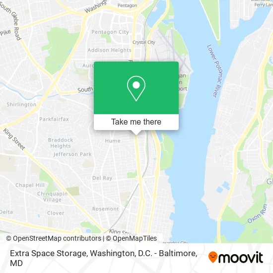
See Extra Space Storage, Alexandria, on the map
Public Transit to Extra Space Storage in Alexandria
Wondering how to get to Extra Space Storage in Alexandria? Moovit helps you find the best way to get to Extra Space Storage with step-by-step directions from the nearest public transit station.
Moovit provides free maps and live directions to help you navigate through your city. View schedules, routes, timetables, and find out how long does it take to get to Extra Space Storage in real time.
Looking for the nearest stop or station to Extra Space Storage? Check out this list of stops closest to your destination: E Glebe Rd + Main Line Blvd; Crystal City.
Bus: A1X, A70, 33, 34, 36A, 36B.Metro: BLUE, YELLOW, METRO STATION CLOSURE SHUTTLE.
Want to see if there’s another route that gets you there at an earlier time? Moovit helps you find alternative routes or times. Get directions from and directions to Extra Space Storage easily from the Moovit App or Website.
We make riding to Extra Space Storage easy, which is why over 1.5 million users, including users in Alexandria, trust Moovit as the best app for public transit. You don’t need to download an individual bus app or train app, Moovit is your all-in-one transit app that helps you find the best bus time or train time available.
For information on prices of bus and metro, costs and ride fares to Extra Space Storage, please check the Moovit app.
Use the app to navigate to popular places including to the airport, hospital, stadium, grocery store, mall, coffee shop, school, college, and university.
Extra Space Storage Address: 2995 Richmond Hwy Alexandria, VA 22301 street in Alexandria
- Orangetheory Fitness,
- Lebosquet at Sunnyside,
- Richmond Hwy and Glebe Rd,
- Shell,
- Coinstar,
- Kim Yiseul Estelle Alexandria,
- STARBUCKS,
- Libertyx Bitcoin ATM,
- Keyme Locksmiths,
- Giant,
- Aquia Episcopal Church,
- Notch 8,
- Ready 2 Go Cabinet,
- A Angel's Car Radio (Angelos Car Radio),
- Los Tres Amigos Tex Mex Italian Cuisine,
- Batteries Plus Bulbs,
- Best Western Aquia / Quantico Inn,
- Target Alexandria,
- The Institute of Defense Analyses (Ida),
- Institute For Defense Analyses
Places Near Extra Space Storage (Alexandria)
- PG Mall, Prince George's County,
- Washington National Cathedral, Washington,
- Capital One Arena, Washington,
- Rock Creek Tennis Center, Washington,
- Warner Theatre, Washington,
- Westfield Montgomery Mall, Montgomery County,
- National Museum of African American History and Culture, Washington,
- Georgetown, Washington,
- Basilica of the National Shrine, Washington,
- The Anthem, Washington,
- Museum Of The Bible, Washington,
- M&T Bank Stadium, Baltimore,
- National Mall, Washington,
- National Zoo, Washington,
- Washington DC VA Medical Center, Washington,
- Marriott Marquis Washington, DC, Washington,
- Sibley Memorial Hospital, Washington,
- Amazon Hq2, Arlington County,
- Pennsylvania Ave NW (3rd st and pennsylvania), Washington,
- Camden Yards, Baltimore
How to get to popular places in Washington, D.C. - Baltimore, MD with public transit
Get around Alexandria by public transit!
Traveling around Alexandria has never been so easy. See step by step directions as you travel to any attraction, street or major public transit station. View bus and train schedules, arrival times, service alerts and detailed routes on a map, so you know exactly how to get to anywhere in Alexandria.
When traveling to any destination around Alexandria use Moovit's Live Directions with Get Off Notifications to know exactly where and how far to walk, how long to wait for your line, and how many stops are left. Moovit will alert you when it's time to get off — no need to constantly re-check whether yours is the next stop.
Wondering how to use public transit in Alexandria or how to pay for public transit in Alexandria? Moovit public transit app can help you navigate your way with public transit easily, and at minimum cost. It includes public transit fees, ticket prices, and costs. Looking for a map of Alexandria public transit lines? Moovit public transit app shows all public transit maps in Alexandria with all Bus, Train, Metro, Light Rail and Ferry routes and stops on an interactive map.
Washington, D.C. - Baltimore, MD has 5 transit type(s), including: Bus, Train, Metro, Light Rail and Ferry, operated by several transit agencies, including WMATA, Montgomery County Ride On, Fairfax Connector, TheBus, PRTC, DASH - Alexandria, Arlington Transit (ART), RTA of Central Maryland, MDOT MTA, MDOT MTA Light RailLink, MDOT MTA Commuter Bus, MDOT MTA Local Bus, FXBGO!, Virginia Railway Express (VRE) and MARC