How to get to Extra Space Storage by bus?
Click on the bus route to see step by step directions with maps, line arrival times and updated time schedules.
From Rose Gaming Resort, Prince William County
249 minFrom Busch Gardens Williamsburg (Employee Parking Lot), James City County
165 minFrom Potomac Mills Mall, Prince William County
224 minFrom Lorton, VA - Amtrak Auto Train Station (LOR), Fairfax County
239 minFrom Lorton, VA, Fairfax County
233 minFrom Amazon Fulfillment Center-Ric3, Richmond
58 minFrom Woodbridge, VA, Prince William County
168 minFrom UVA Hospital Medical Center, Charlottesville
313 min
Bus stops near Extra Space Storage in Richmond
Bus lines to Extra Space Storage in Richmond
What are the closest stations to Extra Space Storage?
The closest stations to Extra Space Storage are:
- Midlothian Pike + Covington is 307 yards away, 4 min walk.
- Westover Hills Boulevard + Crutchfield is 978 yards away, 12 min walk.
- Belt Boulevard + Brandon is 993 yards away, 12 min walk.
Which bus line stops near Extra Space Storage?
1A (Hull/Midlothian Via Southside Plaza)
What’s the nearest bus station to Extra Space Storage in Richmond?
The nearest bus station to Extra Space Storage in Richmond is Midlothian Pike + Covington. It’s a 4 min walk away.
What time is the first bus to Extra Space Storage in Richmond?
The 20 is the first bus that goes to Extra Space Storage in Richmond. It stops nearby at 4:47 AM.
What time is the last bus to Extra Space Storage in Richmond?
The 2C is the last bus that goes to Extra Space Storage in Richmond. It stops nearby at 1:08 AM.
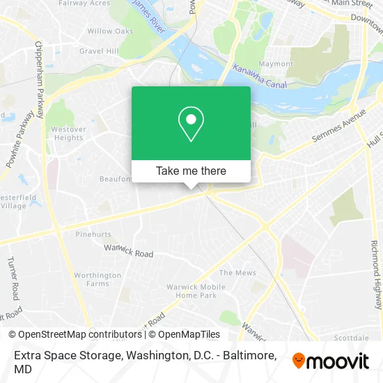
See Extra Space Storage, Richmond, on the map
Public Transit to Extra Space Storage in Richmond
Wondering how to get to Extra Space Storage in Richmond? Moovit helps you find the best way to get to Extra Space Storage with step-by-step directions from the nearest public transit station.
Moovit provides free maps and live directions to help you navigate through your city. View schedules, routes, timetables, and find out how long does it take to get to Extra Space Storage in real time.
Looking for the nearest stop or station to Extra Space Storage? Check out this list of stops closest to your destination: Midlothian Pike + Covington; Westover Hills Boulevard + Crutchfield; Belt Boulevard + Brandon.
Bus: 1A, 20, 2C.
Want to see if there’s another route that gets you there at an earlier time? Moovit helps you find alternative routes or times. Get directions from and directions to Extra Space Storage easily from the Moovit App or Website.
We make riding to Extra Space Storage easy, which is why over 1.5 million users, including users in Richmond, trust Moovit as the best app for public transit. You don’t need to download an individual bus app or train app, Moovit is your all-in-one transit app that helps you find the best bus time or train time available.
For information on prices of bus and train, costs and ride fares to Extra Space Storage, please check the Moovit app.
Use the app to navigate to popular places including to the airport, hospital, stadium, grocery store, mall, coffee shop, school, college, and university.
Extra Space Storage Address: 5050 Midlothian Tpke Richmond, VA 23225 street in Richmond
- CUBESMART,
- Taboo,
- Covington Road Properties,
- Capital Auto Glass,
- All U Need Automotive,
- Route 60 Auto Repair,
- Affordable Body Paint,
- New Super Auto Sales,
- Chesterfield Auto Parts,
- J.L. Minter Electric,
- Brigman Body & Paint,
- Color Tech,
- Sankofa Community Orchard,
- ATM,
- Z Express,
- Libertyx Bitcoin ATM,
- Krispy Krunchy Chicken,
- United Nations Church,
- The International Christian Ministries,
- Super Low Price Auto Glass
Places Near Extra Space Storage (Richmond)
- Westfield Montgomery Mall, Montgomery County,
- National Mall, Washington,
- The Anthem, Washington,
- PG Mall, Prince George's County,
- Capital One Arena, Washington,
- Pennsylvania Ave NW (3rd st and pennsylvania), Washington,
- Warner Theatre, Washington,
- Museum Of The Bible, Washington,
- Camden Yards, Baltimore,
- Washington DC VA Medical Center, Washington,
- Rock Creek Tennis Center, Washington,
- National Zoo, Washington,
- Sibley Memorial Hospital, Washington,
- Marriott Marquis Washington, DC, Washington,
- Basilica of the National Shrine, Washington,
- National Museum of African American History and Culture, Washington,
- Georgetown, Washington,
- M&T Bank Stadium, Baltimore,
- Amazon Hq2, Arlington County,
- Washington National Cathedral, Washington
How to get to popular places in Washington, D.C. - Baltimore, MD with public transit
Get around Richmond by public transit!
Traveling around Richmond has never been so easy. See step by step directions as you travel to any attraction, street or major public transit station. View bus and train schedules, arrival times, service alerts and detailed routes on a map, so you know exactly how to get to anywhere in Richmond.
When traveling to any destination around Richmond use Moovit's Live Directions with Get Off Notifications to know exactly where and how far to walk, how long to wait for your line, and how many stops are left. Moovit will alert you when it's time to get off — no need to constantly re-check whether yours is the next stop.
Wondering how to use public transit in Richmond or how to pay for public transit in Richmond? Moovit public transit app can help you navigate your way with public transit easily, and at minimum cost. It includes public transit fees, ticket prices, and costs. Looking for a map of Richmond public transit lines? Moovit public transit app shows all public transit maps in Richmond with all Bus, Train, Metro, Light Rail and Ferry routes and stops on an interactive map.
Washington, D.C. - Baltimore, MD has 5 transit type(s), including: Bus, Train, Metro, Light Rail and Ferry, operated by several transit agencies, including WMATA, Montgomery County Ride On, Fairfax Connector, TheBus, PRTC, DASH - Alexandria, Arlington Transit (ART), RTA of Central Maryland, MDOT MTA, MDOT MTA Light RailLink, MDOT MTA Commuter Bus, MDOT MTA Local Bus, FXBGO!, Virginia Railway Express (VRE) and MARC