How to get to Exxon by bus?
Click on the bus route to see step by step directions with maps, line arrival times and updated time schedules.
Bus stops near Exxon in Fort Myers
Bus lines to Exxon in Fort Myers
What are the closest stations to Exxon?
The closest stations to Exxon are:
- Summerlin Rd @ Hayley Ln is 137 yards away, 2 min walk.
- S Cleveland Ave @ Boy Scout Dr is 949 yards away, 12 min walk.
Which bus lines stop near Exxon?
These bus lines stop near Exxon: 130, 140.
What’s the nearest bus station to Exxon in Fort Myers?
The nearest bus station to Exxon in Fort Myers is Summerlin Rd @ Hayley Ln. It’s a 2 min walk away.
What time is the first bus to Exxon in Fort Myers?
The 140 is the first bus that goes to Exxon in Fort Myers. It stops nearby at 5:05 AM.
What time is the last bus to Exxon in Fort Myers?
The 140 is the last bus that goes to Exxon in Fort Myers. It stops nearby at 10:51 PM.
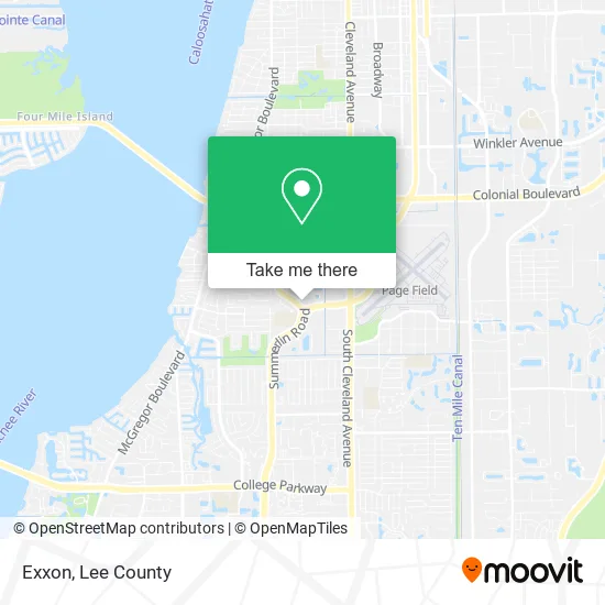
See Exxon, Fort Myers, on the map
Public Transit to Exxon in Fort Myers
Wondering how to get to Exxon in Fort Myers? Moovit helps you find the best way to get to Exxon with step-by-step directions from the nearest public transit station.
Moovit provides free maps and live directions to help you navigate through your city. View schedules, routes, timetables, and find out how long does it take to get to Exxon in real time.
Looking for the nearest stop or station to Exxon? Check out this list of stops closest to your destination: Summerlin Rd @ Hayley Ln; S Cleveland Ave @ Boy Scout Dr.
Bus: 130, 140.
Want to see if there’s another route that gets you there at an earlier time? Moovit helps you find alternative routes or times. Get directions from and directions to Exxon easily from the Moovit App or Website.
We make riding to Exxon easy, which is why over 1.5 million users, including users in Fort Myers, trust Moovit as the best app for public transit. You don’t need to download an individual bus app or train app, Moovit is your all-in-one transit app that helps you find the best bus time or train time available.
For information on prices of bus, costs and ride fares to Exxon, please check the Moovit app.
Use the app to navigate to popular places including to the airport, hospital, stadium, grocery store, mall, coffee shop, school, college, and university.
Exxon Address: 1580 Hayley Ln Fort Myers, FL 33907 street in Fort Myers
- Red Cedar Dental Care,
- Taylor A. Johnson, DDS,
- Cameron A. Long, DMD,
- Sinbad,
- Crossfit,
- Omni Fitness,
- Boy Scout Dr / Summerlin Commons Blvd,
- Regions Bank,
- Marlin Re Investments,
- Cellmark Biopharma,
- Harrison the Health Adviser,
- Everwell Financial,
- Legacy Solutions & Wellness Insurance,
- The West Coast Integrative Wellness Center,
- Drkaster S,
- Dr Cvik Jelin Israel MD,
- Parker Lewis DDS,
- Absolute Home Inspection,
- First Merchant Payment Systems,
- Pocket Locksmith Store
Places Near Exxon (Fort Myers)
- All About U Naples Escorts, Pine Ridge,
- Bonita Beach, Bonita Springs,
- Miromar Outlets, Estero,
- Bonita Springs, FL, Bonita Springs,
- U.S.-41 / Colonial Blvd. Intersection, Fort Myers,
- I-75 & MLK (Exit 138), Fort Myers,
- Walmart Supercenter, Fort Myers,
- Flixbus, Fort Myers,
- US-41, Fort Myers,
- I-75 & Colonial (Exit 136), Fort Myers,
- Rosa Parks Transportation Center, Fort Myers,
- Lee County Tax Collector, Cape Coral,
- Edison Mall, Fort Myers,
- Pelican Landing Beach Shuttle, Bonita Springs,
- Amazon Warehouse Rsw5,
- Lehigh Acres, FL, Lehigh Acres,
- Bonita Bay Private Beach Club, Bonita Springs,
- Matlacha Nude Beach, Matlacha Isles-Matlacha Shores,
- Seminole Casino Hotel Immokalee,
- Ft Myers Airport RSW
How to get to popular places in Lee County with public transit
Get around Fort Myers by public transit!
Traveling around Fort Myers has never been so easy. See step by step directions as you travel to any attraction, street or major public transit station. View bus and train schedules, arrival times, service alerts and detailed routes on a map, so you know exactly how to get to anywhere in Fort Myers.
When traveling to any destination around Fort Myers use Moovit's Live Directions with Get Off Notifications to know exactly where and how far to walk, how long to wait for your line, and how many stops are left. Moovit will alert you when it's time to get off — no need to constantly re-check whether yours is the next stop.
Wondering how to use public transit in Fort Myers or how to pay for public transit in Fort Myers? Moovit public transit app can help you navigate your way with public transit easily, and at minimum cost. It includes public transit fees, ticket prices, and costs. Looking for a map of Fort Myers public transit lines? Moovit public transit app shows all public transit maps in Fort Myers with all bus routes and stops on an interactive map.
Lee County has 1 transit type(s), including: bus, operated by several transit agencies, including LeeTran, CAT and FlixBus-us