How to get to Exxon by bus?
Click on the bus route to see step by step directions with maps, line arrival times and updated time schedules.
From Singer Island, West Palm Beach
50 minFrom John I. Leonard High School, Lake Worth
41 minFrom Palm Beach State College, Lake Worth
66 minFrom The Breakers hotel, West Palm Beach
54 minFrom Singer Island, Riviera Beach
48 minFrom Rosemary Square, West Palm Beach
47 minFrom The Mall at Wellington Green, Sunshine Parkway
53 minFrom JFK Medical Center, West Palm Beach
61 minFrom Greenacres, FL, Lake Worth
45 minFrom Palm Beach County Courthouse Jurors Assembly Room, West Palm Beach
45 min
Bus stops near Exxon in West Palm Beach
Bus lines to Exxon in West Palm Beach
What are the closest stations to Exxon?
The closest stations to Exxon are:
- HAVERHILL RD at COMMUNITY DR is 617 yards away, 8 min walk.
- MILITARY TRL at COMUNITY DR is 1323 yards away, 16 min walk.
Which bus lines stop near Exxon?
These bus lines stop near Exxon: 3, 4.
What’s the nearest bus station to Exxon in West Palm Beach?
The nearest bus station to Exxon in West Palm Beach is HAVERHILL RD at COMMUNITY DR. It’s a 8 min walk away.
What time is the first bus to Exxon in West Palm Beach?
The 3 is the first bus that goes to Exxon in West Palm Beach. It stops nearby at 5:20 AM.
What time is the last bus to Exxon in West Palm Beach?
The 3 is the last bus that goes to Exxon in West Palm Beach. It stops nearby at 10:15 PM.
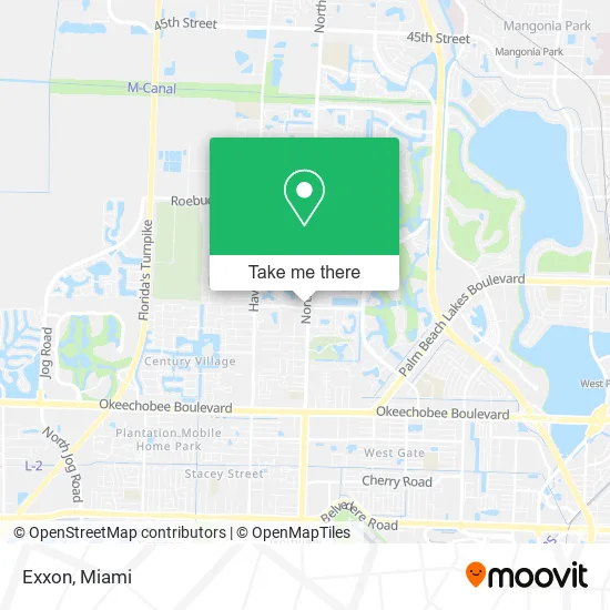
See Exxon, West Palm Beach, on the map
Public Transit to Exxon in West Palm Beach
Wondering how to get to Exxon in West Palm Beach? Moovit helps you find the best way to get to Exxon with step-by-step directions from the nearest public transit station.
Moovit provides free maps and live directions to help you navigate through your city. View schedules, routes, timetables, and find out how long does it take to get to Exxon in real time.
Looking for the nearest stop or station to Exxon? Check out this list of stops closest to your destination: HAVERHILL RD at COMMUNITY DR; MILITARY TRL at COMUNITY DR.
Bus: 3, 4.
Want to see if there’s another route that gets you there at an earlier time? Moovit helps you find alternative routes or times. Get directions from and directions to Exxon easily from the Moovit App or Website.
We make riding to Exxon easy, which is why over 1.5 million users, including users in West Palm Beach, trust Moovit as the best app for public transit. You don’t need to download an individual bus app or train app, Moovit is your all-in-one transit app that helps you find the best bus time or train time available.
For information on prices of bus, costs and ride fares to Exxon, please check the Moovit app.
Use the app to navigate to popular places including to the airport, hospital, stadium, grocery store, mall, coffee shop, school, college, and university.
Exxon Address: 3035 Military Trl West Palm Beach, FL 33409 street in West Palm Beach
- Clean Zone Laundry,
- Oxbridge Academy,
- Keiser University Flagship Campus,
- Holiday Plaza,
- Club Vegas Casino Arcade,
- Massage Relax Asian Massage West Palm Beach,
- Coverman Franye, LCSW, MSW,
- Corte,
- Blank Perrin L, DDS,
- CVS Pharmacy Okeechobee And Military,
- Century Village,
- Florida 809 & Okeechobee Boulevard,
- Winn-Dixie,
- Botanica San Expedito,
- Georgia Mae's,
- Skechers,
- Ruben Party Rentals,
- Dats West Palm Beach,
- Palm Beach County School District,
- EZ Access Arcade
Places Near Exxon (West Palm Beach)
- Wynwood, Miami,
- Richard E. Gerstein Justice Building, Miami,
- Sawgrass mall ( FL ), Miami Beach,
- Bayside Marketplace, Miami,
- Little Havana, Miami,
- Sawgrass Mall, Miami,
- Miami-Dade County Courthouse, Miami,
- Miami VA Hospital, Miami,
- Zoo Miami, Miami,
- Hard Rock Stadium, Miami Gardens,
- Port of Miami Cruise Terminal, Miami,
- Aventura Mall, Miami Beach,
- Dolphin Mall, Miami,
- Keiser University Flagship Campus, West Palm Beach,
- Dolphin Mall Bus, Miami,
- Aventura Mall, Miami,
- Miami Design District, Miami,
- Marlins Park, Miami,
- Miami Freedom Park, Miami,
- Brickell City Centre, Miami
How to get to popular places in Miami with public transit
Get around West Palm Beach by public transit!
Traveling around West Palm Beach has never been so easy. See step by step directions as you travel to any attraction, street or major public transit station. View bus and train schedules, arrival times, service alerts and detailed routes on a map, so you know exactly how to get to anywhere in West Palm Beach.
When traveling to any destination around West Palm Beach use Moovit's Live Directions with Get Off Notifications to know exactly where and how far to walk, how long to wait for your line, and how many stops are left. Moovit will alert you when it's time to get off — no need to constantly re-check whether yours is the next stop.
Wondering how to use public transit in West Palm Beach or how to pay for public transit in West Palm Beach? Moovit public transit app can help you navigate your way with public transit easily, and at minimum cost. It includes public transit fees, ticket prices, and costs. Looking for a map of West Palm Beach public transit lines? Moovit public transit app shows all public transit maps in West Palm Beach with all Bus, Train, Light Rail and Ferry routes and stops on an interactive map.
Miami has 4 transit type(s), including: Bus, Train, Light Rail and Ferry, operated by several transit agencies, including Broward County Transit, Miami-Dade Transit, Metrorail, Palm Tran, Tri-Rail, Brightline, MARTY, City of Homestead Trolley, Key West Transit, Treasure Coast Connector, GoLine IRT, Amtrak, Greyhound-us, FlixBus-us and Aventura Express Shuttle Bus