Directions to Exxon (Stamford) with public transportation
The following transit lines have routes that pass near Exxon
 Bus: 311, 321, 324, 312.
- Train: 3, NORTHEAST REGIONAL, 4, ACELA, COMMUTER RAIL.
How to get to Exxon by bus?
Click on the bus route to see step by step directions with maps, line arrival times and updated time schedules.
From Westchester Mall, White Plains
46 minFrom White Plains, NY, White Plains
45 minFrom Rye Playland, Rye
72 minFrom GFFF, Stamford
32 minFrom Port Chester, NY, Port Chester
46 minFrom The Sono Collection, Norwalk
63 minFrom the bee-line system Bus Stop - Rye Playland (13, 75, 91), Rye
71 minFrom New Rochelle, NY, New Rochelle
106 minFrom Mamaroneck NY, Mamaroneck
85 min
How to get to Exxon by train?
Click on the train route to see step by step directions with maps, line arrival times and updated time schedules.
Bus stops near Exxon in Stamford
Bus lines to Exxon in Stamford
What are the closest stations to Exxon?
The closest stations to Exxon are:
- W Main St @ Liberty St is 71 yards away, 1 min walk.
- West Ave @ W Main St is 315 yards away, 4 min walk.
- Fairfield Ave @ Richmond Pl is 434 yards away, 6 min walk.
- Old Greenwich is 441 yards away, 6 min walk.
- Stamford is 1764 yards away, 21 min walk.
Which bus lines stop near Exxon?
These bus lines stop near Exxon: 311, 321, 324.
Which train lines stop near Exxon?
These train lines stop near Exxon: 3, NORTHEAST REGIONAL.
What’s the nearest train station to Exxon in Stamford?
The nearest train station to Exxon in Stamford is Old Greenwich. It’s a 6 min walk away.
What’s the nearest bus station to Exxon in Stamford?
The nearest bus station to Exxon in Stamford is W Main St @ Liberty St. It’s a 1 min walk away.
What time is the first train to Exxon in Stamford?
The 3 is the first train that goes to Exxon in Stamford. It stops nearby at 3:02 AM.
What time is the last train to Exxon in Stamford?
The 3 is the last train that goes to Exxon in Stamford. It stops nearby at 3:02 AM.
What time is the first bus to Exxon in Stamford?
The 312 is the first bus that goes to Exxon in Stamford. It stops nearby at 5:11 AM.
What time is the last bus to Exxon in Stamford?
The 311 is the last bus that goes to Exxon in Stamford. It stops nearby at 12:28 AM.
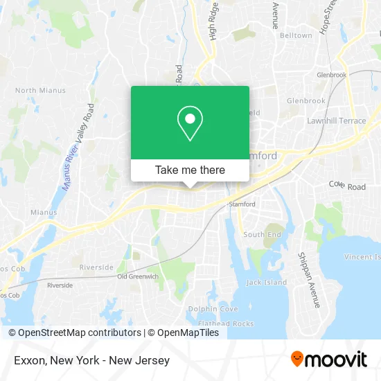
See Exxon, Stamford, on the map
Public Transit to Exxon in Stamford
Wondering how to get to Exxon in Stamford? Moovit helps you find the best way to get to Exxon with step-by-step directions from the nearest public transit station.
Moovit provides free maps and live directions to help you navigate through your city. View schedules, routes, timetables, and find out how long does it take to get to Exxon in real time.
Looking for the nearest stop or station to Exxon? Check out this list of stops closest to your destination: W Main St @ Liberty St; West Ave @ W Main St; Fairfield Ave @ Richmond Pl; Old Greenwich; Stamford.
Bus: 311, 321, 324, 312.Train: 3, NORTHEAST REGIONAL, 4, ACELA, COMMUTER RAIL, VERMONTER, 5.
Want to see if there’s another route that gets you there at an earlier time? Moovit helps you find alternative routes or times. Get directions from and directions to Exxon easily from the Moovit App or Website.
We make riding to Exxon easy, which is why over 1.5 million users, including users in Stamford, trust Moovit as the best app for public transit. You don’t need to download an individual bus app or train app, Moovit is your all-in-one transit app that helps you find the best bus time or train time available.
For information on prices of bus and train, costs and ride fares to Exxon, please check the Moovit app.
Use the app to navigate to popular places including to the airport, hospital, stadium, grocery store, mall, coffee shop, school, college, and university.
Exxon Address: 406 W Main St Stamford, CT 06902 street in Stamford
- Stamford Fuel,
- Sunoco Gas Station,
- CITGO,
- Stamford Express Travel,
- Stamford Fuels Associates,
- Victory Auto Body Of Stamford,
- Total Wireless,
- Triple S Carpet Cleaning,
- Tcc Multikargo,
- Rich Av Design,
- Cubesmart Self Storage,
- Vigo,
- Legends Cutz Barber Shop,
- EvGateway,
- La Nueva 432 W Main S,
- Bank Of America Financial Center,
- Bank Of America Financial Center & Drive-Thru Atm | West Stamford,
- Melia Plumbing and Heating, Llc,
- Richmond / Wilson,
- Muench Company, Inc. & Pro Landscape Supply
Places Near Exxon (Stamford)
- 1 Police Plaza, Manhattan,
- Queens Center Mall, Queens,
- Bellevue Hospital, Manhattan,
- 3 Stone St, Manhattan,
- 26 Federal Plaza, Manhattan,
- SoHo, Manhattan,
- San Gennaro Feast, Manhattan,
- Rockefeller Center, Manhattan,
- Wall Street, Manhattan,
- Hudson Yards, Manhattan,
- 376 Hudson Street, Manhattan,
- Times Square, Manhattan,
- Katz's Deli, Manhattan,
- 111 Centre New York City Supreme Court, Manhattan,
- Mountainside Hospital, Glen Ridge,
- Chinatown, Manhattan,
- Pier 83, Manhattan,
- 911 Memorial, Manhattan,
- 66 John Street, Manhattan,
- qqqq, Manhattan
How to get to popular places in New York - New Jersey with public transit
Get around Stamford by public transit!
Traveling around Stamford has never been so easy. See step by step directions as you travel to any attraction, street or major public transit station. View bus and train schedules, arrival times, service alerts and detailed routes on a map, so you know exactly how to get to anywhere in Stamford.
When traveling to any destination around Stamford use Moovit's Live Directions with Get Off Notifications to know exactly where and how far to walk, how long to wait for your line, and how many stops are left. Moovit will alert you when it's time to get off — no need to constantly re-check whether yours is the next stop.
Wondering how to use public transit in Stamford or how to pay for public transit in Stamford? Moovit public transit app can help you navigate your way with public transit easily, and at minimum cost. It includes public transit fees, ticket prices, and costs. Looking for a map of Stamford public transit lines? Moovit public transit app shows all public transit maps in Stamford with all Bus, Train, Subway, Light Rail, Ferry and Cable Car routes and stops on an interactive map.
New York - New Jersey has 6 transit type(s), including: Bus, Train, Subway, Light Rail, Ferry and Cable Car, operated by several transit agencies, including MTA Subway, Metro-North Railroad, LIRR, PATH, MTA New York City Transit - Express routes, MTA Bus, NJ Transit, NYC Ferry, NICE bus, Bee-Line Bus, NJ Transit Rail, Norwalk Transit District, Hartford Line, River Valley Transit and HART