How to get to Exxon by bus?
Click on the bus route to see step by step directions with maps, line arrival times and updated time schedules.
Bus stops near Exxon in Manchester
Bus lines to Exxon in Manchester
- 80, 80x - Buckland Flyer-Downtown Hartford Via I-84,VIEW
- 82, 82 - Tolland St-Buckland Hills Mall,VIEW
- 83, 83c - Silver La-Buckland Hills Mall Via Mcc,VIEW
- 82/84, 82/84 - Tolland St-Buckland Hills Mall-Rockville,VIEW
- 903, 903 - Hartford Express,VIEW
- 913, 913 - Hartford Express,VIEW
- 903/913, 903/913 - Buckland-Vernon-Storrs Express,VIEW
- 92, 92 - Tower Av-Copaco,VIEW
- 91, 91 - Forbes St-Buckland Hills Mall,VIEW
- 84, 84 - Tolland St-Downtown Hartford,VIEW
What are the closest stations to Exxon?
The closest stations to Exxon are:
- Buckland St @ Buckland Commuter Lot is 185 yards away, 3 min walk.
- Buckland Park & Ride @ Stop A is 225 yards away, 3 min walk.
- Target - Lowes @ Target is 662 yards away, 8 min walk.
- Target - Lowes @ Opp Target is 665 yards away, 8 min walk.
- Tolland Tpke @ Burr Plaza is 1574 yards away, 19 min walk.
Which bus lines stop near Exxon?
These bus lines stop near Exxon: 903/913, 913.
What’s the nearest bus station to Exxon in Manchester?
The nearest bus stations to Exxon in Manchester are Buckland St @ Buckland Commuter Lot and Buckland Park & Ride @ Stop A. The closest one is a 3 min walk away.
What time is the first bus to Exxon in Manchester?
The 82 is the first bus that goes to Exxon in Manchester. It stops nearby at 4:42 AM.
What time is the last bus to Exxon in Manchester?
The 82 is the last bus that goes to Exxon in Manchester. It stops nearby at 12:17 AM.
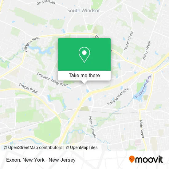
See Exxon, Manchester, on the map
Public Transit to Exxon in Manchester
Wondering how to get to Exxon in Manchester? Moovit helps you find the best way to get to Exxon with step-by-step directions from the nearest public transit station.
Moovit provides free maps and live directions to help you navigate through your city. View schedules, routes, timetables, and find out how long does it take to get to Exxon in real time.
Looking for the nearest stop or station to Exxon? Check out this list of stops closest to your destination: Buckland St @ Buckland Commuter Lot; Buckland Park & Ride @ Stop A; Target - Lowes @ Target; Target - Lowes @ Opp Target; Tolland Tpke @ Burr Plaza.
Bus: 903/913, 913, 80, 82, 83, 82/84, 903, 92, 91, 84.
Want to see if there’s another route that gets you there at an earlier time? Moovit helps you find alternative routes or times. Get directions from and directions to Exxon easily from the Moovit App or Website.
We make riding to Exxon easy, which is why over 1.5 million users, including users in Manchester, trust Moovit as the best app for public transit. You don’t need to download an individual bus app or train app, Moovit is your all-in-one transit app that helps you find the best bus time or train time available.
For information on prices of bus and train, costs and ride fares to Exxon, please check the Moovit app.
Use the app to navigate to popular places including to the airport, hospital, stadium, grocery store, mall, coffee shop, school, college, and university.
Exxon Address: 1527 Pleasant Valley Rd street in Manchester
- Alltown,
- Buckland Hills Mobil,
- Beach House Tanning Club,
- Commuter Lot,
- Hot Table,
- Playa Bowls,
- Ups Access Point Location,
- Signature Smiles Family & Implant Dentistry,
- Pizza Hut Express,
- Crumbl - Buckland Hills,
- Bonchon Chicken,
- Sunglass Hut,
- T-Mobile,
- 1 Nails & Spa,
- Beach House Tan,
- Buckland Hills,
- Vacuums and More (Formerly Bank’S Oreck),
- Manchester Vacuums and More,
- Aroma Body & Foot Massage- Manchester,
- Buckland Hills Plaza - Gamestop
Places Near Exxon (Manchester)
- Mountainside Hospital, Glen Ridge,
- San Gennaro Feast, Manhattan,
- qqqq, Manhattan,
- 111 Centre New York City Supreme Court, Manhattan,
- Wall Street, Manhattan,
- Queens Center Mall, Queens,
- 3 Stone St, Manhattan,
- Chinatown, Manhattan,
- 911 Memorial, Manhattan,
- SoHo, Manhattan,
- Times Square, Manhattan,
- 66 John Street, Manhattan,
- 26 Federal Plaza, Manhattan,
- Katz's Deli, Manhattan,
- Rockefeller Center, Manhattan,
- 376 Hudson Street, Manhattan,
- Bellevue Hospital, Manhattan,
- Hudson Yards, Manhattan,
- 1 Police Plaza, Manhattan,
- Pier 83, Manhattan
How to get to popular places in New York - New Jersey with public transit
Get around Manchester by public transit!
Traveling around Manchester has never been so easy. See step by step directions as you travel to any attraction, street or major public transit station. View bus and train schedules, arrival times, service alerts and detailed routes on a map, so you know exactly how to get to anywhere in Manchester.
When traveling to any destination around Manchester use Moovit's Live Directions with Get Off Notifications to know exactly where and how far to walk, how long to wait for your line, and how many stops are left. Moovit will alert you when it's time to get off — no need to constantly re-check whether yours is the next stop.
Wondering how to use public transit in Manchester or how to pay for public transit in Manchester? Moovit public transit app can help you navigate your way with public transit easily, and at minimum cost. It includes public transit fees, ticket prices, and costs. Looking for a map of Manchester public transit lines? Moovit public transit app shows all public transit maps in Manchester with all Bus, Train, Subway, Light Rail, Ferry and Cable Car routes and stops on an interactive map.
New York - New Jersey has 6 transit type(s), including: Bus, Train, Subway, Light Rail, Ferry and Cable Car, operated by several transit agencies, including MTA Subway, Metro-North Railroad, LIRR, PATH, MTA New York City Transit - Express routes, MTA Bus, NJ Transit, NYC Ferry, NICE bus, Bee-Line Bus, NJ Transit Rail, Norwalk Transit District, Hartford Line, River Valley Transit and HART