Directions to Exxon (Lexington) with public transportation
The following transit lines have routes that pass near Exxon
 Bus: VIRGINIA BREEZE, MAURY EXPRESS.
How to get to Exxon by bus?
Click on the bus route to see step by step directions with maps, line arrival times and updated time schedules.
From IKEA, Prince William County
424 minFrom Centreville, VA, Fairfax County
345 minFrom Walmart Supercenter, Fairfax County
389 minFrom The Cheesecake Factory, Fairfax County
346 minFrom I-95 Exit 158: Prince William Pkwy, Prince William County
383 minFrom Dumfries, VA, Prince William County
414 minFrom Manassas, VA, Manassas
385 minFrom Herndon, Virginia, Fairfax County
325 minFrom Wegmans, Prince William County
436 min
Bus stop near Exxon in Lexington
- Kroger, 3 min walk,VIEW
Bus lines to Exxon in Lexington
- MAURY EXPRESS, Lexington,VIEW
What are the closest stations to Exxon?
The closest stations to Exxon are:
- Kroger is 178 yards away, 3 min walk.
Which bus line stops near Exxon?
VIRGINIA BREEZE
What’s the nearest bus station to Exxon in Lexington?
The nearest bus station to Exxon in Lexington is Kroger. It’s a 3 min walk away.
What time is the first bus to Exxon in Lexington?
The MAURY EXPRESS is the first bus that goes to Exxon in Lexington. It stops nearby at 8:05 AM.
What time is the last bus to Exxon in Lexington?
The MAURY EXPRESS is the last bus that goes to Exxon in Lexington. It stops nearby at 5:50 PM.
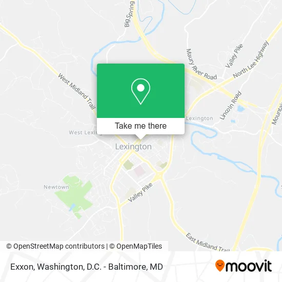
See Exxon, Lexington, on the map
Public Transit to Exxon in Lexington
Wondering how to get to Exxon in Lexington? Moovit helps you find the best way to get to Exxon with step-by-step directions from the nearest public transit station.
Moovit provides free maps and live directions to help you navigate through your city. View schedules, routes, timetables, and find out how long does it take to get to Exxon in real time.
Looking for the nearest stop or station to Exxon? Check out this list of stops closest to your destination: Kroger.
Bus: VIRGINIA BREEZE, MAURY EXPRESS.
Want to see if there’s another route that gets you there at an earlier time? Moovit helps you find alternative routes or times. Get directions from and directions to Exxon easily from the Moovit App or Website.
We make riding to Exxon easy, which is why over 1.5 million users, including users in Lexington, trust Moovit as the best app for public transit. You don’t need to download an individual bus app or train app, Moovit is your all-in-one transit app that helps you find the best bus time or train time available.
For information on prices of bus, metro and train, costs and ride fares to Exxon, please check the Moovit app.
Use the app to navigate to popular places including to the airport, hospital, stadium, grocery store, mall, coffee shop, school, college, and university.
Exxon Address: 113 N Main St Lexington, VA 24450 street in Lexington
- ATM,
- Stop In Food Stores,
- Vital Energy Nutrition,
- Schweizer Heidi Architects,
- Skips Barber Shop,
- New Opticians Boutique,
- Commonwealth Mortgage Group,
- Blue Ridge Legal Services,
- Kjellstrom and Lee Field Office,
- Pure Eats,
- Healing Therapies,
- Valley Real Estate Brokers,
- Better Hearing Center,
- Laura Ruff,
- Compass Counseling Services of VA,
- Americare Plus,
- Bowman Consulting,
- JD Solar Power, LLC,
- Megan Gray Realtor,
- Rockbridge Music
Places Near Exxon (Lexington)
- National Theatre, Washington,
- Pennsylvania Ave NW (3rd st and pennsylvania), Washington,
- Warner Theatre, Washington,
- Georgetown, Washington,
- Washington DC VA Medical Center, Washington,
- Camden Yards, Baltimore,
- PG Mall, Prince George's County,
- Washington National Cathedral, Washington,
- Amazon Hq2, Arlington County,
- The Anthem, Washington,
- M&T Bank Stadium, Baltimore,
- Westfield Montgomery Mall, Montgomery County,
- Capital One Arena, Washington,
- Basilica of the National Shrine, Washington,
- National Museum of African American History and Culture, Washington,
- National Zoo, Washington,
- Rock Creek Tennis Center, Washington,
- Marriott Marquis Washington, DC, Washington,
- Museum Of The Bible, Washington,
- Sibley Memorial Hospital, Washington
How to get to popular places in Washington, D.C. - Baltimore, MD with public transit
Get around Lexington by public transit!
Traveling around Lexington has never been so easy. See step by step directions as you travel to any attraction, street or major public transit station. View bus and train schedules, arrival times, service alerts and detailed routes on a map, so you know exactly how to get to anywhere in Lexington.
When traveling to any destination around Lexington use Moovit's Live Directions with Get Off Notifications to know exactly where and how far to walk, how long to wait for your line, and how many stops are left. Moovit will alert you when it's time to get off — no need to constantly re-check whether yours is the next stop.
Wondering how to use public transit in Lexington or how to pay for public transit in Lexington? Moovit public transit app can help you navigate your way with public transit easily, and at minimum cost. It includes public transit fees, ticket prices, and costs. Looking for a map of Lexington public transit lines? Moovit public transit app shows all public transit maps in Lexington with all Bus, Train, Metro, Light Rail and Ferry routes and stops on an interactive map.
Washington, D.C. - Baltimore, MD has 5 transit type(s), including: Bus, Train, Metro, Light Rail and Ferry, operated by several transit agencies, including WMATA, Montgomery County Ride On, Fairfax Connector, TheBus, PRTC, DASH - Alexandria, Arlington Transit (ART), RTA of Central Maryland, MDOT MTA, MDOT MTA Light RailLink, MDOT MTA Commuter Bus, MDOT MTA Local Bus, FXBGO!, Virginia Railway Express (VRE) and MARC