How to get to Eye Street Cellars by bus?
Click on the bus route to see step by step directions with maps, line arrival times and updated time schedules.
From The Pentagon, Hall Of Heroes, Arlington County
33 minFrom Arlington Central Library, Arlington County
60 minFrom Sheraton Suites Old Town Alexandria, Alexandria
49 minFrom Silver Spring, Maryland, Montgomery County
57 minFrom Silver Spring Civic Building (Silver Spring Civic Center), Montgomery County
64 minFrom Rock Creek Park Tennis Center (William Hg Fitzgerald), Washington
45 minFrom Joint Base Myer – Henderson Hall (JBMHH) | Fort Myer area, Arlington County
55 minFrom Hilton Garden Inn Arlington/Courthouse Plaza, Arlington County
47 minFrom Regal Majestic Stadium 20 and IMAX, Montgomery County
62 minFrom Ellsworth Place, Montgomery County
64 min
How to get to Eye Street Cellars by train?
Click on the train route to see step by step directions with maps, line arrival times and updated time schedules.
From The Pentagon, Hall Of Heroes, Arlington County
106 minFrom Silver Spring, Maryland, Montgomery County
50 minFrom Silver Spring Civic Building (Silver Spring Civic Center), Montgomery County
56 minFrom Regal Majestic Stadium 20 and IMAX, Montgomery County
55 minFrom Ellsworth Place, Montgomery County
54 min
How to get to Eye Street Cellars by metro?
Click on the metro route to see step by step directions with maps, line arrival times and updated time schedules.
From The Pentagon, Hall Of Heroes, Arlington County
24 minFrom Arlington Central Library, Arlington County
39 minFrom Sheraton Suites Old Town Alexandria, Alexandria
41 minFrom Silver Spring, Maryland, Montgomery County
33 minFrom Silver Spring Civic Building (Silver Spring Civic Center), Montgomery County
37 minFrom Hilton Garden Inn Arlington/Courthouse Plaza, Arlington County
34 minFrom Regal Majestic Stadium 20 and IMAX, Montgomery County
35 minFrom Ellsworth Place, Montgomery County
35 min
Bus stops near Eye Street Cellars in Washington
Metro station near Eye Street Cellars in Washington
- Gallery Place-Chinatown, 8 min walk,VIEW
Train station near Eye Street Cellars in Washington
- Union Station Marc Washington, 15 min walk,VIEW
Bus lines to Eye Street Cellars in Washington
- D80, North To Friendship Hts,VIEW
- 220, 220/2 Washington Dc,VIEW
- 240, 240/5 Kent Island,VIEW
- 260, 260/6 Severna Park,VIEW
- D34, North To W Hyattsville,VIEW
- D36, South To Franklin Sq,VIEW
- D90, West To Tenleytown,VIEW
- 281, H ST & 4TH ST - Stone Ridge II,VIEW
- 481, H ST & 4TH ST - Leesburg P&R,VIEW
- 483, H ST & 4TH ST - Harmony Park and Ride,VIEW
- 484, H ST & 4TH ST - Harmony Park and Ride,VIEW
- 486, H ST & 4TH ST - Loudoun Gateway Metro Station,VIEW
- D20, West To Farragut Sq,VIEW
- 681, East Gate Via Stone Ridge II,VIEW
- 881, Loudoun Gateway,VIEW
- 883, Harmony,VIEW
- 884, Loudoun Gateway/Leesburg/Harmony,VIEW
- 885, Leesburg/Harmony,VIEW
- 886, Loudoun Gateway,VIEW
What are the closest stations to Eye Street Cellars?
The closest stations to Eye Street Cellars are:
- Massachusetts Av Nw+5 St NW is 163 yards away, 3 min walk.
- Massachusettes Ave & 5th St NW Wb is 184 yards away, 3 min walk.
- 6 St Nw+Massachusetts Av NW is 260 yards away, 4 min walk.
- H St & 4th St is 388 yards away, 5 min walk.
- H St Nw+5 St NW is 398 yards away, 5 min walk.
- Gallery Place-Chinatown is 605 yards away, 8 min walk.
- Union Station Marc Washington is 1192 yards away, 15 min walk.
Which bus lines stop near Eye Street Cellars?
These bus lines stop near Eye Street Cellars: D20, D36, D40, D80.
Which train lines stop near Eye Street Cellars?
These train lines stop near Eye Street Cellars: MARC, NORTHEAST REGIONAL.
Which metro lines stop near Eye Street Cellars?
These metro lines stop near Eye Street Cellars: RED, YELLOW.
What’s the nearest metro station to Eye Street Cellars in Washington?
The nearest metro station to Eye Street Cellars in Washington is Gallery Place-Chinatown. It’s a 8 min walk away.
What’s the nearest train station to Eye Street Cellars in Washington?
The nearest train station to Eye Street Cellars in Washington is Union Station Marc Washington. It’s a 15 min walk away.
What’s the nearest bus station to Eye Street Cellars in Washington?
The nearest bus stations to Eye Street Cellars in Washington are Massachusetts Av Nw+5 St NW and Massachusettes Ave & 5th St NW Wb. The closest one is a 3 min walk away.
What time is the first metro to Eye Street Cellars in Washington?
The GREEN is the first metro that goes to Eye Street Cellars in Washington. It stops nearby at 5:22 AM.
What time is the last metro to Eye Street Cellars in Washington?
The GREEN is the last metro that goes to Eye Street Cellars in Washington. It stops nearby at 12:19 AM.
What time is the first train to Eye Street Cellars in Washington?
The MARC is the first train that goes to Eye Street Cellars in Washington. It stops nearby at 5:30 AM.
What time is the last train to Eye Street Cellars in Washington?
The MARC is the last train that goes to Eye Street Cellars in Washington. It stops nearby at 10:05 PM.
What time is the first bus to Eye Street Cellars in Washington?
The D80 is the first bus that goes to Eye Street Cellars in Washington. It stops nearby at 3:11 AM.
What time is the last bus to Eye Street Cellars in Washington?
The D80 is the last bus that goes to Eye Street Cellars in Washington. It stops nearby at 3:13 AM.
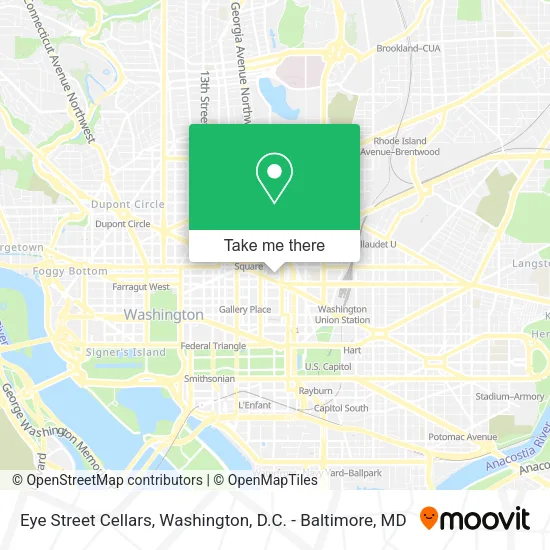
See Eye Street Cellars, Washington, on the map
Public Transit to Eye Street Cellars in Washington
Wondering how to get to Eye Street Cellars in Washington? Moovit helps you find the best way to get to Eye Street Cellars with step-by-step directions from the nearest public transit station.
Moovit provides free maps and live directions to help you navigate through your city. View schedules, routes, timetables, and find out how long does it take to get to Eye Street Cellars in real time.
Looking for the nearest stop or station to Eye Street Cellars? Check out this list of stops closest to your destination: Massachusetts Av Nw+5 St NW; Massachusettes Ave & 5th St NW Wb; 6 St Nw+Massachusetts Av NW; H St & 4th St; H St Nw+5 St NW; Gallery Place-Chinatown; Union Station Marc Washington.
Bus: D20, D36, D40, D80, 220, 240, 260, D34, D90.Train: MARC, NORTHEAST REGIONAL.Metro: RED, YELLOW, GREEN.
Want to see if there’s another route that gets you there at an earlier time? Moovit helps you find alternative routes or times. Get directions from and directions to Eye Street Cellars easily from the Moovit App or Website.
We make riding to Eye Street Cellars easy, which is why over 1.5 million users, including users in Washington, trust Moovit as the best app for public transit. You don’t need to download an individual bus app or train app, Moovit is your all-in-one transit app that helps you find the best bus time or train time available.
For information on prices of bus, metro and train, costs and ride fares to Eye Street Cellars, please check the Moovit app.
Use the app to navigate to popular places including to the airport, hospital, stadium, grocery store, mall, coffee shop, school, college, and university.
Eye Street Cellars Address: I Street Northwest street in Washington
- PATH,
- Baan Siam,
- Path, Washington, D.C.,
- Ndi,
- a baked joint,
- Ottoman Taverna,
- 450 K,
- Busboys and Poets 450k,
- 450k (450 K),
- Mount Vernon Triangle,
- 901 4th St NW,
- Joe & the Juice (Joe the Juice New Yo),
- 901 4th Street Northwest,
- Over under Sportsbook Rooftop Lounge (The Rooftop),
- Cloakroom,
- Mandu,
- Sydney's Apartment,
- Alta Strada,
- Bartaco,
- Hampton Inn Washington-Downtown-Convention Center
Places Near Eye Street Cellars (Washington)
- M&T Bank Stadium, Baltimore,
- Washington DC VA Medical Center, Washington,
- The Anthem, Washington,
- National Museum of African American History and Culture, Washington,
- Basilica of the National Shrine, Washington,
- Camden Yards, Baltimore,
- Amazon Hq2, Arlington County,
- National Theatre, Washington,
- National Zoo, Washington,
- Marriott Marquis Washington, DC, Washington,
- Westfield Montgomery Mall, Montgomery County,
- Pennsylvania Ave NW (3rd st and pennsylvania), Washington,
- Capital One Arena, Washington,
- Museum Of The Bible, Washington,
- Georgetown, Washington,
- PG Mall, Prince George's County,
- Sibley Memorial Hospital, Washington,
- Washington National Cathedral, Washington,
- Rock Creek Tennis Center, Washington,
- Warner Theatre, Washington
How to get to popular places in Washington, D.C. - Baltimore, MD with public transit
Get around Washington by public transit!
Traveling around Washington has never been so easy. See step by step directions as you travel to any attraction, street or major public transit station. View bus and train schedules, arrival times, service alerts and detailed routes on a map, so you know exactly how to get to anywhere in Washington.
When traveling to any destination around Washington use Moovit's Live Directions with Get Off Notifications to know exactly where and how far to walk, how long to wait for your line, and how many stops are left. Moovit will alert you when it's time to get off — no need to constantly re-check whether yours is the next stop.
Wondering how to use public transit in Washington or how to pay for public transit in Washington? Moovit public transit app can help you navigate your way with public transit easily, and at minimum cost. It includes public transit fees, ticket prices, and costs. Looking for a map of Washington public transit lines? Moovit public transit app shows all public transit maps in Washington with all Bus, Train, Metro, Light Rail and Ferry routes and stops on an interactive map.
Washington, D.C. - Baltimore, MD has 5 transit type(s), including: Bus, Train, Metro, Light Rail and Ferry, operated by several transit agencies, including WMATA, Montgomery County Ride On, Fairfax Connector, TheBus, PRTC, DASH - Alexandria, Arlington Transit (ART), RTA of Central Maryland, MDOT MTA, MDOT MTA Light RailLink, MDOT MTA Commuter Bus, MDOT MTA Local Bus, FXBGO!, Virginia Railway Express (VRE) and MARC