How to get to Ezone Logistics by bus?
Click on the bus route to see step by step directions with maps, line arrival times and updated time schedules.
From Dolphin Mall Entrance 2, North Westside
75 minFrom UM Hospital, Miami
69 minFrom W 49th St / NW 103rd St, Hialeah
79 minFrom Social Security Office, Miami
51 minFrom Florida Lottery District Office-Miami, Hialeah
96 minFrom Department of Children and Families, Miami
58 minFrom Ministerio Internacional El Rey Jesus, Miami
66 minFrom Barbara Goleman Senior High, Hialeah
101 minFrom FIU, Miami
47 minFrom Walmart, Miami
76 min
Bus stops near Ezone Logistics in North Westside
Train station near Ezone Logistics in North Westside
- Palmetto Station Rail Southbound, 24 min walk,VIEW
Bus lines to Ezone Logistics in North Westside
What are the closest stations to Ezone Logistics?
The closest stations to Ezone Logistics are:
- Nw 72 Av & # 4855 is 172 yards away, 3 min walk.
- Nw 79 Av @ Nw 48 St is 291 yards away, 4 min walk.
- Nw 36 St @ Nw 72 Av is 868 yards away, 11 min walk.
- Palmetto Station Rail Southbound is 1996 yards away, 24 min walk.
Which bus lines stop near Ezone Logistics?
These bus lines stop near Ezone Logistics: 36, 73.
What’s the nearest train station to Ezone Logistics in North Westside?
The nearest train station to Ezone Logistics in North Westside is Palmetto Station Rail Southbound. It’s a 24 min walk away.
What’s the nearest bus station to Ezone Logistics in North Westside?
The nearest bus station to Ezone Logistics in North Westside is Nw 72 Av & # 4855. It’s a 3 min walk away.
What time is the first train to Ezone Logistics in North Westside?
The GREEN is the first train that goes to Ezone Logistics in North Westside. It stops nearby at 5:00 AM.
What time is the last train to Ezone Logistics in North Westside?
The GREEN is the last train that goes to Ezone Logistics in North Westside. It stops nearby at 1:01 AM.
What time is the first bus to Ezone Logistics in North Westside?
The 36 is the first bus that goes to Ezone Logistics in North Westside. It stops nearby at 4:18 AM.
What time is the last bus to Ezone Logistics in North Westside?
The 36 is the last bus that goes to Ezone Logistics in North Westside. It stops nearby at 12:44 AM.
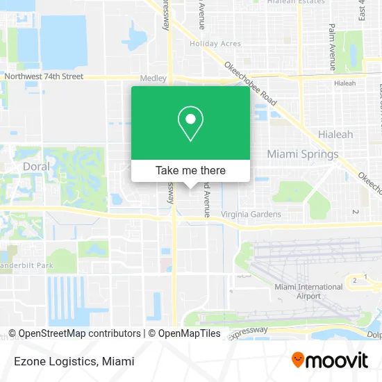
See Ezone Logistics, North Westside, on the map
Public Transit to Ezone Logistics in North Westside
Wondering how to get to Ezone Logistics in North Westside? Moovit helps you find the best way to get to Ezone Logistics with step-by-step directions from the nearest public transit station.
Moovit provides free maps and live directions to help you navigate through your city. View schedules, routes, timetables, and find out how long does it take to get to Ezone Logistics in real time.
Looking for the nearest stop or station to Ezone Logistics? Check out this list of stops closest to your destination: Nw 72 Av & # 4855; Nw 79 Av @ Nw 48 St; Nw 36 St @ Nw 72 Av; Palmetto Station Rail Southbound.
Bus: 36, 73, 132, DLOOP2, 95.Train: GREEN.
Want to see if there’s another route that gets you there at an earlier time? Moovit helps you find alternative routes or times. Get directions from and directions to Ezone Logistics easily from the Moovit App or Website.
We make riding to Ezone Logistics easy, which is why over 1.7 million users, including users in North Westside, trust Moovit as the best app for public transit. You don’t need to download an individual bus app or train app, Moovit is your all-in-one transit app that helps you find the best bus time or train time available.
For information on prices of bus and train, costs and ride fares to Ezone Logistics, please check the Moovit app.
Use the app to navigate to popular places including to the airport, hospital, stadium, grocery store, mall, coffee shop, school, college, and university.
Ezone Logistics Address: 4411 NW 74th Ave street in North Westside
- Walmart Doral Offices,
- Telemundo Studios / NBC Universal,
- Security on the Spot,
- Ddca Security,
- Florida Department of Agriculture Division of Licensing,
- Evtv Miami,
- Bal Harbour Sunny Isles Brickell or Key Biscayne,
- 7743 NW 48th St,
- Quality Inn Miami Airport,
- Northwest 72nd Avenue & Northwest 36th Street,
- Doral Golf Warehouse,
- Turner Guilford Knight Correctional Center,
- Miami - Dade County Turner Guilford Knight Correctional Center,
- NW 72nd Ave / NW 36th St,
- TGK,
- Hilton Garden Inn - Miami Airport West,
- Homewood Suites by Hilton Miami Airport West,
- Bang Bros.,
- Courtyard by Marriott Miami Airport West / Doral,
- Dade County Stockade Pretrial Detention Center
Places Near Ezone Logistics (North Westside)
- Miami VA Hospital, Miami,
- Little Havana, Miami,
- Miami-Dade County Courthouse, Miami,
- Miami Freedom Park, Miami,
- Aventura Mall, Miami Beach,
- Wynwood, Miami,
- Bayside Marketplace, Miami,
- Sawgrass Mall, Miami,
- Keiser University Flagship Campus, West Palm Beach,
- Port of Miami Cruise Terminal, Miami,
- Aventura Mall, Miami,
- Marlins Park, Miami,
- Richard E. Gerstein Justice Building, Miami,
- Dolphin Mall Bus, Miami,
- Sawgrass mall ( FL ), Miami Beach,
- Miami Design District, Miami,
- Brickell City Centre, Miami,
- Dolphin Mall, Miami,
- Zoo Miami, Miami,
- Hard Rock Stadium, Miami Gardens
How to get to popular places in Miami with public transit
Get around North Westside by public transit!
Traveling around North Westside has never been so easy. See step by step directions as you travel to any attraction, street or major public transit station. View bus and train schedules, arrival times, service alerts and detailed routes on a map, so you know exactly how to get to anywhere in North Westside.
When traveling to any destination around North Westside use Moovit's Live Directions with Get Off Notifications to know exactly where and how far to walk, how long to wait for your line, and how many stops are left. Moovit will alert you when it's time to get off — no need to constantly re-check whether yours is the next stop.
Wondering how to use public transit in North Westside or how to pay for public transit in North Westside? Moovit public transit app can help you navigate your way with public transit easily, and at minimum cost. It includes public transit fees, ticket prices, and costs. Looking for a map of North Westside public transit lines? Moovit public transit app shows all public transit maps in North Westside with all Bus, Train, Light Rail and Ferry routes and stops on an interactive map.
Miami has 4 transit type(s), including: Bus, Train, Light Rail and Ferry, operated by several transit agencies, including Broward County Transit, Miami-Dade Transit, Metrorail, Palm Tran, Tri-Rail, Brightline, MARTY, City of Homestead Trolley, Key West Transit, Treasure Coast Connector, GoLine IRT, Amtrak, Greyhound-us, FlixBus-us and Aventura Express Shuttle Bus