How to get to F45 Training Cookes Crossing by bus?
Click on the bus route to see step by step directions with maps, line arrival times and updated time schedules.
From Amazon Web Services - IAD21, Fairfax County
109 minFrom Northern Virginia Community College - Loudoun Campus, Loudoun County
60 minFrom Amazon Iad28, Fairfax County
84 minFrom Dulles Discovery, Fairfax County
94 minFrom Ashby Ponds, Loudoun County
47 minFrom Hookers & Blow, Fairfax County
81 minFrom Reston Town Center, Fairfax County
98 minFrom Sterling VA USA, Loudoun County
79 min
Bus stops near F45 Training Cookes Crossing in Loudoun County
Bus lines to F45 Training Cookes Crossing in Loudoun County
What are the closest stations to F45 Training Cookes Crossing?
The closest stations to F45 Training Cookes Crossing are:
- Potomac Station Dr & Battlefield Pkwy is 164 yards away, 3 min walk.
- Fort Evans Rd & Pine View Sq is 772 yards away, 10 min walk.
Which bus line stops near F45 Training Cookes Crossing?
70 (Leesburg)
What’s the nearest bus station to F45 Training Cookes Crossing in Loudoun County?
The nearest bus station to F45 Training Cookes Crossing in Loudoun County is Potomac Station Dr & Battlefield Pkwy. It’s a 3 min walk away.
What time is the first bus to F45 Training Cookes Crossing in Loudoun County?
The 70 is the first bus that goes to F45 Training Cookes Crossing in Loudoun County. It stops nearby at 7:10 AM.
What time is the last bus to F45 Training Cookes Crossing in Loudoun County?
The 70 is the last bus that goes to F45 Training Cookes Crossing in Loudoun County. It stops nearby at 9:45 PM.
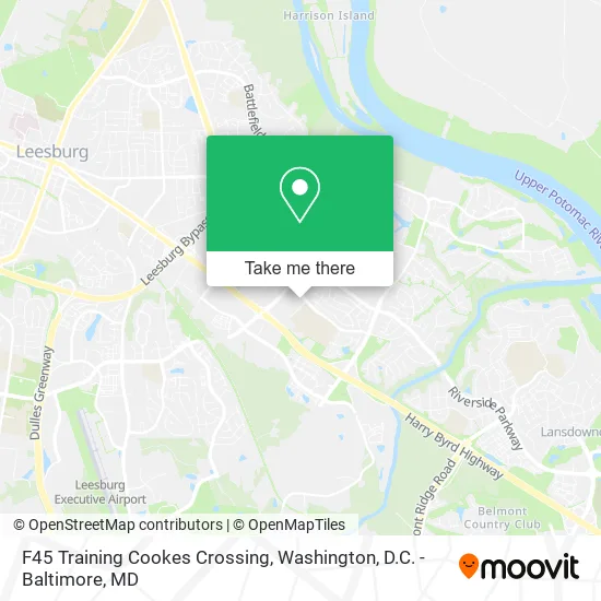
See F45 Training Cookes Crossing, Loudoun County, on the map
Public Transit to F45 Training Cookes Crossing in Loudoun County
Wondering how to get to F45 Training Cookes Crossing in Loudoun County? Moovit helps you find the best way to get to F45 Training Cookes Crossing with step-by-step directions from the nearest public transit station.
Moovit provides free maps and live directions to help you navigate through your city. View schedules, routes, timetables, and find out how long does it take to get to F45 Training Cookes Crossing in real time.
Looking for the nearest stop or station to F45 Training Cookes Crossing? Check out this list of stops closest to your destination: Potomac Station Dr & Battlefield Pkwy; Fort Evans Rd & Pine View Sq.
Bus: 70, 57.
Want to see if there’s another route that gets you there at an earlier time? Moovit helps you find alternative routes or times. Get directions from and directions to F45 Training Cookes Crossing easily from the Moovit App or Website.
We make riding to F45 Training Cookes Crossing easy, which is why over 1.5 million users, including users in Loudoun County, trust Moovit as the best app for public transit. You don’t need to download an individual bus app or train app, Moovit is your all-in-one transit app that helps you find the best bus time or train time available.
For information on prices of bus and metro, costs and ride fares to F45 Training Cookes Crossing, please check the Moovit app.
Use the app to navigate to popular places including to the airport, hospital, stadium, grocery store, mall, coffee shop, school, college, and university.
F45 Training Cookes Crossing Address: 665 Potomac Station Dr NE Leesburg, VA 20176 street in Loudoun County
- Subway,
- Hotworx,
- KeyMe,
- Libertyx Bitcoin ATM,
- Balloons by Mike,
- Home Carpet Cleaning,
- Coinstar - Bitcoin ATM,
- Laces & Pages Co.,
- Wrison Financial,
- Linkvisum Consulting Group,
- Bella Interior des,
- Strategic Solution Services,
- Oak Olde Ridge Homeowners Association,
- Career Development Services,
- Capital Chapter of,
- Gabberz,
- Mattress Firm Leesburg East,
- Geese Police Department,
- Beazer Homes Gatherings at Potomac Station,
- Potomac Station Apartments
Places Near F45 Training Cookes Crossing (Loudoun County)
- Sibley Memorial Hospital, Washington,
- Camden Yards, Baltimore,
- PG Mall, Prince George's County,
- National Mall, Washington,
- Washington National Cathedral, Washington,
- Washington DC VA Medical Center, Washington,
- Pennsylvania Ave NW (3rd st and pennsylvania), Washington,
- M&T Bank Stadium, Baltimore,
- National Museum of African American History and Culture, Washington,
- Rock Creek Tennis Center, Washington,
- Basilica of the National Shrine, Washington,
- National Zoo, Washington,
- Amazon Hq2, Arlington County,
- Museum Of The Bible, Washington,
- Westfield Montgomery Mall, Montgomery County,
- Capital One Arena, Washington,
- Marriott Marquis Washington, DC, Washington,
- Warner Theatre, Washington,
- Georgetown, Washington,
- The Anthem, Washington
How to get to popular places in Washington, D.C. - Baltimore, MD with public transit
Get around Loudoun County by public transit!
Traveling around Loudoun County has never been so easy. See step by step directions as you travel to any attraction, street or major public transit station. View bus and train schedules, arrival times, service alerts and detailed routes on a map, so you know exactly how to get to anywhere in Loudoun County.
When traveling to any destination around Loudoun County use Moovit's Live Directions with Get Off Notifications to know exactly where and how far to walk, how long to wait for your line, and how many stops are left. Moovit will alert you when it's time to get off — no need to constantly re-check whether yours is the next stop.
Wondering how to use public transit in Loudoun County or how to pay for public transit in Loudoun County? Moovit public transit app can help you navigate your way with public transit easily, and at minimum cost. It includes public transit fees, ticket prices, and costs. Looking for a map of Loudoun County public transit lines? Moovit public transit app shows all public transit maps in Loudoun County with all Bus, Train, Metro, Light Rail and Ferry routes and stops on an interactive map.
Washington, D.C. - Baltimore, MD has 5 transit type(s), including: Bus, Train, Metro, Light Rail and Ferry, operated by several transit agencies, including WMATA, Montgomery County Ride On, Fairfax Connector, TheBus, PRTC, DASH - Alexandria, Arlington Transit (ART), RTA of Central Maryland, MDOT MTA, MDOT MTA Light RailLink, MDOT MTA Commuter Bus, MDOT MTA Local Bus, FXBGO!, Virginia Railway Express (VRE) and MARC