How to get to F Kitchen by bus?
Click on the bus route to see step by step directions with maps, line arrival times and updated time schedules.
From Teatros Luchana, Madrid
59 minFrom Polígono Industrial de Vallecas, Madrid
88 minFrom Palacio De Liria, Área Metropolitana De Madrid Y Corredor Del Henares
38 minFrom Calle de Pradillo 66, Madrid
83 minFrom C/ Isla Cerdeña s/n, Madrid
84 minFrom Avenida Ramon y Cajal, Madrid
79 minFrom Hospital Fundación Alcorcón., Área Metropolitana De Madrid Y Corredor Del Henares
50 minFrom Plaza de Toros de Las Ventas, Madrid
73 minFrom Calle Marroquina, Madrid
75 minFrom Avenida de Monforte de Lemos 40, Madrid
90 min
How to get to F Kitchen by train?
Click on the train route to see step by step directions with maps, line arrival times and updated time schedules.
How to get to F Kitchen by metro?
Click on the metro route to see step by step directions with maps, line arrival times and updated time schedules.
From Teatros Luchana, Madrid
37 minFrom Palacio De Liria, Área Metropolitana De Madrid Y Corredor Del Henares
33 minFrom Calle de Pradillo 66, Madrid
48 minFrom C/ Isla Cerdeña s/n, Madrid
59 minFrom Avenida Ramon y Cajal, Madrid
55 minFrom Hospital Fundación Alcorcón., Área Metropolitana De Madrid Y Corredor Del Henares
46 minFrom Plaza de Toros de Las Ventas, Madrid
48 minFrom Calle Marroquina, Madrid
64 minFrom Avenida de Monforte de Lemos 40, Madrid
56 min
Bus stops near F Kitchen in Madrid
Metro station near F Kitchen in Madrid
- Empalme, 6 min walk,VIEW
Light Rail stations near F Kitchen in Madrid
- Colonia Jardín, 11 min walk,VIEW
Bus lines to F Kitchen in Madrid
- 65, Gran Capitan,VIEW
- 521, Madrid (Cuatro Vientos) - Móstoles,VIEW
- 523, Madrid (Cuatro Vientos) - Móstoles (Villafontana),VIEW
- 528, Madrid (Cuatro Vientos) - Navalcarnero,VIEW
- N501, Madrid (Príncipe Pío) - Alcorcón - Móstoles,VIEW
- N502, Madrid (Príncipe Pío) - Alcorcón,VIEW
- N503, Madrid (Príncipe Pío) - Móstoles (Villafontana),VIEW
- N504, Madrid (Príncipe Pío) - Villaviciosa de Odón,VIEW
- N505, Madrid (Príncipe Pío) - Navalcarnero - El Álamo,VIEW
- N808, Madrid (Príncipe Pío) - Arroyomolinos,VIEW
- N905, Madrid (Moncloa) - Boadilla del Monte,VIEW
- 36, Atocha - Campamento,VIEW
- 39, Plaza de España - Colonia San Ignacio de Loyola,VIEW
- N19, Plaza de Cibeles - Colonia San Ignacio de Loyola,VIEW
- 121, H. 12 Octubre,VIEW
- 25, Casa De Campo,VIEW
What are the closest stations to F Kitchen?
The closest stations to F Kitchen are:
- Villaviciosa - Carabias is 261 meters away, 4 min walk.
- Empalme is 424 meters away, 6 min walk.
- Campamento is 442 meters away, 6 min walk.
- Colonia Jardín is 842 meters away, 11 min walk.
- Seseña - Centro De Salud is 989 meters away, 13 min walk.
Which bus lines stop near F Kitchen?
These bus lines stop near F Kitchen: 131, 39, 65.
Which train line stops near F Kitchen?
C5 (Móstoles - El Soto)
Which metro lines stop near F Kitchen?
These metro lines stop near F Kitchen: M-10, M-5.
What’s the nearest light rail station to F Kitchen in Madrid?
The nearest light rail station to F Kitchen in Madrid is Colonia Jardín. It’s a 11 min walk away.
What’s the nearest metro station to F Kitchen in Madrid?
The nearest metro station to F Kitchen in Madrid is Empalme. It’s a 6 min walk away.
What’s the nearest bus station to F Kitchen in Madrid?
The nearest bus station to F Kitchen in Madrid is Villaviciosa - Carabias. It’s a 4 min walk away.
What time is the first light rail to F Kitchen in Madrid?
The ML-3 is the first light rail that goes to F Kitchen in Madrid. It stops nearby at 6:00 AM.
What time is the last light rail to F Kitchen in Madrid?
The ML-3 is the last light rail that goes to F Kitchen in Madrid. It stops nearby at 2:06 AM.
What time is the first metro to F Kitchen in Madrid?
The M-5 is the first metro that goes to F Kitchen in Madrid. It stops nearby at 6:05 AM.
What time is the last metro to F Kitchen in Madrid?
The M-5 is the last metro that goes to F Kitchen in Madrid. It stops nearby at 2:25 AM.
What time is the first bus to F Kitchen in Madrid?
The N501 is the first bus that goes to F Kitchen in Madrid. It stops nearby at 3:03 AM.
What time is the last bus to F Kitchen in Madrid?
The N19 is the last bus that goes to F Kitchen in Madrid. It stops nearby at 3:29 AM.
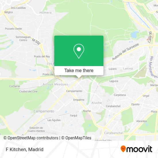
See F Kitchen, Madrid, on the map
Public Transit to F Kitchen in Madrid
Wondering how to get to F Kitchen in Madrid? Moovit helps you find the best way to get to F Kitchen with step-by-step directions from the nearest public transit station.
Moovit provides free maps and live directions to help you navigate through your city. View schedules, routes, timetables, and find out how long does it take to get to F Kitchen in real time.
Looking for the nearest stop or station to F Kitchen? Check out this list of stops closest to your destination: Villaviciosa - Carabias; Empalme; Campamento; Colonia Jardín; Seseña - Centro De Salud.
Bus: 131, 39, 65, 521, 523, 528, N501, N502, 121, 25.Train: C5.Metro: M-10, M-5.
Want to see if there’s another route that gets you there at an earlier time? Moovit helps you find alternative routes or times. Get directions from and directions to F Kitchen easily from the Moovit App or Website.
We make riding to F Kitchen easy, which is why over 1.5 million users, including users in Madrid, trust Moovit as the best app for public transit. You don’t need to download an individual bus app or train app, Moovit is your all-in-one transit app that helps you find the best bus time or train time available.
For information on prices of metro, bus and train, costs and ride fares to F Kitchen, please check the Moovit app.
Use the app to navigate to popular places including to the airport, hospital, stadium, grocery store, mall, coffee shop, school, college, and university.
F Kitchen Address: Paseo de Extremadura, 28024 Campamento Madrid street in Madrid
- Lindared,
- Calle Villaviciosa 2,
- Pollo a la Brasa,
- Autolavado Maiquez,
- E-90,
- Bar La Misionera,
- Carretera de Boadilla del Monte,
- Calle de Illescas, 1a,
- Canal De Isabel II,
- Calle Illescas 5,
- Concepción Alejo Díaz-Zorita,
- Entrenador Personal Eleven Fitness,
- Plaza Cartaya,
- Aurgi,
- Ivan Mencias Sanchez,
- Notaria Maria Teresa G,
- Calle de Granja de Torrehermosa 1,
- Centro Municipal De Mayores 'Campamento',
- Centro Comercial Xanadu - Mostoles,
- Rafael Calle Arrabal
Places Near F Kitchen (Madrid)
- Palacio De Vistalegre, Área Metropolitana De Madrid Y Corredor Del Henares,
- Calle de López de Hoyos 169, Madrid,
- Centro Comercial La Vaguada, Área Metropolitana De Madrid Y Corredor Del Henares,
- Tres Aguas, Alcorcón,
- Nassica, Área Metropolitana De Madrid Y Corredor Del Henares,
- Hospital Universitario La Paz, Madrid,
- Sala La Riviera, Madrid,
- Hospital Clínico Universitario San Carlos, Madrid,
- Centro Comercial La Gavia, Área Metropolitana De Madrid Y Corredor Del Henares,
- Mercadillo de Majadahonda, Majadahonda,
- Centro Comercial Islazul, Área Metropolitana De Madrid Y Corredor Del Henares,
- Centro Comercial Oasiz Madrid, Área Metropolitana De Madrid Y Corredor Del Henares,
- Rastro De Madrid, Área Metropolitana De Madrid Y Corredor Del Henares,
- Wizink Center, Madrid,
- Mendez Alvaro, Madrid,
- Hospital Universitario Ramón y Cajal, Madrid,
- Plaza Mayor, Madrid,
- Plenilunio, Área Metropolitana De Madrid Y Corredor Del Henares,
- Estadio Wanda Metropolitano, Área Metropolitana De Madrid Y Corredor Del Henares,
- Estacion de Chamartin, Madrid
How to get to popular places in Madrid with public transit
Get around Madrid by public transit!
Traveling around Madrid has never been so easy. See step by step directions as you travel to any attraction, street or major public transit station. View bus and train schedules, arrival times, service alerts and detailed routes on a map, so you know exactly how to get to anywhere in Madrid.
When traveling to any destination around Madrid use Moovit's Live Directions with Get Off Notifications to know exactly where and how far to walk, how long to wait for your line, and how many stops are left. Moovit will alert you when it's time to get off — no need to constantly re-check whether yours is the next stop.
Wondering how to use public transit in Madrid or how to pay for public transit in Madrid? Moovit public transit app can help you navigate your way with public transit easily, and at minimum cost. It includes public transit fees, ticket prices, and costs. Looking for a map of Madrid public transit lines? Moovit public transit app shows all public transit maps in Madrid with all Bus, Train, Metro and Light Rail routes and stops on an interactive map.
Madrid has 4 transit type(s), including: Bus, Train, Metro and Light Rail, operated by several transit agencies, including Metro de Madrid, Metro Ligero, Tranvía de Parla, Renfe Cercanías - Servicios de Autobús especiales, Renfe Cercanias, Renfe Cercanías, EMT, Interurbanos, Urbanos de Alcalá de Henares, Urbanos de Alcobendas, Urbanos de Alcorcón, Urbanos de Algete, Urbanos de Aranjuez, Urbanos de Arganda del Rey and Urbanos de Arroyomolinos