How to get to Facility-Design by bus?
Click on the bus route to see step by step directions with maps, line arrival times and updated time schedules.
How to get to Facility-Design by train?
Click on the train route to see step by step directions with maps, line arrival times and updated time schedules.
From Karlsruher Straße, Pforzheim
109 minFrom Waldbronn Eistreff, Waldbronn
86 minFrom Epplesee, Rheinstetten
54 minFrom Hopfenschlingel, Vereinbarte Verwaltungsgemeinschaft Rastatt
73 minFrom Rkh Kliniken, Verwaltungsgemeinschaft Bretten
79 minFrom Kaufland Pforzheim Wilhelm-Becker-Str., Pforzheim
104 minFrom POCO Einrichtungsmärkte, Pforzheim
110 min
Light Rail stations near Facility-Design in Stuttgart
Bus stops near Facility-Design in Stuttgart
Bus lines to Facility-Design in Stuttgart
What are the closest stations to Facility-Design?
The closest stations to Facility-Design are:
- Karlsruhe Lilienthalstraße Gleis 1 is 428 meters away, 6 min walk.
- Karlsruhe Lilienthalstraße is 428 meters away, 6 min walk.
- Karlsruhe Heidehof is 649 meters away, 9 min walk.
- Karlsruhe Schützenhaus is 789 meters away, 11 min walk.
- Karlsruhe Schützenhaus Bstg A is 789 meters away, 11 min walk.
Which train lines stop near Facility-Design?
These train lines stop near Facility-Design: S1, S11, S12, S2.
Which light rail line stops near Facility-Design?
1 (Neureut-Heide)
Which bus lines stop near Facility-Design?
These bus lines stop near Facility-Design: 42, 55, 70, 71.
What’s the nearest light rail station to Facility-Design in Stuttgart?
The nearest light rail stations to Facility-Design in Stuttgart are Karlsruhe Lilienthalstraße Gleis 1 and Karlsruhe Lilienthalstraße. The closest one is a 6 min walk away.
What’s the nearest bus station to Facility-Design in Stuttgart?
The nearest bus station to Facility-Design in Stuttgart is Karlsruhe Heidehof. It’s a 9 min walk away.
What time is the first light rail to Facility-Design in Stuttgart?
The E is the first light rail that goes to Facility-Design in Stuttgart. It stops nearby at 3:58 AM.
What time is the last light rail to Facility-Design in Stuttgart?
The E is the last light rail that goes to Facility-Design in Stuttgart. It stops nearby at 1:08 AM.
What time is the first bus to Facility-Design in Stuttgart?
The 70 is the first bus that goes to Facility-Design in Stuttgart. It stops nearby at 5:08 AM.
What time is the last bus to Facility-Design in Stuttgart?
The 73 is the last bus that goes to Facility-Design in Stuttgart. It stops nearby at 1:05 AM.
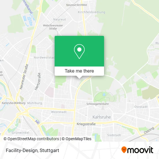
See Facility-Design, Stuttgart, on the map
Public Transit to Facility-Design in Stuttgart
Wondering how to get to Facility-Design in Stuttgart? Moovit helps you find the best way to get to Facility-Design with step-by-step directions from the nearest public transit station.
Moovit provides free maps and live directions to help you navigate through your city. View schedules, routes, timetables, and find out how long does it take to get to Facility-Design in real time.
Looking for the nearest stop or station to Facility-Design? Check out this list of stops closest to your destination: Karlsruhe Lilienthalstraße Gleis 1; Karlsruhe Lilienthalstraße; Karlsruhe Heidehof; Karlsruhe Schützenhaus; Karlsruhe Schützenhaus Bstg A.
Train: S1, S11, S12, S2.Light Rail: 1.Bus: 42, 55, 70, 71, 73, 73.
Want to see if there’s another route that gets you there at an earlier time? Moovit helps you find alternative routes or times. Get directions from and directions to Facility-Design easily from the Moovit App or Website.
We make riding to Facility-Design easy, which is why over 1.5 million users, including users in Stuttgart, trust Moovit as the best app for public transit. You don’t need to download an individual bus app or train app, Moovit is your all-in-one transit app that helps you find the best bus time or train time available.
For information on prices of light rail, train and bus, costs and ride fares to Facility-Design, please check the Moovit app.
Use the app to navigate to popular places including to the airport, hospital, stadium, grocery store, mall, coffee shop, school, college, and university.
Facility-Design Address: Tennesseeallee 56 Nordstadt, 76149 Karlsruhe street in Stuttgart
- Julijane - Hochzeitsplanung mit Herz,
- Florian Prüfer Huk-Coburg Versicherung,
- Binsenschlauchallee,
- Städtische Kindertagesstätte Nordstadt,
- Golek Renovierung,
- Städt. Kindergarten,
- Städtische Kindertagesstätte,
- Kita Kentuckyallee,
- Precht R.,
- Impressum,
- Erwin Ruoff,
- Edele-Fotografie,
- Itp,
- Dr. Jean-Louis Zambujo Dipl.,
- Deutsches Institut für Tanzpädagogik,
- Dit Studio Karlsruhe der Werkstatt Tanzpädagogik,
- Max-Kade-Haus,
- Dieter Christian Obermayer,
- Psltik,
- Architekturundbarrierefreiheit
Places Near Facility-Design (Stuttgart)
- Hauptbahnhof Stuttgart, Stuttgart-Mitte,
- Mercedes-Benz Museum (Mercedes Museum Stuttgart), Bad Cannstatt,
- Waldfriedhof, Degerloch,
- FlixBus Haltestelle, Stuttgart,
- Gleis 101/102 (tief), Stuttgart-Mitte,
- Hanns-Martin-Schleyer-Halle, Bad Cannstatt,
- Porsche Museum, Zuffenhausen,
- Wilhelma (U-Bahn Wilhelma), Bad Cannstatt,
- Hanns-Martin-Schleyer-Halle (Stuttgart Hans-Martin-Schleyerhalle), Bad Cannstatt,
- Im Wizemann (Halle), Bad Cannstatt,
- Porsche-Arena, Bad Cannstatt,
- Mercedes-Benz Museum, Bad Cannstatt,
- Klinikum Stuttgart - Katharinenhospital, Stuttgart-Mitte,
- Schleyerhalle, Bad Cannstatt,
- Geilhaus Haus 33a, Reutlingen-Betzingen,
- Mettingen Eros-Center Puff Laufhaus, Esslingen Am Neckar,
- Gasometer Pforzheim, Pforzheim,
- Marmorsaal Im Weissenburgpark, Stuttgart-Süd,
- Pariser Platz Stuttgart, Stuttgart-Mitte,
- SI-Centrum, Möhringen
How to get to popular places in Stuttgart with public transit
Get around Stuttgart by public transit!
Traveling around Stuttgart has never been so easy. See step by step directions as you travel to any attraction, street or major public transit station. View bus and train schedules, arrival times, service alerts and detailed routes on a map, so you know exactly how to get to anywhere in Stuttgart.
When traveling to any destination around Stuttgart use Moovit's Live Directions with Get Off Notifications to know exactly where and how far to walk, how long to wait for your line, and how many stops are left. Moovit will alert you when it's time to get off — no need to constantly re-check whether yours is the next stop.
Wondering how to use public transit in Stuttgart or how to pay for public transit in Stuttgart? Moovit public transit app can help you navigate your way with public transit easily, and at minimum cost. It includes public transit fees, ticket prices, and costs. Looking for a map of Stuttgart public transit lines? Moovit public transit app shows all public transit maps in Stuttgart with all Bus, Train, Subway, Light Rail, Ferry, S-Bahn and Funicular routes and stops on an interactive map.
Stuttgart has 7 transit type(s), including: Bus, Train, Subway, Light Rail, Ferry, S-Bahn and Funicular, operated by several transit agencies, including SSB - Stadtbahn, SSB, SSB - Seilbahn / Zacke, S-Bahn Stuttgart, Rhein-Neckar-Verkehr GmbH (rnv), Karlsruher Verkehrsverbund, DB AG, DB Regiobus BW, Arverio Baden-Württemberg GmbH, DB RegioNetz Verkehrs GmbH Westfrankenbahn, DB Regio AG Baden-Württemberg, Südwestdeutsche Verkehrs-AG, DB Regio AG Mitte Region Hessen, DB and Bodensee-Oberschwaben-Bahn