How to get to Faherty Bethesda Row by bus?
Click on the bus route to see step by step directions with maps, line arrival times and updated time schedules.
From WESTIN-Washington, Washington
69 minFrom Washington National Cathedral (Atlantic Services Location, Washington
34 minFrom VFS Services USA, Washington
68 minFrom Rock Creek Tennis Center, Washington
58 minFrom 17th & K Street NW, Washington
69 minFrom The Westin Washington, D.C. City Center, Washington
69 minFrom L St NW (18th & L St NW), Washington
65 minFrom MedStar Washington Hospital Center, Washington
72 minFrom Hyatt Place-Arlington Courthouse Plaza (Hyatt Place Arlington/Courthouse Plaza), Arlington County
74 minFrom Georgetown Flea Market, Washington
45 min
How to get to Faherty Bethesda Row by metro?
Click on the metro route to see step by step directions with maps, line arrival times and updated time schedules.
From WESTIN-Washington, Washington
38 minFrom Washington National Cathedral (Atlantic Services Location, Washington
47 minFrom VFS Services USA, Washington
28 minFrom 17th & K Street NW, Washington
29 minFrom The Westin Washington, D.C. City Center, Washington
38 minFrom L St NW (18th & L St NW), Washington
30 minFrom MedStar Washington Hospital Center, Washington
58 minFrom Hyatt Place-Arlington Courthouse Plaza (Hyatt Place Arlington/Courthouse Plaza), Arlington County
51 min
Bus stops near Faherty Bethesda Row in Montgomery County
Metro station near Faherty Bethesda Row in Montgomery County
- Tenleytown Metro Station, 10 min walk,VIEW
Bus lines to Faherty Bethesda Row in Montgomery County
What are the closest stations to Faherty Bethesda Row?
The closest stations to Faherty Bethesda Row are:
- Arlington Rd & Bethesda Ave is 156 yards away, 2 min walk.
- Wisconsin Av+Miller Av is 487 yards away, 6 min walk.
- Montgomery Ln @ East Ln is 506 yards away, 7 min walk.
- Montgomery Ln+East Ln is 515 yards away, 7 min walk.
- Tenleytown Metro Station is 770 yards away, 10 min walk.
Which bus lines stop near Faherty Bethesda Row?
These bus lines stop near Faherty Bethesda Row: D96, M70.
Which metro line stops near Faherty Bethesda Row?
RED (Shady Grove)
What’s the nearest metro station to Faherty Bethesda Row in Montgomery County?
The nearest metro station to Faherty Bethesda Row in Montgomery County is Tenleytown Metro Station. It’s a 10 min walk away.
What’s the nearest bus station to Faherty Bethesda Row in Montgomery County?
The nearest bus station to Faherty Bethesda Row in Montgomery County is Arlington Rd & Bethesda Ave. It’s a 2 min walk away.
What time is the first metro to Faherty Bethesda Row in Montgomery County?
The RED is the first metro that goes to Faherty Bethesda Row in Montgomery County. It stops nearby at 5:21 AM.
What time is the last metro to Faherty Bethesda Row in Montgomery County?
The RED is the last metro that goes to Faherty Bethesda Row in Montgomery County. It stops nearby at 12:19 AM.
What time is the first bus to Faherty Bethesda Row in Montgomery County?
The M70 is the first bus that goes to Faherty Bethesda Row in Montgomery County. It stops nearby at 5:20 AM.
What time is the last bus to Faherty Bethesda Row in Montgomery County?
The M70 is the last bus that goes to Faherty Bethesda Row in Montgomery County. It stops nearby at 2:18 AM.
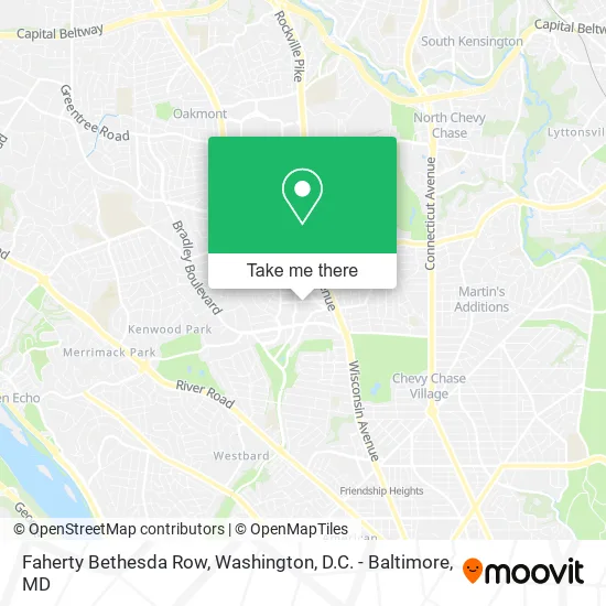
See Faherty Bethesda Row, Montgomery County, on the map
Public Transit to Faherty Bethesda Row in Montgomery County
Wondering how to get to Faherty Bethesda Row in Montgomery County? Moovit helps you find the best way to get to Faherty Bethesda Row with step-by-step directions from the nearest public transit station.
Moovit provides free maps and live directions to help you navigate through your city. View schedules, routes, timetables, and find out how long does it take to get to Faherty Bethesda Row in real time.
Looking for the nearest stop or station to Faherty Bethesda Row? Check out this list of stops closest to your destination: Arlington Rd & Bethesda Ave; Wisconsin Av+Miller Av; Montgomery Ln @ East Ln; Montgomery Ln+East Ln; Tenleytown Metro Station.
Bus: D96, M70, 36, 798, M22.Metro: RED.
Want to see if there’s another route that gets you there at an earlier time? Moovit helps you find alternative routes or times. Get directions from and directions to Faherty Bethesda Row easily from the Moovit App or Website.
We make riding to Faherty Bethesda Row easy, which is why over 1.5 million users, including users in Montgomery County, trust Moovit as the best app for public transit. You don’t need to download an individual bus app or train app, Moovit is your all-in-one transit app that helps you find the best bus time or train time available.
For information on prices of metro and bus, costs and ride fares to Faherty Bethesda Row, please check the Moovit app.
Use the app to navigate to popular places including to the airport, hospital, stadium, grocery store, mall, coffee shop, school, college, and university.
Faherty Bethesda Row Address: 4848 Bethesda Ave Bethesda, MD 20814 street in Montgomery County
- Levain Bakery,
- Allbirds,
- Veronica Beard,
- Georgetown Cupcake,
- Madewell,
- lululemon athletica,
- Bethesda Row Arts Festival,
- Apple Bethesda Row,
- Poshortho,
- Bethesda Row Dental: April Linder, DDS,
- Facial Art,
- RE/MAX,
- Wood Equipment,
- Mark Butterfield-Re / Max Realty Services,
- Bethesda Home Pro Services,
- Vuori,
- Reformation,
- Uncle Julio's,
- Uncle Julio's Rio Grande Cafe,
- Bethesda Row
Places Near Faherty Bethesda Row (Montgomery County)
- National Museum of African American History and Culture, Washington,
- National Theatre, Washington,
- Camden Yards, Baltimore,
- Museum Of The Bible, Washington,
- M&T Bank Stadium, Baltimore,
- Marriott Marquis Washington, DC, Washington,
- Basilica of the National Shrine, Washington,
- Sibley Memorial Hospital, Washington,
- Pennsylvania Ave NW (3rd st and pennsylvania), Washington,
- Amazon Hq2, Arlington County,
- National Zoo, Washington,
- PG Mall, Prince George's County,
- Washington National Cathedral, Washington,
- Georgetown, Washington,
- Washington DC VA Medical Center, Washington,
- The Anthem, Washington,
- Warner Theatre, Washington,
- Capital One Arena, Washington,
- Rock Creek Tennis Center, Washington,
- Westfield Montgomery Mall, Montgomery County
How to get to popular places in Washington, D.C. - Baltimore, MD with public transit
Get around Montgomery County by public transit!
Traveling around Montgomery County has never been so easy. See step by step directions as you travel to any attraction, street or major public transit station. View bus and train schedules, arrival times, service alerts and detailed routes on a map, so you know exactly how to get to anywhere in Montgomery County.
When traveling to any destination around Montgomery County use Moovit's Live Directions with Get Off Notifications to know exactly where and how far to walk, how long to wait for your line, and how many stops are left. Moovit will alert you when it's time to get off — no need to constantly re-check whether yours is the next stop.
Wondering how to use public transit in Montgomery County or how to pay for public transit in Montgomery County? Moovit public transit app can help you navigate your way with public transit easily, and at minimum cost. It includes public transit fees, ticket prices, and costs. Looking for a map of Montgomery County public transit lines? Moovit public transit app shows all public transit maps in Montgomery County with all Bus, Train, Metro, Light Rail and Ferry routes and stops on an interactive map.
Washington, D.C. - Baltimore, MD has 5 transit type(s), including: Bus, Train, Metro, Light Rail and Ferry, operated by several transit agencies, including WMATA, Montgomery County Ride On, Fairfax Connector, TheBus, PRTC, DASH - Alexandria, Arlington Transit (ART), RTA of Central Maryland, MDOT MTA, MDOT MTA Light RailLink, MDOT MTA Commuter Bus, MDOT MTA Local Bus, FXBGO!, Virginia Railway Express (VRE) and MARC