Directions to Family Support Center Of Maryland (Baltimore County) with public transportation
The following transit lines have routes that pass near Family Support Center Of Maryland
 Bus: 32, CITYLINK YELLOW, 29.
- Train: MARC.
How to get to Family Support Center Of Maryland by bus?
Click on the bus route to see step by step directions with maps, line arrival times and updated time schedules.
From Druid Hill Park, Baltimore
54 minFrom Baltimore Polytechnic Institute, Baltimore
73 minFrom Social Security Administration (Robert M. Ball Building), Baltimore County
66 minFrom Mva, Baltimore
68 minFrom Renaissance Baltimore Harborplace Hotel, Baltimore
30 minFrom Glen Burnie, MD, Anne Arundel County
56 minFrom Oriole Park At Camden Yards, Baltimore
28 minFrom Baltimore Poly Tech High School, Baltimore
74 minFrom Maryland Science Center, Baltimore
38 minFrom Bwi2 Employee Shuttles, Baltimore
50 min
How to get to Family Support Center Of Maryland by train?
Click on the train route to see step by step directions with maps, line arrival times and updated time schedules.
Bus stops near Family Support Center Of Maryland in Baltimore County
Light Rail stations near Family Support Center Of Maryland in Baltimore County
- Westport, 29 min walk,VIEW
Train station near Family Support Center Of Maryland in Baltimore County
- Halethorpe Marc Nb, 47 min walk,VIEW
Bus lines to Family Support Center Of Maryland in Baltimore County
What are the closest stations to Family Support Center Of Maryland?
The closest stations to Family Support Center Of Maryland are:
- Joh Ave & Bloomfield Ave FS Wb is 918 yards away, 11 min walk.
- Washington Blvd & Blind Industries Entrance Eb is 1059 yards away, 13 min walk.
- Westport is 2432 yards away, 29 min walk.
- Halethorpe Marc Nb is 3998 yards away, 47 min walk.
Which bus lines stop near Family Support Center Of Maryland?
These bus lines stop near Family Support Center Of Maryland: 32, CITYLINK YELLOW.
Which train line stops near Family Support Center Of Maryland?
MARC (Inbound - Penn)
What’s the nearest light rail station to Family Support Center Of Maryland in Baltimore County?
The nearest light rail station to Family Support Center Of Maryland in Baltimore County is Westport. It’s a 29 min walk away.
What’s the nearest bus station to Family Support Center Of Maryland in Baltimore County?
The nearest bus station to Family Support Center Of Maryland in Baltimore County is Joh Ave & Bloomfield Ave FS Wb. It’s a 11 min walk away.
What time is the first light rail to Family Support Center Of Maryland in Baltimore County?
The LIGHT RAILLINK is the first light rail that goes to Family Support Center Of Maryland in Baltimore County. It stops nearby at 4:22 AM.
What time is the last light rail to Family Support Center Of Maryland in Baltimore County?
The LIGHT RAILLINK is the last light rail that goes to Family Support Center Of Maryland in Baltimore County. It stops nearby at 1:01 AM.
What time is the first train to Family Support Center Of Maryland in Baltimore County?
The MARC is the first train that goes to Family Support Center Of Maryland in Baltimore County. It stops nearby at 4:46 AM.
What time is the last train to Family Support Center Of Maryland in Baltimore County?
The MARC is the last train that goes to Family Support Center Of Maryland in Baltimore County. It stops nearby at 10:46 PM.
What time is the first bus to Family Support Center Of Maryland in Baltimore County?
The CITYLINK YELLOW is the first bus that goes to Family Support Center Of Maryland in Baltimore County. It stops nearby at 3:03 AM.
What time is the last bus to Family Support Center Of Maryland in Baltimore County?
The CITYLINK YELLOW is the last bus that goes to Family Support Center Of Maryland in Baltimore County. It stops nearby at 3:06 AM.
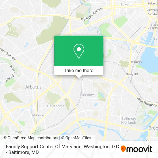
See Family Support Center Of Maryland, Baltimore County, on the map
Public Transit to Family Support Center Of Maryland in Baltimore County
Wondering how to get to Family Support Center Of Maryland in Baltimore County? Moovit helps you find the best way to get to Family Support Center Of Maryland with step-by-step directions from the nearest public transit station.
Moovit provides free maps and live directions to help you navigate through your city. View schedules, routes, timetables, and find out how long does it take to get to Family Support Center Of Maryland in real time.
Looking for the nearest stop or station to Family Support Center Of Maryland? Check out this list of stops closest to your destination: Joh Ave & Bloomfield Ave FS Wb; Washington Blvd & Blind Industries Entrance Eb; Westport; Halethorpe Marc Nb.
Bus: 32, CITYLINK YELLOW, 29.Train: MARC.
Want to see if there’s another route that gets you there at an earlier time? Moovit helps you find alternative routes or times. Get directions from and directions to Family Support Center Of Maryland easily from the Moovit App or Website.
We make riding to Family Support Center Of Maryland easy, which is why over 1.7 million users, including users in Baltimore County, trust Moovit as the best app for public transit. You don’t need to download an individual bus app or train app, Moovit is your all-in-one transit app that helps you find the best bus time or train time available.
For information on prices of bus, light rail, train and metro, costs and ride fares to Family Support Center Of Maryland, please check the Moovit app.
Use the app to navigate to popular places including to the airport, hospital, stadium, grocery store, mall, coffee shop, school, college, and university.
Family Support Center Of Maryland Address: 1927 Lansdowne Rd street in Baltimore County
- Coin Cloud DCM,
- Kaiser Permanente South Baltimore County Medical Center,
- Amazon Fulfillment Center-HBA2,
- Gardaworld,
- Walmart,
- Walmart Supercenter,
- Commerce Dr (washington blvd and commerce),
- West Baltimore, Maryland,
- W Patapsco Ave (washington blvd and patapsco),
- Washington Blvd & W Patapsco,
- Setting the Scene Event Planning & Decor,
- Caton Ave and Joh Ave,
- I'm Still Standing Community Corporation,
- Social Security,
- Lansdowne MD USA,
- Dashmart,
- 3701 Koppers St,
- Uscis Baltimore Field Office,
- Furnival,
- Ocean Beach
Places Near Family Support Center Of Maryland (Baltimore County)
- M&T Bank Stadium, Baltimore,
- Amazon Hq2, Arlington County,
- National Theatre, Washington,
- Capital One Arena, Washington,
- Georgetown, Washington,
- Camden Yards, Baltimore,
- Sibley Memorial Hospital, Washington,
- PG Mall, Prince George's County,
- Westfield Montgomery Mall, Montgomery County,
- Basilica of the National Shrine, Washington,
- Marriott Marquis Washington, DC, Washington,
- Museum Of The Bible, Washington,
- Washington National Cathedral, Washington,
- National Zoo, Washington,
- Washington DC VA Medical Center, Washington,
- The Anthem, Washington,
- Pennsylvania Ave NW (3rd st and pennsylvania), Washington,
- Warner Theatre, Washington,
- National Museum of African American History and Culture, Washington,
- Rock Creek Tennis Center, Washington
How to get to popular places in Washington, D.C. - Baltimore, MD with public transit
Get around Baltimore County by public transit!
Traveling around Baltimore County has never been so easy. See step by step directions as you travel to any attraction, street or major public transit station. View bus and train schedules, arrival times, service alerts and detailed routes on a map, so you know exactly how to get to anywhere in Baltimore County.
When traveling to any destination around Baltimore County use Moovit's Live Directions with Get Off Notifications to know exactly where and how far to walk, how long to wait for your line, and how many stops are left. Moovit will alert you when it's time to get off — no need to constantly re-check whether yours is the next stop.
Wondering how to use public transit in Baltimore County or how to pay for public transit in Baltimore County? Moovit public transit app can help you navigate your way with public transit easily, and at minimum cost. It includes public transit fees, ticket prices, and costs. Looking for a map of Baltimore County public transit lines? Moovit public transit app shows all public transit maps in Baltimore County with all Bus, Train, Metro, Light Rail and Ferry routes and stops on an interactive map.
Washington, D.C. - Baltimore, MD has 5 transit type(s), including: Bus, Train, Metro, Light Rail and Ferry, operated by several transit agencies, including WMATA, Montgomery County Ride On, Fairfax Connector, TheBus, PRTC, DASH - Alexandria, Arlington Transit (ART), RTA of Central Maryland, MDOT MTA, MDOT MTA Light RailLink, MDOT MTA Commuter Bus, MDOT MTA Local Bus, FXBGO!, Virginia Railway Express (VRE) and MARC