How to get to Fantasy by bus?
Click on the bus route to see step by step directions with maps, line arrival times and updated time schedules.
From Reims-Sud, Villers-Aux-Noeuds
43 minFrom Musée Du Fort De La Pompelle, Puisieulx
46 minFrom Relais Nautique, Sillery
34 minFrom Aquamoovprunay, Prunay
61 minFrom Forma, Thillois
33 minFrom Parking D944 N44, Saint-Léonard
57 minFrom Girardin, Prunay
57 minFrom Le Relais de, Sillery
43 minFrom Bistrot de la Gare, Prunay
58 minFrom Freshmile, Saint-Léonard
50 min
Bus stops near Fantasy in Reims
Bus lines to Fantasy in Reims
- U1, C.C. Cernay,VIEW
- U4, Orgeval,VIEW
- U6, Croix Blandin,VIEW
- U7, Hopital Debre,VIEW
- U8, La Couturelle,VIEW
- TRAM, Leon Blum,VIEW
- O1, Moulin Housse,VIEW
- U2, Route De Witry,VIEW
- U9, C.C. Cormontreuil,VIEW
- C, Gare Centre,VIEW
- E5, Cathedrale,VIEW
- 20, Gare Clairmarais,VIEW
- U3, Maurencienne,VIEW
- E2, St-Etienne/Sui.,VIEW
- E3, Saint-Symphorien,VIEW
- E4, Betheniville,VIEW
- 22, U22-NEUVILETTE MAIRIE <> ROYALE,VIEW
- 23, U23-ODILE MADELIN <> ROYALE,VIEW
What are the closest stations to Fantasy?
The closest stations to Fantasy are:
- Manege is 267 meters away, 4 min walk.
- Comedie is 383 meters away, 6 min walk.
- Chanzy is 393 meters away, 6 min walk.
- Conservatoire is 460 meters away, 6 min walk.
- Cathedrale is 809 meters away, 11 min walk.
- Gare De Reims - Centre is 831 meters away, 11 min walk.
- Saint-Symphorien is 871 meters away, 12 min walk.
- Royale is 983 meters away, 13 min walk.
Which bus lines stop near Fantasy?
These bus lines stop near Fantasy: O1, U1, U2, U9.
What’s the nearest bus station to Fantasy in Reims?
The nearest bus station to Fantasy in Reims is Manege. It’s a 4 min walk away.
What time is the first light rail to Fantasy in Reims?
The TRAM is the first light rail that goes to Fantasy in Reims. It stops nearby at 5:14 AM.
What time is the last light rail to Fantasy in Reims?
The TRAM is the last light rail that goes to Fantasy in Reims. It stops nearby at 12:57 AM.
What time is the first bus to Fantasy in Reims?
The U9 is the first bus that goes to Fantasy in Reims. It stops nearby at 5:21 AM.
What time is the last bus to Fantasy in Reims?
The U2 is the last bus that goes to Fantasy in Reims. It stops nearby at 12:43 AM.
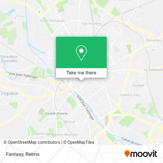
See Fantasy, Reims, on the map
Public Transit to Fantasy in Reims
Wondering how to get to Fantasy in Reims? Moovit helps you find the best way to get to Fantasy with step-by-step directions from the nearest public transit station.
Moovit provides free maps and live directions to help you navigate through your city. View schedules, routes, timetables, and find out how long does it take to get to Fantasy in real time.
Looking for the nearest stop or station to Fantasy? Check out this list of stops closest to your destination: Manege; Comedie; Chanzy; Conservatoire; Cathedrale; Gare De Reims - Centre; Saint-Symphorien; Royale.
Bus: O1, U1, U2, U9, U4, U6, U7, U8, TRAM, C, E5, 20, U3.
Want to see if there’s another route that gets you there at an earlier time? Moovit helps you find alternative routes or times. Get directions from and directions to Fantasy easily from the Moovit App or Website.
We make riding to Fantasy easy, which is why over 1.5 million users, including users in Reims, trust Moovit as the best app for public transit. You don’t need to download an individual bus app or train app, Moovit is your all-in-one transit app that helps you find the best bus time or train time available.
For information on prices of bus, costs and ride fares to Fantasy, please check the Moovit app.
Use the app to navigate to popular places including to the airport, hospital, stadium, grocery store, mall, coffee shop, school, college, and university.
Fantasy Address: 48 Rue de Vesle 51100 Reims street in Reims
- Godot Reims,
- Achat or et Argent,
- BCBGMAXAZRIA,
- Institut Meggan,
- H & M,
- The Mother Road,
- Canard Street,
- Csr,
- Hugo,
- Acuitis,
- Le Temple de Sasha,
- La Hutte Centre Sports,
- Coiff & Co,
- Jean Louis David,
- Popleen,
- New Yorker,
- Carré Blanc,
- Marionnaud France,
- Nouvelles Frontières,
- Horizon Telecom
Places Near Fantasy (Reims)
- Leclerc, Saint-Brice-Courcelles,
- La Neuvillette, Reims,
- Moulin De La Housse, Reims,
- Croix Blandin, Reims,
- Hôpital Debré, Reims,
- Parc Des Expositions, Reims,
- Bezannes, Bezannes,
- Bétheny, Bétheny,
- Ikea, Thillois,
- CHU, Reims,
- St Remi, Reims,
- Cormontreuil, Reims,
- Parc de Champagne, Reims,
- Tinqueux, Tinqueux,
- Campus Croix Rouge, Reims,
- Carrefour, Tinqueux,
- Gare Tgv, Bezannes,
- Polyclinique Reims Bezannes, Bezannes,
- Hôpital Maison Blanche, Reims,
- E. Leclerc Champfleury, Champfleury
How to get to popular places in Reims with public transit
Get around Reims by public transit!
Traveling around Reims has never been so easy. See step by step directions as you travel to any attraction, street or major public transit station. View bus and train schedules, arrival times, service alerts and detailed routes on a map, so you know exactly how to get to anywhere in Reims.
When traveling to any destination around Reims use Moovit's Live Directions with Get Off Notifications to know exactly where and how far to walk, how long to wait for your line, and how many stops are left. Moovit will alert you when it's time to get off — no need to constantly re-check whether yours is the next stop.
Wondering how to use public transit in Reims or how to pay for public transit in Reims? Moovit public transit app can help you navigate your way with public transit easily, and at minimum cost. It includes public transit fees, ticket prices, and costs. Looking for a map of Reims public transit lines? Moovit public transit app shows all public transit maps in Reims with all Bus and Light Rail routes and stops on an interactive map.
Reims has 2 transit type(s), including: Bus and Light Rail, operated by several transit agencies, including Transdev Reims