How to get to Farm Store by bus?
Click on the bus route to see step by step directions with maps, line arrival times and updated time schedules.
From Baptist homestead hospital, Homestead
40 minFrom Martinez Distributors, Kendale Lakes-Tamiami
133 minFrom Eureka Drive & U.S. 1, Kendall-Palmetto Bay
49 minFrom SW 137th Ave / US-1, Princeton-Goulds
38 minFrom Robert Morgan Educational Center, Kendale Lakes-Tamiami
80 minFrom Herbert Ammons Middle School, Kendale Lakes-Tamiami
81 minFrom Cutler Bay, FL, Princeton-Goulds
92 minFrom Zoo Miami, Kendale Lakes-Tamiami
110 minFrom US 1@SW 248 St, Princeton-Goulds
35 minFrom SW 184 St & US 1, Kendall-Palmetto Bay
50 min
Bus stops near Farm Store in Homestead
Bus lines to Farm Store in Homestead
- 344, 344 - Everglades Village,VIEW
- HOMEDT, City Of Homestead Downtown Trolley,VIEW
- EAST/WEST, East/West Trolley Route,VIEW
- 70, 70 - FL City SW 344 St Park & Ride,VIEW
- DOWNTOWN, Downtown,VIEW
- 35, 35 - Cutler Bay SW 112 Av/211 St,VIEW
- HOMELR, City Of Homestead Lucy Route,VIEW
- 601, Metro Express FL City SW 344 St P&R,VIEW
What are the closest stations to Farm Store?
The closest stations to Farm Store are:
- N Krome Av & Ne 8 St (N/n) is 167 yards away, 3 min walk.
- Post Office/English Ave is 212 yards away, 3 min walk.
- Krome Av & Nw 9 St is 222 yards away, 3 min walk.
- Krome Av @ Ne 9 Ct is 283 yards away, 4 min walk.
- Washington Av @ Ne 8 St is 288 yards away, 4 min walk.
- Ne 8 St & Ne 2 Av is 320 yards away, 4 min walk.
- Civic Ct Station is 887 yards away, 11 min walk.
Which bus lines stop near Farm Store?
These bus lines stop near Farm Store: 35, 601, 602, 70.
What’s the nearest bus station to Farm Store in Homestead?
The nearest bus stations to Farm Store in Homestead are N Krome Av & Ne 8 St (N/n), Post Office/English Ave and Krome Av & Nw 9 St. The closest one is a 3 min walk away.
What time is the first bus to Farm Store in Homestead?
The 35 is the first bus that goes to Farm Store in Homestead. It stops nearby at 5:15 AM.
What time is the last bus to Farm Store in Homestead?
The 601 is the last bus that goes to Farm Store in Homestead. It stops nearby at 12:49 AM.
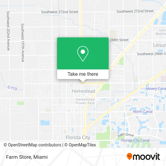
See Farm Store, Homestead, on the map
Public Transit to Farm Store in Homestead
Wondering how to get to Farm Store in Homestead? Moovit helps you find the best way to get to Farm Store with step-by-step directions from the nearest public transit station.
Moovit provides free maps and live directions to help you navigate through your city. View schedules, routes, timetables, and find out how long does it take to get to Farm Store in real time.
Looking for the nearest stop or station to Farm Store? Check out this list of stops closest to your destination: N Krome Av & Ne 8 St (N/n); Post Office/English Ave; Krome Av & Nw 9 St; Krome Av @ Ne 9 Ct; Washington Av @ Ne 8 St; Ne 8 St & Ne 2 Av; Civic Ct Station.
Bus: 35, 601, 602, 70, 344, HOMEDT, EAST/WEST, DOWNTOWN, HOMELR.
Want to see if there’s another route that gets you there at an earlier time? Moovit helps you find alternative routes or times. Get directions from and directions to Farm Store easily from the Moovit App or Website.
We make riding to Farm Store easy, which is why over 1.5 million users, including users in Homestead, trust Moovit as the best app for public transit. You don’t need to download an individual bus app or train app, Moovit is your all-in-one transit app that helps you find the best bus time or train time available.
For information on prices of bus, costs and ride fares to Farm Store, please check the Moovit app.
Use the app to navigate to popular places including to the airport, hospital, stadium, grocery store, mall, coffee shop, school, college, and university.
Farm Store Address: 55 NE 8th St Homestead, FL 33030 street in Homestead
- Big Pine Tree Service,
- Ducasse Landscaping,
- Nexx Motel,
- Calypso Lounge,
- Post Office,
- FedEx Drop Box,
- Memorial Plan Branam Funeral Home,
- Miami-Dade County Public Schools,
- Avon Representative,
- Export Guatemala,
- Miss Unique Beauty Supply,
- Mobile Auto Glass,
- Mega Dollar Homestead,
- All Services Ent of South Florida,
- Genny Hair Salon,
- Lupita's Bakery Panaderia Mexicana,
- Cienfuegos Clothing Store,
- Money Mex,
- Judith Fernandez Insurance Agency,
- Papeles Y Mucho Mas
Places Near Farm Store (Homestead)
- Bayside Marketplace, Miami,
- Marlins Park, Miami,
- Keiser University Flagship Campus, West Palm Beach,
- Sawgrass Mall, Miami,
- Aventura Mall, Miami,
- Miami-Dade County Courthouse, Miami,
- Zoo Miami, Miami,
- Aventura Mall, Miami Beach,
- Dolphin Mall, Miami,
- Dolphin Mall Bus, Miami,
- Wynwood, Miami,
- Little Havana, Miami,
- Richard E. Gerstein Justice Building, Miami,
- Port of Miami Cruise Terminal, Miami,
- Miami Freedom Park, Miami,
- Hard Rock Stadium, Miami Gardens,
- Miami VA Hospital, Miami,
- Miami Design District, Miami,
- Sawgrass mall ( FL ), Miami Beach,
- Brickell City Centre, Miami
How to get to popular places in Miami with public transit
Get around Homestead by public transit!
Traveling around Homestead has never been so easy. See step by step directions as you travel to any attraction, street or major public transit station. View bus and train schedules, arrival times, service alerts and detailed routes on a map, so you know exactly how to get to anywhere in Homestead.
When traveling to any destination around Homestead use Moovit's Live Directions with Get Off Notifications to know exactly where and how far to walk, how long to wait for your line, and how many stops are left. Moovit will alert you when it's time to get off — no need to constantly re-check whether yours is the next stop.
Wondering how to use public transit in Homestead or how to pay for public transit in Homestead? Moovit public transit app can help you navigate your way with public transit easily, and at minimum cost. It includes public transit fees, ticket prices, and costs. Looking for a map of Homestead public transit lines? Moovit public transit app shows all public transit maps in Homestead with all Bus, Train, Light Rail and Ferry routes and stops on an interactive map.
Miami has 4 transit type(s), including: Bus, Train, Light Rail and Ferry, operated by several transit agencies, including Broward County Transit, Miami-Dade Transit, Metrorail, Palm Tran, Tri-Rail, Brightline, MARTY, City of Homestead Trolley, Key West Transit, Treasure Coast Connector, GoLine IRT, Amtrak, Greyhound-us, FlixBus-us and Aventura Express Shuttle Bus