How to get to Farm Worker Association by bus?
Click on the bus route to see step by step directions with maps, line arrival times and updated time schedules.
From Miccosukee Casino, Kendall-Palmetto Bay
68 minFrom Baptist homestead hospital, Homestead
44 minFrom SW 137th Ave / US-1, Princeton-Goulds
33 minFrom Eureka Drive & U.S. 1, Kendall-Palmetto Bay
45 minFrom SW 184 St & US 1, Kendall-Palmetto Bay
45 minFrom Cutler Bay, FL, Princeton-Goulds
88 minFrom Robert Morgan Educational Center, Kendale Lakes-Tamiami
67 minFrom Herbert Ammons Middle School, Kendale Lakes-Tamiami
77 minFrom Zoo Miami, Kendale Lakes-Tamiami
106 minFrom US 1@SW 248 St, Princeton-Goulds
31 min
Bus stops near Farm Worker Association in Homestead
Bus lines to Farm Worker Association in Homestead
- 601, Metro Express Dadeland South Station,VIEW
- 602, Transitway Local Dadeland South Station,VIEW
- 35, 35 - Cutler Bay SW 112 Av/211 St,VIEW
- 344, 344 - Everglades Village,VIEW
- DOWNTOWN, Downtown,VIEW
- EAST/WEST, East/West Trolley Route,VIEW
- HOMEDT, City Of Homestead Downtown Trolley,VIEW
- HOMELR, City Of Homestead Lucy Route,VIEW
What are the closest stations to Farm Worker Association?
The closest stations to Farm Worker Association are:
- Civic Ct Station is 357 yards away, 5 min walk.
- Transitway & Civic Ct Station is 363 yards away, 5 min walk.
- Washington Av @ Ne 2 St is 493 yards away, 7 min walk.
- English Av @ Park Pl is 600 yards away, 8 min walk.
- N Krome Av @ Ne 2 St is 643 yards away, 8 min walk.
- N Krome Av @ Ne 4 St is 719 yards away, 9 min walk.
Which bus lines stop near Farm Worker Association?
These bus lines stop near Farm Worker Association: 35, 601, 602.
What’s the nearest bus station to Farm Worker Association in Homestead?
The nearest bus stations to Farm Worker Association in Homestead are Civic Ct Station and Transitway & Civic Ct Station. The closest one is a 5 min walk away.
What time is the first bus to Farm Worker Association in Homestead?
The 602 is the first bus that goes to Farm Worker Association in Homestead. It stops nearby at 3:07 AM.
What time is the last bus to Farm Worker Association in Homestead?
The 602 is the last bus that goes to Farm Worker Association in Homestead. It stops nearby at 3:34 AM.
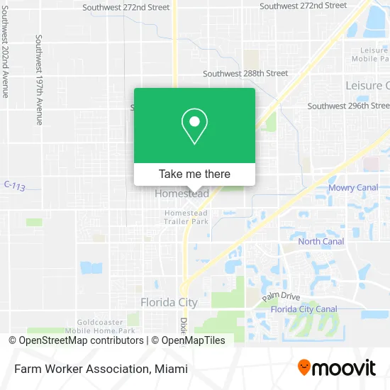
See Farm Worker Association, Homestead, on the map
Public Transit to Farm Worker Association in Homestead
Wondering how to get to Farm Worker Association in Homestead? Moovit helps you find the best way to get to Farm Worker Association with step-by-step directions from the nearest public transit station.
Moovit provides free maps and live directions to help you navigate through your city. View schedules, routes, timetables, and find out how long does it take to get to Farm Worker Association in real time.
Looking for the nearest stop or station to Farm Worker Association? Check out this list of stops closest to your destination: Civic Ct Station; Transitway & Civic Ct Station; Washington Av @ Ne 2 St; English Av @ Park Pl; N Krome Av @ Ne 2 St; N Krome Av @ Ne 4 St.
Bus: 35, 601, 602, 344, DOWNTOWN, EAST/WEST, HOMEDT, HOMELR.
Want to see if there’s another route that gets you there at an earlier time? Moovit helps you find alternative routes or times. Get directions from and directions to Farm Worker Association easily from the Moovit App or Website.
We make riding to Farm Worker Association easy, which is why over 1.5 million users, including users in Homestead, trust Moovit as the best app for public transit. You don’t need to download an individual bus app or train app, Moovit is your all-in-one transit app that helps you find the best bus time or train time available.
For information on prices of bus, costs and ride fares to Farm Worker Association, please check the Moovit app.
Use the app to navigate to popular places including to the airport, hospital, stadium, grocery store, mall, coffee shop, school, college, and university.
Farm Worker Association Address: 329 N Flagler Ave Homestead, FL 33030 street in Homestead
- Triana Fence Supply,
- Unbreakable Chains of Faith Ministries of Jesus Christ,
- Wepa FM,
- Skynet360,
- Dade-Monroe Grower,
- Homestead Books,
- Crossfire Financial Network,
- Colegiate Virtual Academy,
- A D T,
- Southern Baptist Convention,
- Homestead Trolley-Everglades National Park,
- Flamingo,
- 100 Civic Ct Parking,
- Homestead Tomato Packing Company,
- Cope Produce,
- Suvi,
- Yalexis Gonzalez - Realtor,
- Branderburg Security,
- Vacharakiat Malissa DMD,
- 320kbps SW 320th St
Places Near Farm Worker Association (Homestead)
- Dolphin Mall Bus, Miami,
- Port of Miami Cruise Terminal, Miami,
- Wynwood, Miami,
- Little Havana, Miami,
- Dolphin Mall, Miami,
- Miami VA Hospital, Miami,
- Aventura Mall, Miami Beach,
- Miami-Dade County Courthouse, Miami,
- Keiser University Flagship Campus, West Palm Beach,
- Marlins Park, Miami,
- Hard Rock Stadium, Miami Gardens,
- Richard E. Gerstein Justice Building, Miami,
- Brickell City Centre, Miami,
- Miami Design District, Miami,
- Aventura Mall, Miami,
- Zoo Miami, Miami,
- Sawgrass mall ( FL ), Miami Beach,
- Sawgrass Mall, Miami,
- Bayside Marketplace, Miami,
- Miami Freedom Park, Miami
How to get to popular places in Miami with public transit
Get around Homestead by public transit!
Traveling around Homestead has never been so easy. See step by step directions as you travel to any attraction, street or major public transit station. View bus and train schedules, arrival times, service alerts and detailed routes on a map, so you know exactly how to get to anywhere in Homestead.
When traveling to any destination around Homestead use Moovit's Live Directions with Get Off Notifications to know exactly where and how far to walk, how long to wait for your line, and how many stops are left. Moovit will alert you when it's time to get off — no need to constantly re-check whether yours is the next stop.
Wondering how to use public transit in Homestead or how to pay for public transit in Homestead? Moovit public transit app can help you navigate your way with public transit easily, and at minimum cost. It includes public transit fees, ticket prices, and costs. Looking for a map of Homestead public transit lines? Moovit public transit app shows all public transit maps in Homestead with all Bus, Train, Light Rail and Ferry routes and stops on an interactive map.
Miami has 4 transit type(s), including: Bus, Train, Light Rail and Ferry, operated by several transit agencies, including Broward County Transit, Miami-Dade Transit, Metrorail, Palm Tran, Tri-Rail, Brightline, MARTY, City of Homestead Trolley, Key West Transit, Treasure Coast Connector, GoLine IRT, Amtrak, Greyhound-us, FlixBus-us and Aventura Express Shuttle Bus