How to get to Farmacia Popular Unidade 2 by bus?
Click on the bus route to see step by step directions with maps, line arrival times and updated time schedules.
From Cadeia Publica Juiza Patricia Lourival Acioli, São Gonçalo
45 minFrom Shopping São Gonçalo., São Gonçalo
73 minFrom Área de Exame Prático Detran - São Gonçalo, São Gonçalo
68 minFrom Praia de Mauá, Magé
55 minFrom Ônibus Guapimirim X Central, Guapimirim
44 minFrom Clínica Municipal Gonçalense, São Gonçalo
75 minFrom Cadeia Pública Tiago Teles, São Gonçalo
61 minFrom Rodovia BR-101, Km 298 s/n, Itaboraí
38 minFrom Cemitério São Miguel, São Gonçalo
86 minFrom São Gonçalo Shopping, São Gonçalo
63 min
Bus stops near Farmacia Popular Unidade 2 in Magé
Train station near Farmacia Popular Unidade 2 in Magé
- Magé, 10 min walk,VIEW
Bus lines to Farmacia Popular Unidade 2 in Magé
- TZ01, Piabetá,VIEW
- TZ09, Magé,VIEW
- 511Q, Imbariê,VIEW
- 122Q, Terminal Magé,VIEW
- TERESÓPOLIS - MAGÉ, Teresópolis - Magé,VIEW
- TZ08, Andorinhas - Magé,VIEW
- MB15, Cachoeiras de Macacu - Magé (Via Guapimirim),VIEW
- 125C, Magé - Central,VIEW
- 127C, Magé - Castelo (via Túnel Marcello Alencar),VIEW
- MS201, Teresópolis - Magé,VIEW
- 415M, Magé - Caxias (Integração Para Barra da Tijuca),VIEW
- 415M, Magé - Caxias (Integração Barra da Tijuca),VIEW
- 465C, Andorinhas - Caxias (Via Magé),VIEW
- 800I, Magé - Caneca Fina,VIEW
- 805I, Magé - Paraíso,VIEW
- 815I, Magé - Vale das Pedrinhas,VIEW
- 1001, Andorinhas - Magé,VIEW
- 1003, Magé - Pau Grande (Via Fragoso / Piabetá),VIEW
- 1007, Piabetá - Magé (Via Estrada da Conceição),VIEW
- 1008, Magé - Barão de Iriri (Via Suruí - Circular),VIEW
What are the closest stations to Farmacia Popular Unidade 2?
The closest stations to Farmacia Popular Unidade 2 are:
- Rod. Santos Dumont 361 Magé is 258 meters away, 4 min walk.
- R. Cel. João Valério 75 - Mage Magé is 277 meters away, 4 min walk.
- Rua Mario Maia, 44 is 349 meters away, 5 min walk.
- R. Paulo Leitão 113 - Flexeiras Magé is 393 meters away, 6 min walk.
- Magé is 764 meters away, 10 min walk.
Which bus lines stop near Farmacia Popular Unidade 2?
These bus lines stop near Farmacia Popular Unidade 2: 1011, 1121Q, 121Q, 122Q, 800I.
What’s the nearest train station to Farmacia Popular Unidade 2 in Magé?
The nearest train station to Farmacia Popular Unidade 2 in Magé is Magé. It’s a 10 min walk away.
What’s the nearest bus station to Farmacia Popular Unidade 2 in Magé?
The nearest bus stations to Farmacia Popular Unidade 2 in Magé are Rod. Santos Dumont 361 Magé and R. Cel. João Valério 75 - Mage Magé. The closest one is a 4 min walk away.
What time is the first train to Farmacia Popular Unidade 2 in Magé?
The EXTENSÃO GUAPIMIRIM is the first train that goes to Farmacia Popular Unidade 2 in Magé. It stops nearby at 4:33 AM.
What time is the last train to Farmacia Popular Unidade 2 in Magé?
The EXTENSÃO GUAPIMIRIM is the last train that goes to Farmacia Popular Unidade 2 in Magé. It stops nearby at 8:07 PM.
What time is the first bus to Farmacia Popular Unidade 2 in Magé?
The 603I is the first bus that goes to Farmacia Popular Unidade 2 in Magé. It stops nearby at 3:15 AM.
What time is the last bus to Farmacia Popular Unidade 2 in Magé?
The 415M is the last bus that goes to Farmacia Popular Unidade 2 in Magé. It stops nearby at 12:56 AM.
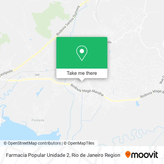
See Farmacia Popular Unidade 2, Magé, on the map
Public Transit to Farmacia Popular Unidade 2 in Magé
Wondering how to get to Farmacia Popular Unidade 2 in Magé? Moovit helps you find the best way to get to Farmacia Popular Unidade 2 with step-by-step directions from the nearest public transit station.
Moovit provides free maps and live directions to help you navigate through your city. View schedules, routes, timetables, and find out how long does it take to get to Farmacia Popular Unidade 2 in real time.
Looking for the nearest stop or station to Farmacia Popular Unidade 2? Check out this list of stops closest to your destination: Rod. Santos Dumont 361 Magé; R. Cel. João Valério 75 - Mage Magé; Rua Mario Maia; R. Paulo Leitão 113 - Flexeiras Magé; Magé.
Bus: 1011, 1121Q, 121Q, 122Q, 800I, TZ01, TZ09, 511Q, TERESÓPOLIS - MAGÉ, TZ08, MB15, 125C, 127C, 123Q, 603I.Train: EXTENSÃO GUAPIMIRIM.
Want to see if there’s another route that gets you there at an earlier time? Moovit helps you find alternative routes or times. Get directions from and directions to Farmacia Popular Unidade 2 easily from the Moovit App or Website.
We make riding to Farmacia Popular Unidade 2 easy, which is why over 1.5 million users, including users in Magé, trust Moovit as the best app for public transit. You don’t need to download an individual bus app or train app, Moovit is your all-in-one transit app that helps you find the best bus time or train time available.
For information on prices of bus, costs and ride fares to Farmacia Popular Unidade 2, please check the Moovit app.
Use the app to navigate to popular places including to the airport, hospital, stadium, grocery store, mall, coffee shop, school, college, and university.
Farmacia Popular Unidade 2 Address: Rua Doutor Siqueira, 1 Centro Magé-RJ 25900-094 street in Magé
- R Xavier Construções e Servicos,
- Reis Cell Cnpj,
- Cimadon Incorporações, Planejamentos e Parcerias,
- Jkm Empreendimentos Imobiliários,
- Lng Holding,
- Escritório Dr. Fernando Repani Filho,
- TRE - Tribunal Regional Eleitoral - Magé,
- Dentista,
- Gabriela Carvalho de Almeida Comercio de Roupas e Acessórios,
- Auto Serviços Capri,
- Supermercado Terê Frutas,
- Mercado de Peixe São Pedro,
- Rua Professor José Leonardo / Rua Agenor P. da Silva Coelho,
- Jlmmcontabilidade,
- Hugo Leonardo Duarte D,
- Espaço Calma - Consultórios,
- Ciz Vestuário Feminino,
- Vaze Agn,
- Bar do Celestino de Piabetá,
- Varejao das Fabricas
Places Near Farmacia Popular Unidade 2 (Magé)
- Shopping Downtown, Barra Da Tijuca,
- Shopping Rio Sul, Botafogo,
- Niterói, Niterói,
- Hospital Federal Cardoso Fontes, Jacarepaguá,
- Praia do Arpoador, Ipanema,
- Rio De Janeiro,
- Hospital Municipal Ronaldo Gazolla, Acari,
- Avenida Rio Branco, Centro,
- Rodoviária Novo Rio (Rodoviária do Rio de Janeiro), Santo Cristo,
- Rua Licínio Cardoso, São Francisco Xavier,
- Feirão De Malhas, Duque De Caxias,
- Feira Livre da Gloria, Glória,
- Rua Ulysses Guimarães 16, Cidade Nova,
- Norte Shopping, Cachambi,
- Shopping RioSul, Botafogo,
- Museu Do Amanhã, Centro,
- Avenida Venezuela 134, Saúde,
- Hospital Federal Do Andaraí, Andaraí,
- Hospital Pedro Ernesto, Vila Isabel,
- Shopping Nova América, Del Castilho
How to get to popular places in Rio de Janeiro Region with public transit
Get around Magé by public transit!
Traveling around Magé has never been so easy. See step by step directions as you travel to any attraction, street or major public transit station. View bus and train schedules, arrival times, service alerts and detailed routes on a map, so you know exactly how to get to anywhere in Magé.
When traveling to any destination around Magé use Moovit's Live Directions with Get Off Notifications to know exactly where and how far to walk, how long to wait for your line, and how many stops are left. Moovit will alert you when it's time to get off — no need to constantly re-check whether yours is the next stop.
Wondering how to use public transit in Magé or how to pay for public transit in Magé? Moovit public transit app can help you navigate your way with public transit easily, and at minimum cost. It includes public transit fees, ticket prices, and costs. Looking for a map of Magé public transit lines? Moovit public transit app shows all public transit maps in Magé with all Bus, Train, Metro, Light Rail, Ferry, Cable Car, Gondola and Funicular routes and stops on an interactive map.
Rio de Janeiro Region has 8 transit type(s), including: Bus, Train, Metro, Light Rail, Ferry, Cable Car, Gondola and Funicular, operated by several transit agencies, including TrensRJ, Metrô Rio, VLT Carioca, Barcas Rio, BRT MOBI-Rio, Auto Viação Alpha, Auto Viação Tijuca, Gire Transportes, Transurb, Viação Nossa Senhora das Graças, Consórcio INTERSUL, Braso Lisboa (Municipal), Caprichosa Auto Ônibus, Auto Viação Três Amigos and Rodoviária Âncora Matias