Directions to Farmapronto (Ocoyucan) with public transportation
The following transit lines have routes that pass near Farmapronto
 Bus: A6 - A, LINEA 4, LÍNEA PERIFÉRICO, RUTA 14A, RUTA AZTECA B.
How to get to Farmapronto by bus?
Click on the bus route to see step by step directions with maps, line arrival times and updated time schedules.
From Iglesia de Ocotlán, Puebla
54 minFrom Xilotzingo, Puebla
47 minFrom Fuente De Los Frailes, San Andrés Cholula
38 minFrom Colonia Azteca, Puebla
54 minFrom Tepeyahualco de Cuauhtemoc, Puebla
46 minFrom Parque 2 de Octubre, Puebla
48 minFrom Hospital Gral Rafael Moreno Valle-UR, San Pedro Cholula
57 minFrom SNTE Sección 23, San Pedro Cholula
56 minFrom San Francisco Totimehuacán, Puebla
72 minFrom Texcoco, Puebla
56 min
Bus stops near Farmapronto in Ocoyucan
Bus lines to Farmapronto in Ocoyucan
- RUTA SAN ANDRÉS CHOLULA, Ramal 4, Santiago Xicotenco,VIEW
- LÍNEA PERIFÉRICO, Ramal Finsa - Buap (Circuito),VIEW
- RUTA SUBURBANA PIRÁMIDES, Ramal 2, Barrio De San Miguel - Ciudad Judicial,VIEW
- RUTA AZTECA B, Ramal 1, Lomas Flor Del Bosque - Villa De Los Ángeles (Regreso),VIEW
- RUTA AZTECA C, Ramal 1, San Esteban - Villa De Los Ángeles,VIEW
- RUTA 14A, Ramal 1, 20 De Nov. - Paseo De San Andrés,VIEW
- RUTA 29, Ramal 2 El Molinito - Coronel Miguel Auza,VIEW
- LINEA 4, Valsequillo - FINSA,VIEW
- A6 - A, Estadios - Ciudad Judicial,VIEW
What are the closest stations to Farmapronto?
The closest stations to Farmapronto are:
- Avenida Orion Norte, 121 is 283 meters away, 5 min walk.
- Avenida Orion Norte, 501 is 362 meters away, 6 min walk.
- Avenida Orion Norte, 503 is 375 meters away, 6 min walk.
- Ciudad Judicial is 382 meters away, 6 min walk.
- Wallmart Ciudad Judicial is 440 meters away, 7 min walk.
Which bus lines stop near Farmapronto?
These bus lines stop near Farmapronto: A6 - A, LINEA 4, LÍNEA PERIFÉRICO, RUTA 14A, RUTA AZTECA B, RUTA SAN ANDRÉS CHOLULA.
What’s the nearest bus station to Farmapronto in Ocoyucan?
The nearest bus station to Farmapronto in Ocoyucan is Avenida Orion Norte, 121. It’s a 5 min walk away.
What time is the first bus to Farmapronto in Ocoyucan?
The A6 - A is the first bus that goes to Farmapronto in Ocoyucan. It stops nearby at 5:02 AM.
What time is the last bus to Farmapronto in Ocoyucan?
The LÍNEA PERIFÉRICO is the last bus that goes to Farmapronto in Ocoyucan. It stops nearby at 12:23 AM.
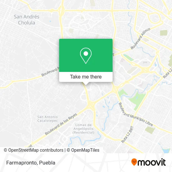
See Farmapronto, Ocoyucan, on the map
Public Transit to Farmapronto in Ocoyucan
Wondering how to get to Farmapronto in Ocoyucan? Moovit helps you find the best way to get to Farmapronto with step-by-step directions from the nearest public transit station.
Moovit provides free maps and live directions to help you navigate through your city. View schedules, routes, timetables, and find out how long does it take to get to Farmapronto in real time.
Looking for the nearest stop or station to Farmapronto? Check out this list of stops closest to your destination: Avenida Orion Norte; Avenida Orion Norte; Avenida Orion Norte; Ciudad Judicial; Wallmart Ciudad Judicial.
Bus: A6 - A, LINEA 4, LÍNEA PERIFÉRICO, RUTA 14A, RUTA AZTECA B, RUTA SAN ANDRÉS CHOLULA, RUTA SUBURBANA PIRÁMIDES, RUTA AZTECA C, RUTA 29.
Want to see if there’s another route that gets you there at an earlier time? Moovit helps you find alternative routes or times. Get directions from and directions to Farmapronto easily from the Moovit App or Website.
We make riding to Farmapronto easy, which is why over 1.5 million users, including users in Ocoyucan, trust Moovit as the best app for public transit. You don’t need to download an individual bus app or train app, Moovit is your all-in-one transit app that helps you find the best bus time or train time available.
For information on prices of bus, costs and ride fares to Farmapronto, please check the Moovit app.
Use the app to navigate to popular places including to the airport, hospital, stadium, grocery store, mall, coffee shop, school, college, and university.
Farmapronto Address: Tlaxcalancingo, 72821 San Andrés Cholula, Puebla street in Ocoyucan
- Hospital Mac Puebla,
- Ortopedista / Cirujano Articular Dr. Abdiel Ng González,
- Frklicious,
- Dra. Abril Montes Yanez,
- Odontopediatra Dra. María Karina Machorro Espinosa,
- Empire Fitness Torres Medicas,
- Dr. Ysauro Cid Polo - Ginecología y Obstetricia,
- Dr. Agustín Tlaseca Guzmán,
- Dr. Luis Carlos Canto Jonguitud,
- Odc,
- Dra. Jorneri Stephanie Cristóbal Ramírez,
- Espresso 730,
- Torres Médicas Angelópolis,
- WESTERN UNION,
- Plaza Anahuac,
- Cima Adventure Puebla,
- Auditorio Universidad Anáhuac,
- Salón Usos Múltiples (SUM) Anáhuac Puebla,
- Edificio 2 Universidad Anahuac,
- La Vista Country Club
Places Near Farmapronto (Ocoyucan)
- Estadio Cuauhtémoc, Puebla,
- Hospital Traumatología y Ortopedia de Puebla, San Pedro Cholula,
- SAT, San Andrés Cholula,
- Ciudad Judicial del Estado de Puebla, San Andrés Cholula,
- Hospital Imss La Margarita, Puebla,
- Plaza Las Animas, Puebla,
- Centro Comercial Angelópolis, San Andrés Cholula,
- Galerías Serdán, San Pedro Cholula,
- Complejo Cultural Universitario, Ocoyucan,
- Tres Cruces, Puebla,
- Parque Ecologico, Pue., San Andrés Cholula,
- Plaza Dorada Centro Comercial, Puebla,
- Centro de Desarrollo Comunitario Tres Cruces, Puebla,
- Parque Puebla, Puebla,
- Zona de los Fuertes, Puebla,
- Secretaria de Finanzas, Puebla,
- 25 Zona Militar, Puebla,
- Hospital General Regional 36 IMSS San Alejandro, San Andrés Cholula,
- Centro Integral de Servicios CIS, San Andrés Cholula,
- Ciudad Universitaria, Puebla
How to get to popular places in Puebla with public transit
Get around Ocoyucan by public transit!
Traveling around Ocoyucan has never been so easy. See step by step directions as you travel to any attraction, street or major public transit station. View bus and train schedules, arrival times, service alerts and detailed routes on a map, so you know exactly how to get to anywhere in Ocoyucan.
When traveling to any destination around Ocoyucan use Moovit's Live Directions with Get Off Notifications to know exactly where and how far to walk, how long to wait for your line, and how many stops are left. Moovit will alert you when it's time to get off — no need to constantly re-check whether yours is the next stop.
Wondering how to use public transit in Ocoyucan or how to pay for public transit in Ocoyucan? Moovit public transit app can help you navigate your way with public transit easily, and at minimum cost. It includes public transit fees, ticket prices, and costs. Looking for a map of Ocoyucan public transit lines? Moovit public transit app shows all public transit maps in Ocoyucan with all bus routes and stops on an interactive map.
Puebla has 1 transit type(s), including: bus, operated by several transit agencies, including RUTA, RUTA Alimentadoras, Rutas Convencionales and Líneas temporales