Directions to Farmapronto (Juan C. Bonilla) with public transportation
The following transit lines have routes that pass near Farmapronto
How to get to Farmapronto by bus?
Click on the bus route to see step by step directions with maps, line arrival times and updated time schedules.
From Lateral de la Recta a Cholula 103, San Gregorio Atzompa
64 minFrom Centro Comercial Galería las Animas, San Andrés Cholula
53 minFrom Rastro Municipal de Puebla, San Pedro Cholula
39 minFrom Avenida 18 Poniente & Diagonal Defensores de la República, San Andrés Cholula
45 minFrom Fraccionamiento Estrellas del Sur, San Andrés Cholula
61 minFrom Santa Cruz Buenavista, San Pedro Cholula
48 minFrom Mercado Hidalgo, San Pedro Cholula
36 minFrom Estrellas Del Sur, San Andrés Cholula
62 minFrom Boulevard Hermanos Serdán, San Pedro Cholula
31 minFrom Santa María Zacatepec, Calpan
77 min
Bus stops near Farmapronto in Juan C. Bonilla
Bus lines to Farmapronto in Juan C. Bonilla
- RUTA 65, Ramal 1, Geovillas San Jacinto - Centro,VIEW
- LÍNEA PERIFÉRICO, Ramal Finsa - Buap (Circuito),VIEW
- RUTA SAN MIGUEL XOXTLA, Ramal 2 Puebla - San Miguel Xoxtla (Ida),VIEW
- RUTA 30A, Ramal 1, Xanenetla - San Lorenzo Almecatla (Regreso),VIEW
- RUTA 72-A, Ramal 1, Villa Deportiva - Misiones De San Fco (Regreso),VIEW
- LINEA 4, Misiones - CAPU,VIEW
- LINEA 4, Valsequillo - FINSA,VIEW
What are the closest stations to Farmapronto?
The closest stations to Farmapronto are:
- L. Cárdenas, 740 is 130 meters away, 2 min walk.
- Hermenegildo Galeana, 12 is 377 meters away, 6 min walk.
- Calle Industrial, 718 is 2347 meters away, 30 min walk.
- Autopista is 2379 meters away, 31 min walk.
Which bus line stops near Farmapronto?
RUTA 65 (Ramal 2, San Francisco Ocotlan - Centro)
What’s the nearest bus station to Farmapronto in Juan C. Bonilla?
The nearest bus station to Farmapronto in Juan C. Bonilla is L. Cárdenas, 740. It’s a 2 min walk away.
What time is the first bus to Farmapronto in Juan C. Bonilla?
The LINEA 4 is the first bus that goes to Farmapronto in Juan C. Bonilla. It stops nearby at 5:09 AM.
What time is the last bus to Farmapronto in Juan C. Bonilla?
The LÍNEA PERIFÉRICO is the last bus that goes to Farmapronto in Juan C. Bonilla. It stops nearby at 1:03 AM.
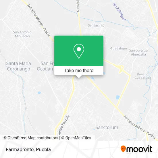
See Farmapronto, Juan C. Bonilla, on the map
Public Transit to Farmapronto in Juan C. Bonilla
Wondering how to get to Farmapronto in Juan C. Bonilla? Moovit helps you find the best way to get to Farmapronto with step-by-step directions from the nearest public transit station.
Moovit provides free maps and live directions to help you navigate through your city. View schedules, routes, timetables, and find out how long does it take to get to Farmapronto in real time.
Looking for the nearest stop or station to Farmapronto? Check out this list of stops closest to your destination: L. Cárdenas; Hermenegildo Galeana; Calle Industrial; Autopista.
Bus: RUTA 65, LÍNEA PERIFÉRICO, RUTA SAN MIGUEL XOXTLA, RUTA 30A, RUTA 72-A, LINEA 4, LINEA 4.
Want to see if there’s another route that gets you there at an earlier time? Moovit helps you find alternative routes or times. Get directions from and directions to Farmapronto easily from the Moovit App or Website.
We make riding to Farmapronto easy, which is why over 1.5 million users, including users in Juan C. Bonilla, trust Moovit as the best app for public transit. You don’t need to download an individual bus app or train app, Moovit is your all-in-one transit app that helps you find the best bus time or train time available.
For information on prices of bus, costs and ride fares to Farmapronto, please check the Moovit app.
Use the app to navigate to popular places including to the airport, hospital, stadium, grocery store, mall, coffee shop, school, college, and university.
Farmapronto Address: Calle Hermenegildo Galeana, San Francisco Ocotlán, 72680 Coronango, Puebla street in Juan C. Bonilla
- Cocina Economica La Pura Sabrosura,
- Gorditas,
- Cocina Carmelita,
- Transportes Marva,
- Bancos De Alimentos Puebla,
- Capilla del Señor de los Milagros,
- Gasolinera Grupo Gemma,
- Faurecia Planta Accesorios,
- Grupo Gemma,
- Faurecia Nave 4,
- Lingerie,
- El Tejado de Ocotlán,
- Huf México S. de R.L.,
- Knasta,
- Dicsa Puebla,
- Hollister,
- Plaza Periférico Ecologico Libramiento Elevado Puebla,
- Daeco Metales del Centro,
- Hackett Outlet Puebla Premier,
- Jessy Franz Alta Moda para Niña
Places Near Farmapronto (Juan C. Bonilla)
- SAT, San Andrés Cholula,
- Hospital Traumatología y Ortopedia de Puebla, San Pedro Cholula,
- Secretaria de Finanzas, Puebla,
- Ciudad Judicial del Estado de Puebla, San Andrés Cholula,
- Ciudad Universitaria, Puebla,
- Complejo Cultural Universitario, Ocoyucan,
- Parque Puebla, Puebla,
- Galerías Serdán, San Pedro Cholula,
- Hospital General Regional 36 IMSS San Alejandro, San Andrés Cholula,
- Centro Integral de Servicios CIS, San Andrés Cholula,
- Centro Comercial Angelópolis, San Andrés Cholula,
- Plaza Las Animas, Puebla,
- Plaza Dorada Centro Comercial, Puebla,
- 25 Zona Militar, Puebla,
- Tres Cruces, Puebla,
- Estadio Cuauhtémoc, Puebla,
- Zona de los Fuertes, Puebla,
- Hospital Imss La Margarita, Puebla,
- Centro de Desarrollo Comunitario Tres Cruces, Puebla,
- Parque Ecologico, Pue., San Andrés Cholula
How to get to popular places in Puebla with public transit
Get around Juan C. Bonilla by public transit!
Traveling around Juan C. Bonilla has never been so easy. See step by step directions as you travel to any attraction, street or major public transit station. View bus and train schedules, arrival times, service alerts and detailed routes on a map, so you know exactly how to get to anywhere in Juan C. Bonilla.
When traveling to any destination around Juan C. Bonilla use Moovit's Live Directions with Get Off Notifications to know exactly where and how far to walk, how long to wait for your line, and how many stops are left. Moovit will alert you when it's time to get off — no need to constantly re-check whether yours is the next stop.
Wondering how to use public transit in Juan C. Bonilla or how to pay for public transit in Juan C. Bonilla? Moovit public transit app can help you navigate your way with public transit easily, and at minimum cost. It includes public transit fees, ticket prices, and costs. Looking for a map of Juan C. Bonilla public transit lines? Moovit public transit app shows all public transit maps in Juan C. Bonilla with all bus routes and stops on an interactive map.
Puebla has 1 transit type(s), including: bus, operated by several transit agencies, including RUTA, RUTA Alimentadoras, Rutas Convencionales and Líneas temporales