Directions to Farr Building (Boston) with public transportation
The following transit lines have routes that pass near Farr Building
 Bus: 39, 47, 65, 85, CT3.
- Train: PROVIDENCE/STOUGHTON.
- Subway: GREEN LINE D, GREEN LINE C, GREEN LINE E.
How to get to Farr Building by bus?
Click on the bus route to see step by step directions with maps, line arrival times and updated time schedules.
From Malden, MA, Malden
86 minFrom Georgetown, Massachusetts, Boston
68 minFrom Davis Sq, Somerville
62 minFrom Arlington, MA, Arlington
92 minFrom Boda Borg, Malden
90 minFrom Academy Of the Pacific Rim Charter Public School, Boston
66 minFrom The Schrafft Center, Boston
54 minFrom The Lawn on D, Boston
57 minFrom Wollaston Beach, Quincy
113 minFrom Newton, MA, Newton
55 min
How to get to Farr Building by train?
Click on the train route to see step by step directions with maps, line arrival times and updated time schedules.
How to get to Farr Building by subway?
Click on the subway route to see step by step directions with maps, line arrival times and updated time schedules.
Bus stops near Farr Building in Boston
Subway stations near Farr Building in Boston
Bus lines to Farr Building in Boston
- 60, Kenmore - Chestnut Hill Mall,VIEW
- 65, Kenmore - Brighton Center,VIEW
- 35, Forest Hills - Dedham Mall,VIEW
- 39, Back Bay - Forest Hills,VIEW
- 66, Nubian via Allston - Harvard via Allston,VIEW
- GREEN LINE E SHUTTLE, Heath Street - Park Street,VIEW
- GREEN LINE E SHUTTLE, Heath Street - Prudential,VIEW
- GREEN LINE D SHUTTLE, Riverside - Kenmore (Shuttle),VIEW
- GREEN LINE D SHUTTLE, Reservoir - Fenway,VIEW
- GREEN LINE D SHUTTLE, Reservoir - Kenmore,VIEW
- GREEN LINE D SHUTTLE, Newton Highlands - Kenmore,VIEW
- GREEN LINE D SHUTTLE, Riverside - Kenmore via Saint Mary's Street,VIEW
- GREEN LINE D SHUTTLE, Newton Highlands - Fenway,VIEW
- GREEN LINE D SHUTTLE, Riverside - Fenway,VIEW
- GREEN LINE D SHUTTLE, Brookline Hills - Kenmore,VIEW
- GREEN LINE D SHUTTLE, Newton Highlands - Kenmore via Saint Mary's Street,VIEW
- GREEN LINE D SHUTTLE, Riverside - Kenmore,VIEW
- GREEN LINE D SHUTTLE, Brookline Hills - Back Bay (Shuttle),VIEW
- 8, Kenmore via South Bay Center - Harbor Point via South Bay Center,VIEW
- 9, Copley - City Point,VIEW
What are the closest stations to Farr Building?
The closest stations to Farr Building are:
- Brookline Ave @ Francis St is 199 yards away, 3 min walk.
- Hawes Street is 217 yards away, 3 min walk.
- Mission Park is 259 yards away, 4 min walk.
- 835 Huntington Ave Opp Parker Hill Ave is 295 yards away, 4 min walk.
- Brookline Ave @ Deaconess Rd is 314 yards away, 5 min walk.
- Longwood Ave @ Binney St is 318 yards away, 5 min walk.
- Chapel St, Colchester St is 458 yards away, 6 min walk.
- Ave Louis Pasteur @ Longwood Ave is 618 yards away, 8 min walk.
Which bus lines stop near Farr Building?
These bus lines stop near Farr Building: 39, 47, 65, 85, CT3.
Which train line stops near Farr Building?
PROVIDENCE/STOUGHTON (#824 | South Station)
Which subway line stops near Farr Building?
GREEN LINE D (Government Center)
What’s the nearest subway station to Farr Building in Boston?
The nearest subway station to Farr Building in Boston is Hawes Street. It’s a 3 min walk away.
What’s the nearest bus station to Farr Building in Boston?
The nearest bus station to Farr Building in Boston is Brookline Ave @ Francis St. It’s a 3 min walk away.
What time is the first subway to Farr Building in Boston?
The GREEN LINE D is the first subway that goes to Farr Building in Boston. It stops nearby at 4:55 AM.
What time is the last subway to Farr Building in Boston?
The GREEN LINE D is the last subway that goes to Farr Building in Boston. It stops nearby at 2:22 AM.
What time is the first bus to Farr Building in Boston?
The 66 is the first bus that goes to Farr Building in Boston. It stops nearby at 4:54 AM.
What time is the last bus to Farr Building in Boston?
The 66 is the last bus that goes to Farr Building in Boston. It stops nearby at 2:11 AM.
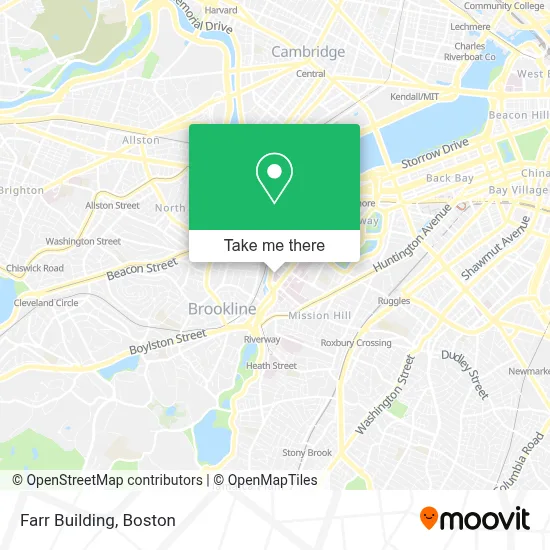
See Farr Building, Boston, on the map
Public Transit to Farr Building in Boston
Wondering how to get to Farr Building in Boston? Moovit helps you find the best way to get to Farr Building with step-by-step directions from the nearest public transit station.
Moovit provides free maps and live directions to help you navigate through your city. View schedules, routes, timetables, and find out how long does it take to get to Farr Building in real time.
Looking for the nearest stop or station to Farr Building? Check out this list of stops closest to your destination: Brookline Ave @ Francis St; Hawes Street; Mission Park; 835 Huntington Ave Opp Parker Hill Ave; Brookline Ave @ Deaconess Rd; Longwood Ave @ Binney St; Chapel St; Ave Louis Pasteur @ Longwood Ave.
Bus: 39, 47, 65, 85, CT3, 60, 35, 66, GREEN LINE E SHUTTLE, GREEN LINE E SHUTTLE, GREEN LINE D SHUTTLE, GREEN LINE D SHUTTLE, GREEN LINE D SHUTTLE, GREEN LINE D SHUTTLE, GREEN LINE D SHUTTLE.Train: PROVIDENCE/STOUGHTON.Subway: GREEN LINE D, GREEN LINE C, GREEN LINE E.
Want to see if there’s another route that gets you there at an earlier time? Moovit helps you find alternative routes or times. Get directions from and directions to Farr Building easily from the Moovit App or Website.
We make riding to Farr Building easy, which is why over 1.7 million users, including users in Boston, trust Moovit as the best app for public transit. You don’t need to download an individual bus app or train app, Moovit is your all-in-one transit app that helps you find the best bus time or train time available.
For information on prices of bus, subway and train, costs and ride fares to Farr Building, please check the Moovit app.
Use the app to navigate to popular places including to the airport, hospital, stadium, grocery store, mall, coffee shop, school, college, and university.
Farr Building Address: 185 Pilgrim Rd street in Boston
- Beth Israel Deaconess Medical Center West Campus,
- Beth Israel Deaconess Medical Center, West Campus - Farr Building,
- Rosenberg Building Bidmc,
- Beth Israel Deaconess Emergency Room,
- Bidmc,
- Joslin Clinic,
- Bidmc West Campus,
- Dr. Hasanain Shikari M.D., D.N.B.,
- Gordon Weir MD,
- Joslin,
- Food for the Soul II,
- Feldberg Garage,
- Joslin Diabetes Center,
- Sodexo Corner Deli,
- Junne Kamihara MD PH.D.,
- Trauma and Community Resilience Center,
- Boston Children's Hospital,
- Yawkey Cafeteria,
- Andrew L. Hong, MD,
- For Five
Places Near Farr Building (Boston)
- Museum Of Science, Boston,
- Quincy Market, Boston,
- Wilbur Theatre, Boston,
- Wang Theater, Boston,
- Faneuil Hall, Boston,
- North End, Boston,
- House Of Blues, Boston,
- Boston Common, Boston,
- Seaport District, Boston,
- Prudential Center, Boston,
- Cheers, Boston,
- Boston Children's Hospital, Boston,
- Mgm Music Hall, Boston,
- Boston Medical Center, Boston,
- Castle Island, Boston,
- Isabella Stewart Gardner Museum, Boston,
- Boston Convention & Exhibition Center, Boston,
- Massachusetts General Hospital, Boston,
- Td Garden, Boston,
- Leader Bank Pavilion (Leader Bank Pavillion), Boston
How to get to popular places in Boston with public transit
Get around Boston by public transit!
Traveling around Boston has never been so easy. See step by step directions as you travel to any attraction, street or major public transit station. View bus and train schedules, arrival times, service alerts and detailed routes on a map, so you know exactly how to get to anywhere in Boston.
When traveling to any destination around Boston use Moovit's Live Directions with Get Off Notifications to know exactly where and how far to walk, how long to wait for your line, and how many stops are left. Moovit will alert you when it's time to get off — no need to constantly re-check whether yours is the next stop.
Wondering how to use public transit in Boston or how to pay for public transit in Boston? Moovit public transit app can help you navigate your way with public transit easily, and at minimum cost. It includes public transit fees, ticket prices, and costs. Looking for a map of Boston public transit lines? Moovit public transit app shows all public transit maps in Boston with all Bus, Train, Subway and Ferry routes and stops on an interactive map.
Boston has 4 transit type(s), including: Bus, Train, Subway and Ferry, operated by several transit agencies, including MBTA, Southeastern Regional Transit Authority, MetroWest Regional Transit Authority, Rhode Island Public Transit Authority, WRTA, Lowell Regional Transit Authority, Merrimack Valley Transit, Montachusett Regional Transit Authority, Cape Cod Regional Transit Authority, Brockton Area Transit Authority, Martha's Vineyard Transit Authority, the WAVE - Nantucket Regional Transit Authority, GATRA, Cape Ann Transportation Authority and Massport