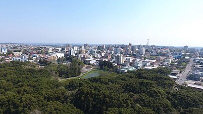
Directions to Farroupilha with public transportation
The following transit lines have routes that pass near Farroupilha
How to get to Farroupilha by bus?
Click on the bus route to see step by step directions with maps, line arrival times and updated time schedules.
Bus stops near Farroupilha
- Mal. Floriano Peixoto - Moinho Covolan, 1 min walk,
- Treze De Maio, 3 min walk,
- Independência - Praça Da Matriz, 6 min walk,
Bus lines to Farroupilha
- C120 BENTO GONÇALVES / CAXIAS, Caxias Via Barracão,
- C140 FARROUPILHA / CAXIAS, Caxias Via Rs-122,
- 01 1° DE MAIO VIA CLUBE, Praça Da Matriz,
- 02 1° DE MAIO VIA RODOVIÁRIA, 1° De Maio,
- C430 FARROUPILHA / CARLOS BARBOSA VIA NOVA SARDENHA, Farroupilha,
- C130 CARLOS BARBOSA / CAXIAS, Caxias - Garib./Bento/Farr.,
What are the closest stations to Farroupilha?
The closest stations to Farroupilha are:
- Mal. Floriano Peixoto - Moinho Covolan is 29 meters away, 1 min walk.
- Treze De Maio is 215 meters away, 3 min walk.
- Independência - Praça Da Matriz is 438 meters away, 6 min walk.
Which bus lines stop near Farroupilha?
These bus lines stop near Farroupilha: C120 BENTO GONÇALVES / CAXIAS, C140 FARROUPILHA / CAXIAS.
What’s the nearest bus station to Farroupilha?
The nearest bus station to Farroupilha is Mal. Floriano Peixoto - Moinho Covolan. It’s a 1 min walk away.
What time is the first bus to Farroupilha?
The C140 FARROUPILHA / CAXIAS is the first bus that goes to Farroupilha. It stops nearby at 5:51 AM.
What time is the last bus to Farroupilha?
The C140 FARROUPILHA / CAXIAS is the last bus that goes to Farroupilha. It stops nearby at 11:12 PM.
See Farroupilha on the map
Public Transportation to Farroupilha
Wondering how to get to Farroupilha? Moovit helps you find the best way to get to Farroupilha with step-by-step directions from the nearest public transit station.
Moovit provides free maps and live directions to help you navigate through your city. View schedules, routes, timetables, and find out how long does it take to get to Farroupilha in real time.
Looking for the nearest stop or station to Farroupilha? Check out this list of stops closest to your destination: Mal. Floriano Peixoto - Moinho Covolan; Treze De Maio; Independência - Praça Da Matriz.
Bus: C120 BENTO GONÇALVES / CAXIAS, C140 FARROUPILHA / CAXIAS, 01 1° DE MAIO VIA CLUBE, 02 1° DE MAIO VIA RODOVIÁRIA, C430 FARROUPILHA / CARLOS BARBOSA VIA NOVA SARDENHA, C130 CARLOS BARBOSA / CAXIAS.
Want to see if there’s another route that gets you there at an earlier time? Moovit helps you find alternative routes or times. Get directions from and directions to Farroupilha easily from the Moovit App or Website.
We make riding to Farroupilha easy, which is why over 1.5 million users, including users in Caxias do Sul and Serra Gaucha, trust Moovit as the best app for public transit. You don’t need to download an individual bus app or train app, Moovit is your all-in-one transit app that helps you find the best bus time or train time available.
For information on prices of bus, costs and ride fares to Farroupilha, please check the Moovit app.
Use the app to navigate to popular places including to the airport, hospital, stadium, grocery store, mall, coffee shop, school, college, and university.
Location: Caxias do Sul and Serra Gaucha
Popular routes to Farroupilha
Popular routes from Farroupilha
Places Near Farroupilha
How to get to popular places in Caxias do Sul and Serra Gaucha with public transit
Get around Caxias do Sul and Serra Gaucha by public transit!
Traveling around Caxias do Sul and Serra Gaucha has never been so easy. See step by step directions as you travel to any attraction, street or major public transit station. View bus and train schedules, arrival times, service alerts and detailed routes on a map, so you know exactly how to get to anywhere in Caxias do Sul and Serra Gaucha.
When traveling to any destination around Caxias do Sul and Serra Gaucha use Moovit's Live Directions with Get Off Notifications to know exactly where and how far to walk, how long to wait for your line, and how many stops are left. Moovit will alert you when it's time to get off — no need to constantly re-check whether yours is the next stop.
Wondering how to use public transit in Caxias do Sul and Serra Gaucha or how to pay for public transit in Caxias do Sul and Serra Gaucha? Moovit public transit app can help you navigate your way with public transit easily, and at minimum cost. It includes public transit fees, ticket prices, and costs. Looking for a map of Caxias do Sul and Serra Gaucha public transit lines? Moovit public transit app shows all public transit maps in Caxias do Sul and Serra Gaucha with all Bus and Train routes and stops on an interactive map.
Caxias do Sul and Serra Gaucha has 2 transit type(s), including: Bus and Train, operated by several transit agencies, including Gramado Turismo, Citral - DAER, ACTL - Táxi-Lotação, Caxiense - DAER e Metroplan, São Marcos - Metroplan, Santa Luíza - Urbano, Ozelame - Metroplan, Bento - DAER e Metroplan, Giordani Turismo, Brocker Turismo, Transportes DDD Ltda, Unesul - DAER e ANTT, Cidade de Farroupilha and Protásio Alves - DAER