How to get to Fast Bail Bonding by bus?
Click on the bus route to see step by step directions with maps, line arrival times and updated time schedules.
From Lorton, VA, Fairfax County
273 minFrom Busch Gardens Williamsburg (Employee Parking Lot), James City County
292 minFrom Potomac Mills Mall, Prince William County
264 minFrom Lorton, VA - Amtrak Auto Train Station (LOR), Fairfax County
279 minFrom Rose Gaming Resort, Prince William County
289 minFrom UVA Hospital Medical Center, Charlottesville
353 minFrom Woodbridge, VA, Prince William County
190 minFrom Amazon Fulfillment Center-Ric3, Richmond
68 min
Bus stops near Fast Bail Bonding in Richmond
Bus lines to Fast Bail Bonding in Richmond
What are the closest stations to Fast Bail Bonding?
The closest stations to Fast Bail Bonding are:
- Forest Hill + Woodberry La is 34 yards away, 2 min walk.
- Forest Hill + Fairlee is 934 yards away, 12 min walk.
Which bus lines stop near Fast Bail Bonding?
These bus lines stop near Fast Bail Bonding: 20, 2A, 64.
What’s the nearest bus station to Fast Bail Bonding in Richmond?
The nearest bus station to Fast Bail Bonding in Richmond is Forest Hill + Woodberry La. It’s a 2 min walk away.
What time is the first bus to Fast Bail Bonding in Richmond?
The 20 is the first bus that goes to Fast Bail Bonding in Richmond. It stops nearby at 4:53 AM.
What time is the last bus to Fast Bail Bonding in Richmond?
The 2A is the last bus that goes to Fast Bail Bonding in Richmond. It stops nearby at 11:45 PM.
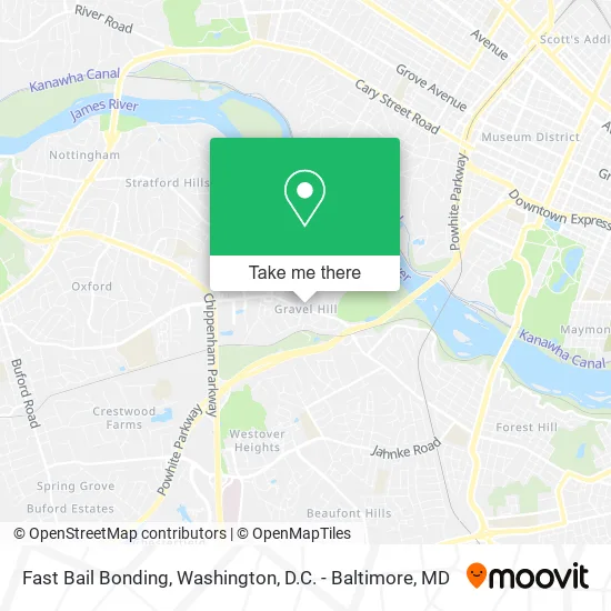
See Fast Bail Bonding, Richmond, on the map
Public Transit to Fast Bail Bonding in Richmond
Wondering how to get to Fast Bail Bonding in Richmond? Moovit helps you find the best way to get to Fast Bail Bonding with step-by-step directions from the nearest public transit station.
Moovit provides free maps and live directions to help you navigate through your city. View schedules, routes, timetables, and find out how long does it take to get to Fast Bail Bonding in real time.
Looking for the nearest stop or station to Fast Bail Bonding? Check out this list of stops closest to your destination: Forest Hill + Woodberry La; Forest Hill + Fairlee.
Bus: 20, 2A, 64.
Want to see if there’s another route that gets you there at an earlier time? Moovit helps you find alternative routes or times. Get directions from and directions to Fast Bail Bonding easily from the Moovit App or Website.
We make riding to Fast Bail Bonding easy, which is why over 1.5 million users, including users in Richmond, trust Moovit as the best app for public transit. You don’t need to download an individual bus app or train app, Moovit is your all-in-one transit app that helps you find the best bus time or train time available.
For information on prices of bus and train, costs and ride fares to Fast Bail Bonding, please check the Moovit app.
Use the app to navigate to popular places including to the airport, hospital, stadium, grocery store, mall, coffee shop, school, college, and university.
Fast Bail Bonding Address: 2800 Skipton Rd Richmond, VA 23225 street in Richmond
- Gravel Hill,
- Speechlanguage Connection,
- Forest Hill Massage,
- Capital Dental Design,
- Two Maids,
- Watershed Hypnotherapy,
- Edward Jones Investments,
- Graham Forbes,
- Ashley Peat DDS,
- Commonwealth Dentistry,
- Amanda Hoover DDS,
- Cadco,
- DSG Commercial Funding Group,
- Spotless Touch,
- Willow Oaks Executive Suites,
- Hope,
- Ek Commando Knife,
- Trade To Travel,
- Gray Construction Reality Comp,
- James F Sumpter P C
Places Near Fast Bail Bonding (Richmond)
- M&T Bank Stadium, Baltimore,
- Westfield Montgomery Mall, Montgomery County,
- Rock Creek Tennis Center, Washington,
- Camden Yards, Baltimore,
- Washington National Cathedral, Washington,
- Marriott Marquis Washington, DC, Washington,
- National Zoo, Washington,
- PG Mall, Prince George's County,
- Museum Of The Bible, Washington,
- Basilica of the National Shrine, Washington,
- Washington DC VA Medical Center, Washington,
- The Anthem, Washington,
- National Museum of African American History and Culture, Washington,
- Sibley Memorial Hospital, Washington,
- Pennsylvania Ave NW (3rd st and pennsylvania), Washington,
- Georgetown, Washington,
- Amazon Hq2, Arlington County,
- National Theatre, Washington,
- Capital One Arena, Washington,
- Warner Theatre, Washington
How to get to popular places in Washington, D.C. - Baltimore, MD with public transit
Get around Richmond by public transit!
Traveling around Richmond has never been so easy. See step by step directions as you travel to any attraction, street or major public transit station. View bus and train schedules, arrival times, service alerts and detailed routes on a map, so you know exactly how to get to anywhere in Richmond.
When traveling to any destination around Richmond use Moovit's Live Directions with Get Off Notifications to know exactly where and how far to walk, how long to wait for your line, and how many stops are left. Moovit will alert you when it's time to get off — no need to constantly re-check whether yours is the next stop.
Wondering how to use public transit in Richmond or how to pay for public transit in Richmond? Moovit public transit app can help you navigate your way with public transit easily, and at minimum cost. It includes public transit fees, ticket prices, and costs. Looking for a map of Richmond public transit lines? Moovit public transit app shows all public transit maps in Richmond with all Bus, Train, Metro, Light Rail and Ferry routes and stops on an interactive map.
Washington, D.C. - Baltimore, MD has 5 transit type(s), including: Bus, Train, Metro, Light Rail and Ferry, operated by several transit agencies, including WMATA, Montgomery County Ride On, Fairfax Connector, TheBus, PRTC, DASH - Alexandria, Arlington Transit (ART), RTA of Central Maryland, MDOT MTA, MDOT MTA Light RailLink, MDOT MTA Commuter Bus, MDOT MTA Local Bus, FXBGO!, Virginia Railway Express (VRE) and MARC