How to get to Fast Car Auto Repair by bus?
Click on the bus route to see step by step directions with maps, line arrival times and updated time schedules.
From Boca Regional Hospital, Boca Raton
116 minFrom Amerant Bank, Fort Lauderdale
37 minFrom Cam Transfer, Coral Springs-Margate
54 minFrom Mizner Park, Boca Raton
95 minFrom The Red Light District, Fort Lauderdale
47 minFrom Boca Raton, FL, Boca Raton
95 minFrom Blanche Ely High School, Pompano Beach
49 minFrom Sensual Asian Massage, Boca Raton
106 minFrom Florida Atlantic University, Boca Raton
104 minFrom Bepxxx, Fort Lauderdale
50 min
How to get to Fast Car Auto Repair by train?
Click on the train route to see step by step directions with maps, line arrival times and updated time schedules.
Bus stop near Fast Car Auto Repair in Deerfield Beach
- Powerline Road/Green Road, 6 min walk,VIEW
Train station near Fast Car Auto Repair in Deerfield Beach
- Pompano Beach Station, 48 min walk,VIEW
Bus lines to Fast Car Auto Repair in Deerfield Beach
- 14, Central Terminal Via Tri-Rail,VIEW
What are the closest stations to Fast Car Auto Repair?
The closest stations to Fast Car Auto Repair are:
- Powerline Road/Green Road is 468 yards away, 6 min walk.
- Pompano Beach Station is 4125 yards away, 48 min walk.
Which bus lines stop near Fast Car Auto Repair?
These bus lines stop near Fast Car Auto Repair: 14, 34.
Which train line stops near Fast Car Auto Repair?
TRIRAIL (Northbound To Mangonia Park)
What’s the nearest bus station to Fast Car Auto Repair in Deerfield Beach?
The nearest bus station to Fast Car Auto Repair in Deerfield Beach is Powerline Road/Green Road. It’s a 6 min walk away.
What time is the first train to Fast Car Auto Repair in Deerfield Beach?
The TRIRAIL is the first train that goes to Fast Car Auto Repair in Deerfield Beach. It stops nearby at 4:41 AM.
What time is the last train to Fast Car Auto Repair in Deerfield Beach?
The TRIRAIL is the last train that goes to Fast Car Auto Repair in Deerfield Beach. It stops nearby at 10:50 PM.
What time is the first bus to Fast Car Auto Repair in Deerfield Beach?
The 14 is the first bus that goes to Fast Car Auto Repair in Deerfield Beach. It stops nearby at 5:15 AM.
What time is the last bus to Fast Car Auto Repair in Deerfield Beach?
The 14 is the last bus that goes to Fast Car Auto Repair in Deerfield Beach. It stops nearby at 12:18 AM.
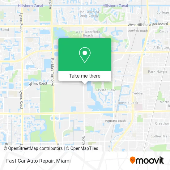
See Fast Car Auto Repair, Deerfield Beach, on the map
Public Transit to Fast Car Auto Repair in Deerfield Beach
Wondering how to get to Fast Car Auto Repair in Deerfield Beach? Moovit helps you find the best way to get to Fast Car Auto Repair with step-by-step directions from the nearest public transit station.
Moovit provides free maps and live directions to help you navigate through your city. View schedules, routes, timetables, and find out how long does it take to get to Fast Car Auto Repair in real time.
Looking for the nearest stop or station to Fast Car Auto Repair? Check out this list of stops closest to your destination: Powerline Road/Green Road; Pompano Beach Station.
Bus: 14, 34.Train: TRIRAIL.
Want to see if there’s another route that gets you there at an earlier time? Moovit helps you find alternative routes or times. Get directions from and directions to Fast Car Auto Repair easily from the Moovit App or Website.
We make riding to Fast Car Auto Repair easy, which is why over 1.5 million users, including users in Deerfield Beach, trust Moovit as the best app for public transit. You don’t need to download an individual bus app or train app, Moovit is your all-in-one transit app that helps you find the best bus time or train time available.
For information on prices of bus and train, costs and ride fares to Fast Car Auto Repair, please check the Moovit app.
Use the app to navigate to popular places including to the airport, hospital, stadium, grocery store, mall, coffee shop, school, college, and university.
Fast Car Auto Repair Address: 4862 N Powerline Rd Pompano Beach, FL 33073 street in Deerfield Beach
- PORSCHE BMW Audi Mercedes BENTLEY Rolls Royce at Eurowerks,
- Twisted Brands,
- Buy Me Beauty,
- World Tool and Supply,
- WESTERN UNION,
- Digital Imaging - Pompano,
- Ricman Construction,
- Paragon Recovery,
- Cash for Cars Florida,
- PC USA Group,
- Casablanca Marble and Granite,
- Asap Construction & Remodeling,
- Asap Restoration,
- Complete Building Products & Services, Inc.,
- Phoenix Ultrasonic Restoration,
- Dairy Shine,
- Drivestr8,
- Ferraras Air,
- Ace Car Clinic,
- Terracast Products
Places Near Fast Car Auto Repair (Deerfield Beach)
- Miami Design District, Miami,
- Sawgrass mall ( FL ), Miami Beach,
- Brickell City Centre, Miami,
- Miami Freedom Park, Miami,
- Port of Miami Cruise Terminal, Miami,
- Miami-Dade County Courthouse, Miami,
- Dolphin Mall, Miami,
- Wynwood, Miami,
- Bayside Marketplace, Miami,
- Miami VA Hospital, Miami,
- Zoo Miami, Miami,
- Richard E. Gerstein Justice Building, Miami,
- Aventura Mall, Miami Beach,
- Sawgrass Mall, Miami,
- Little Havana, Miami,
- Aventura Mall, Miami,
- Dolphin Mall Bus, Miami,
- Keiser University Flagship Campus, West Palm Beach,
- Hard Rock Stadium, Miami Gardens,
- Marlins Park, Miami
How to get to popular places in Miami with public transit
Get around Deerfield Beach by public transit!
Traveling around Deerfield Beach has never been so easy. See step by step directions as you travel to any attraction, street or major public transit station. View bus and train schedules, arrival times, service alerts and detailed routes on a map, so you know exactly how to get to anywhere in Deerfield Beach.
When traveling to any destination around Deerfield Beach use Moovit's Live Directions with Get Off Notifications to know exactly where and how far to walk, how long to wait for your line, and how many stops are left. Moovit will alert you when it's time to get off — no need to constantly re-check whether yours is the next stop.
Wondering how to use public transit in Deerfield Beach or how to pay for public transit in Deerfield Beach? Moovit public transit app can help you navigate your way with public transit easily, and at minimum cost. It includes public transit fees, ticket prices, and costs. Looking for a map of Deerfield Beach public transit lines? Moovit public transit app shows all public transit maps in Deerfield Beach with all Bus, Train, Light Rail and Ferry routes and stops on an interactive map.
Miami has 4 transit type(s), including: Bus, Train, Light Rail and Ferry, operated by several transit agencies, including Broward County Transit, Miami-Dade Transit, Metrorail, Palm Tran, Tri-Rail, Brightline, MARTY, City of Homestead Trolley, Key West Transit, Treasure Coast Connector, GoLine IRT, Amtrak, Greyhound-us, FlixBus-us and Aventura Express Shuttle Bus