How to get to Fast Food Kiko by bus?
Click on the bus route to see step by step directions with maps, line arrival times and updated time schedules.
From Hospital De San Juan De Lurigancho, San Juan D
52 minFrom Ate Vitarte, Ate
49 minFrom Geishas de Santa Anita, Ate
39 minFrom Avenida Marañón & Avenida Universitaria, Los Olivos
30 minFrom Clínica Sanna El Golf, San Isidro
44 minFrom Salamanca, Ate
49 minFrom Mall Plaza Comas, Comas
44 minFrom Hospital Militar Central, Jesus Mari
36 minFrom Tomas Marsano, Surquillo
45 minFrom Av Guardia Civil, San Isidro
49 min
Bus stops near Fast Food Kiko in San Martin
Bus lines to Fast Food Kiko in San Martin
- 1012, Comas - Magdalena,VIEW
- 1181, Ensenada (Puente Piedra) - Pumacahua (Chorrillos),VIEW
- 1189, Izaguirre (San Martin De Porres) - Bravo Chico (El Agustino) ,VIEW
- 1471, Av. Juan Velasco Alvarado (Villa El Salvador) - Oquendo (San Martin De Porres),VIEW
- CR07, Callao,VIEW
- CR43, Ventanilla - Carabayllo,VIEW
- CR62, Carabayllo - Lima - Carabayllo,VIEW
- IO27, Alcazar/Tacna (Rimac),VIEW
- OM23, Callao - Rímac (B),VIEW
- OM33, Puente Santa Rosa (Rimac),VIEW
- IM47, Km. 22 - Caquetá - Brasil - La Marina - Faucett - Km. 22,VIEW
- 1284, Canta Callao (San Martin De Porres),VIEW
- 1197, Chuquitanta (San Martin De Porres) - Ovalo Higuereta (Santiago De Surco) - Chuquitanta (San Martin De Porres),VIEW
- 1226, Ceres Medio (Ate) - Av. Perú (San Martin De Porres),VIEW
- CR24, Callao,VIEW
- CR25, Santa Clara (Ate) - Pacasmayo (Callao),VIEW
- CR44, Ate - Callao,VIEW
- CR57, Puente Nuevo (El Agustino) - Parque Porcino (Ventanilla),VIEW
- 1233, Puente Camote (San Martin De Porres),VIEW
- 1244, Las Palmas (Pachacamac) - Pan de Azúcar (San Martín De Porres),VIEW
What are the closest stations to Fast Food Kiko?
The closest stations to Fast Food Kiko are:
- Avenida José Granda, 2097 is 320 meters away, 5 min walk.
- Avenida José Granda, 2092 is 330 meters away, 5 min walk.
- Chile is 476 meters away, 7 min walk.
- Dueñas is 745 meters away, 10 min walk.
- Santa Fe is 888 meters away, 12 min walk.
Which bus lines stop near Fast Food Kiko?
These bus lines stop near Fast Food Kiko: 1471, CR07, CR43.
What’s the nearest bus station to Fast Food Kiko in San Martin?
The nearest bus stations to Fast Food Kiko in San Martin are Avenida José Granda, 2097 and Avenida José Granda, 2092. The closest one is a 5 min walk away.
What time is the first bus to Fast Food Kiko in San Martin?
The 1471 is the first bus that goes to Fast Food Kiko in San Martin. It stops nearby at 3:47 AM.
What time is the last bus to Fast Food Kiko in San Martin?
The OM23 is the last bus that goes to Fast Food Kiko in San Martin. It stops nearby at 2:54 AM.
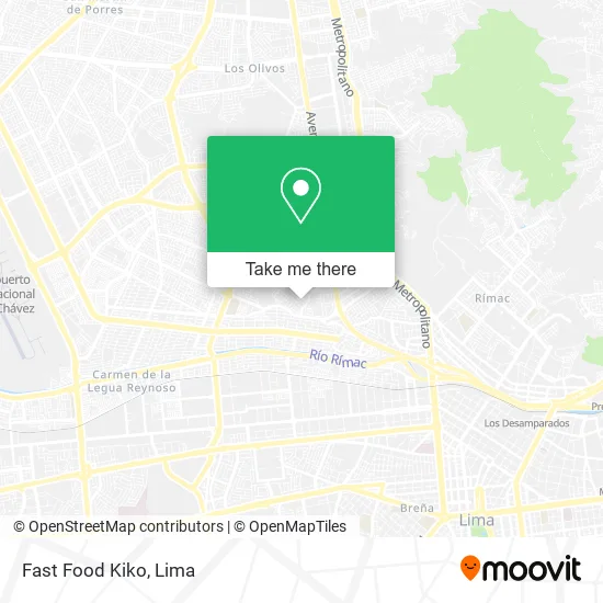
See Fast Food Kiko, San Martin, on the map
Public Transit to Fast Food Kiko in San Martin
Wondering how to get to Fast Food Kiko in San Martin? Moovit helps you find the best way to get to Fast Food Kiko with step-by-step directions from the nearest public transit station.
Moovit provides free maps and live directions to help you navigate through your city. View schedules, routes, timetables, and find out how long does it take to get to Fast Food Kiko in real time.
Looking for the nearest stop or station to Fast Food Kiko? Check out this list of stops closest to your destination: Avenida José Granda; Avenida José Granda; Chile; Dueñas; Santa Fe.
Bus: 1471, CR07, CR43, 1012, 1181, 1189, IM47, 1284, 1197, 1226, CR24, CR25, CR44, 1233, 1244, 1249, 1280, 1303.
Want to see if there’s another route that gets you there at an earlier time? Moovit helps you find alternative routes or times. Get directions from and directions to Fast Food Kiko easily from the Moovit App or Website.
We make riding to Fast Food Kiko easy, which is why over 1.5 million users, including users in San Martin, trust Moovit as the best app for public transit. You don’t need to download an individual bus app or train app, Moovit is your all-in-one transit app that helps you find the best bus time or train time available.
For information on prices of bus, costs and ride fares to Fast Food Kiko, please check the Moovit app.
Use the app to navigate to popular places including to the airport, hospital, stadium, grocery store, mall, coffee shop, school, college, and university.
Fast Food Kiko Address: Avenida John F. Kennedy Popular Valdiviezo, 15103 San Martín de Porres street in San Martin
- Unidos en El Señor,
- Joyeria Relojeria-Coralte S. A. c.,
- Iglesia Cristo de Nuestro Camino,
- I.E. La Cuna,
- Kusunoki Sushi Food,
- Colegio Reyna de los Cielos,
- Collado Arenas Enrique Wency,
- Pizza Raul,
- Avenida TUPA AMARU,
- Institución Educativa Inicial No. 65,
- Avenida los Conquistadores,
- Picantería El Rincón del Chiste,
- Valdivieso,
- Sitio Arqueológico Huaca Palao,
- Paradero Grifo Palao,
- Parque Cooperativa Valdiviezo,
- Corporación Madere,
- Paradero Chile,
- Av Luna Pizarro 321,
- Gonzales Flores David Eduardo
Places Near Fast Food Kiko (San Martin)
- Hospital Edgardo Rebagliati Martins, Jesus Mari,
- Real Plaza Puruchuco, Ate,
- Pontificia Universidad Católica del Perú - PUCP, San Miguel,
- Av. Abancay, Lima,
- Parque de las Leyendas, San Miguel,
- Av. Salaverry, Jesus Mari,
- Barranco, Barranco,
- Av. La Marina, San Miguel,
- Larcomar, Miraflores,
- av arequipa, Lima,
- Parque Kennedy, Miraflores,
- Paradero Av.Brasil,
- Miraflores, Miraflores,
- Jockey Plaza, Santiago D,
- Plaza San Miguel, San Miguel,
- Circuito Mágico Del Agua, Lima,
- Centro Comercial Plaza Norte, Independen,
- Gamarra,
- Mall Del Sur,
- Aeropuerto Internacional Jorge Chávez, Ventanilla
How to get to popular places in Lima with public transit
Get around San Martin by public transit!
Traveling around San Martin has never been so easy. See step by step directions as you travel to any attraction, street or major public transit station. View bus and train schedules, arrival times, service alerts and detailed routes on a map, so you know exactly how to get to anywhere in San Martin.
When traveling to any destination around San Martin use Moovit's Live Directions with Get Off Notifications to know exactly where and how far to walk, how long to wait for your line, and how many stops are left. Moovit will alert you when it's time to get off — no need to constantly re-check whether yours is the next stop.
Wondering how to use public transit in San Martin or how to pay for public transit in San Martin? Moovit public transit app can help you navigate your way with public transit easily, and at minimum cost. It includes public transit fees, ticket prices, and costs. Looking for a map of San Martin public transit lines? Moovit public transit app shows all public transit maps in San Martin with all Bus, Metro and Ferry routes and stops on an interactive map.
Lima has 3 transit type(s), including: Bus, Metro and Ferry, operated by several transit agencies, including Metro de Lima Línea 2 , Metro de Lima, Corredor Rojo, Metropolitano, Metropolitano - Alimentadores, Corredor Morado, Corredor Azul, Rutas Tradicionales, Transportes y Servicios La Esperanza S.A., Las Flores S.A., Virgen de la Asunción S.A., Consorcio HAM, Transportes y Service Canadá S.A., ETUL4SA and ETUCHISA