Directions to Fast Lockout Service (Anne Arundel County) with public transportation
The following transit lines have routes that pass near Fast Lockout Service
 Bus: 69, 70.
- Light Rail: LIGHT RAILLINK.
How to get to Fast Lockout Service by bus?
Click on the bus route to see step by step directions with maps, line arrival times and updated time schedules.
From Port of Baltimore - Cruise Maryland Terminal, Baltimore
62 minFrom Arundel Mills, Anne Arundel County
108 minFrom NSA Friendship Annex (FANX), Anne Arundel County
92 minFrom Nick's Fish House, Baltimore
42 minFrom Archbishop Spalding High School, Severn
38 minFrom Walmart Supercenter, Baltimore County
60 minFrom MD Live Casino Arundel Mills, Anne Arundel County
105 minFrom Baltimore Greyhound Station, Baltimore
54 minFrom Horseshoe Baltimore, Baltimore
55 min
Bus stop near Fast Lockout Service in Anne Arundel County
- Baltimore Annapolis Blvd & Crain Hwy Eb, 7 min walk,VIEW
Light Rail stations near Fast Lockout Service in Anne Arundel County
- Bwi Airport, 27 min walk,VIEW
Bus lines to Fast Lockout Service in Anne Arundel County
What are the closest stations to Fast Lockout Service?
The closest stations to Fast Lockout Service are:
- Baltimore Annapolis Blvd & Crain Hwy Eb is 571 yards away, 7 min walk.
- Bwi Airport is 2240 yards away, 27 min walk.
Which bus lines stop near Fast Lockout Service?
These bus lines stop near Fast Lockout Service: 69, 70.
Which light rail line stops near Fast Lockout Service?
LIGHT RAILLINK (Soutbound)
What’s the nearest light rail station to Fast Lockout Service in Anne Arundel County?
The nearest light rail station to Fast Lockout Service in Anne Arundel County is Bwi Airport. It’s a 27 min walk away.
What’s the nearest bus station to Fast Lockout Service in Anne Arundel County?
The nearest bus station to Fast Lockout Service in Anne Arundel County is Baltimore Annapolis Blvd & Crain Hwy Eb. It’s a 7 min walk away.
What time is the first light rail to Fast Lockout Service in Anne Arundel County?
The LIGHT RAILLINK is the first light rail that goes to Fast Lockout Service in Anne Arundel County. It stops nearby at 4:32 AM.
What time is the last light rail to Fast Lockout Service in Anne Arundel County?
The LIGHT RAILLINK is the last light rail that goes to Fast Lockout Service in Anne Arundel County. It stops nearby at 12:40 AM.
What time is the first bus to Fast Lockout Service in Anne Arundel County?
The 69 is the first bus that goes to Fast Lockout Service in Anne Arundel County. It stops nearby at 5:14 AM.
What time is the last bus to Fast Lockout Service in Anne Arundel County?
The 69 is the last bus that goes to Fast Lockout Service in Anne Arundel County. It stops nearby at 2:41 AM.
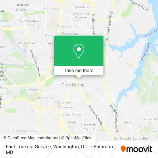
See Fast Lockout Service, Anne Arundel County, on the map
Public Transit to Fast Lockout Service in Anne Arundel County
Wondering how to get to Fast Lockout Service in Anne Arundel County? Moovit helps you find the best way to get to Fast Lockout Service with step-by-step directions from the nearest public transit station.
Moovit provides free maps and live directions to help you navigate through your city. View schedules, routes, timetables, and find out how long does it take to get to Fast Lockout Service in real time.
Looking for the nearest stop or station to Fast Lockout Service? Check out this list of stops closest to your destination: Baltimore Annapolis Blvd & Crain Hwy Eb; Bwi Airport.
Bus: 69, 70.Light Rail: LIGHT RAILLINK.
Want to see if there’s another route that gets you there at an earlier time? Moovit helps you find alternative routes or times. Get directions from and directions to Fast Lockout Service easily from the Moovit App or Website.
We make riding to Fast Lockout Service easy, which is why over 1.5 million users, including users in Anne Arundel County, trust Moovit as the best app for public transit. You don’t need to download an individual bus app or train app, Moovit is your all-in-one transit app that helps you find the best bus time or train time available.
For information on prices of bus, light rail and train, costs and ride fares to Fast Lockout Service, please check the Moovit app.
Use the app to navigate to popular places including to the airport, hospital, stadium, grocery store, mall, coffee shop, school, college, and university.
Fast Lockout Service Address: 7405 Governor Ritchie Hwy Glen Burnie, MD 21061 street in Anne Arundel County
- Corbin Locksmith Glen Burnie,
- Pat Hiban Real Estate Group,
- Shon Emergency Garage Door Repair,
- Waldorf Ford,
- MD Interscholastic Athletic Association,
- Black Cat Tattoos,
- New Jersey NW MD-BR,
- J.B.A. Motors, LLC,
- J.B.A. Kia,
- Capital Gazette Newspapers,
- Maryland First Title, LTD.,
- Ward & Co Law,
- American Society of Plastic Surgeons,
- Dance Explosion,
- Four Seasons,
- Baltimore Implant Center,
- ROYAL FARMS,
- Coin Cloud Bitcoin ATM,
- Sheehy Auto,
- Tirewala
Places Near Fast Lockout Service (Anne Arundel County)
- Pennsylvania Ave NW (3rd st and pennsylvania), Washington,
- PG Mall, Prince George's County,
- Amazon Hq2, Arlington County,
- National Zoo, Washington,
- Basilica of the National Shrine, Washington,
- National Theatre, Washington,
- National Museum of African American History and Culture, Washington,
- Marriott Marquis Washington, DC, Washington,
- Camden Yards, Baltimore,
- The Anthem, Washington,
- Warner Theatre, Washington,
- Sibley Memorial Hospital, Washington,
- Rock Creek Tennis Center, Washington,
- Capital One Arena, Washington,
- Washington DC VA Medical Center, Washington,
- Washington National Cathedral, Washington,
- Westfield Montgomery Mall, Montgomery County,
- Georgetown, Washington,
- M&T Bank Stadium, Baltimore,
- Museum Of The Bible, Washington
How to get to popular places in Washington, D.C. - Baltimore, MD with public transit
Get around Anne Arundel County by public transit!
Traveling around Anne Arundel County has never been so easy. See step by step directions as you travel to any attraction, street or major public transit station. View bus and train schedules, arrival times, service alerts and detailed routes on a map, so you know exactly how to get to anywhere in Anne Arundel County.
When traveling to any destination around Anne Arundel County use Moovit's Live Directions with Get Off Notifications to know exactly where and how far to walk, how long to wait for your line, and how many stops are left. Moovit will alert you when it's time to get off — no need to constantly re-check whether yours is the next stop.
Wondering how to use public transit in Anne Arundel County or how to pay for public transit in Anne Arundel County? Moovit public transit app can help you navigate your way with public transit easily, and at minimum cost. It includes public transit fees, ticket prices, and costs. Looking for a map of Anne Arundel County public transit lines? Moovit public transit app shows all public transit maps in Anne Arundel County with all Bus, Train, Metro, Light Rail and Ferry routes and stops on an interactive map.
Washington, D.C. - Baltimore, MD has 5 transit type(s), including: Bus, Train, Metro, Light Rail and Ferry, operated by several transit agencies, including WMATA, Montgomery County Ride On, Fairfax Connector, TheBus, PRTC, DASH - Alexandria, Arlington Transit (ART), RTA of Central Maryland, MDOT MTA, MDOT MTA Light RailLink, MDOT MTA Commuter Bus, MDOT MTA Local Bus, FXBGO!, Virginia Railway Express (VRE) and MARC