How to get to Fast Photo by bus?
Click on the bus route to see step by step directions with maps, line arrival times and updated time schedules.
From La Plaine Saint-Denis, Saint-Denis
70 minFrom Grande Halle de la Villette, Paris
67 minFrom Rue Hélène et François Missoffe, Paris
90 minFrom 40 Rue de Paris, Clichy
91 minFrom Rue de Crimée, Paris
81 minFrom Cité des sciences, Paris
57 minFrom Orange Stadium, Saint-Denis
58 minFrom Marché D'Argenteuil, Argenteuil
79 minFrom Rue Eugène Carrière, Paris
74 minFrom Bois-Colombes, Bois-Colombes
93 min
Light Rail stations near Fast Photo in Sarcelles
- Les Flanades, 1 min walk,VIEW
Bus stops near Fast Photo in Sarcelles
Bus lines to Fast Photo in Sarcelles
- 1537, Gare D'Epinay-Sur-Seine,VIEW
- 270, Villiers Le Bel - Gonesse - Arnouville RER,VIEW
- 368, Garges - Sarcelles Rer - Place Du Souvenir Français,VIEW
- 9502, Gare De Sarcelles - Saint-Brice - Gare De Roissypole - Aéroport Cdg1 (b4),VIEW
- FILÉO SAR, Gare De Roissypole - Aéroport Cdg1 (b4) - Gare De Sarcelles - Saint-Brice,VIEW
- N44, Garges - Sarcelles RER,VIEW
- VITAVIL, Espace Angela Davis,VIEW
- 133, Le Bourget Rer - Gare De Sarcelles - Saint-Brice,VIEW
- N43, Gare De Sarcelles - Saint-Brice - Gare De L'est,VIEW
What are the closest stations to Fast Photo?
The closest stations to Fast Photo are:
- Les Flanades is 10 meters away, 1 min walk.
- Forum Des Cholettes is 71 meters away, 2 min walk.
- Paul Valéry - de Lattre de Tassigny / Hôpital Nord is 402 meters away, 6 min walk.
Which RER line stops near Fast Photo?
D (Creil)
Which bus lines stop near Fast Photo?
These bus lines stop near Fast Photo: 1537, 268.
Which light rail line stops near Fast Photo?
T5 (Garges - Sarcelles)
What’s the nearest light rail station to Fast Photo in Sarcelles?
The nearest light rail station to Fast Photo in Sarcelles is Les Flanades. It’s a 1 min walk away.
What’s the nearest bus station to Fast Photo in Sarcelles?
The nearest bus stations to Fast Photo in Sarcelles are Les Flanades and Forum Des Cholettes. The closest one is a 2 min walk away.
What time is the first light rail to Fast Photo in Sarcelles?
The T5 is the first light rail that goes to Fast Photo in Sarcelles. It stops nearby at 6:31 AM.
What time is the last light rail to Fast Photo in Sarcelles?
The T5 is the last light rail that goes to Fast Photo in Sarcelles. It stops nearby at 12:52 AM.
What time is the first bus to Fast Photo in Sarcelles?
The FILÉO SAR is the first bus that goes to Fast Photo in Sarcelles. It stops nearby at 3:00 AM.
What time is the last bus to Fast Photo in Sarcelles?
The N44 is the last bus that goes to Fast Photo in Sarcelles. It stops nearby at 3:46 AM.
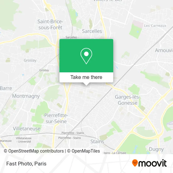
See Fast Photo, Sarcelles, on the map
Public Transit to Fast Photo in Sarcelles
Wondering how to get to Fast Photo in Sarcelles? Moovit helps you find the best way to get to Fast Photo with step-by-step directions from the nearest public transit station.
Moovit provides free maps and live directions to help you navigate through your city. View schedules, routes, timetables, and find out how long does it take to get to Fast Photo in real time.
Looking for the nearest stop or station to Fast Photo? Check out this list of stops closest to your destination: Les Flanades; Forum Des Cholettes; Paul Valéry - de Lattre de Tassigny / Hôpital Nord.
RER: D.Bus: 1537, 268, 368, 9502, FILÉO SAR, 270, N44, VITAVIL, 133, N43.Light Rail: T5.
Want to see if there’s another route that gets you there at an earlier time? Moovit helps you find alternative routes or times. Get directions from and directions to Fast Photo easily from the Moovit App or Website.
We make riding to Fast Photo easy, which is why over 1.5 million users, including users in Sarcelles, trust Moovit as the best app for public transit. You don’t need to download an individual bus app or train app, Moovit is your all-in-one transit app that helps you find the best bus time or train time available.
For information on prices of bus, light rail, metro, RER and train, costs and ride fares to Fast Photo, please check the Moovit app.
Use the app to navigate to popular places including to the airport, hospital, stadium, grocery store, mall, coffee shop, school, college, and university.
Fast Photo Address: 1 Place de Navarre 95200 Sarcelles street in Sarcelles
- 12 Avenue Auguste Perret,
- Cordonnerie des Flanades,
- Les Flanades Centre Commercial,
- Western Union,
- Supermarché G20,
- Rana Gold,
- Feyza Decoration,
- Sécurité Sociale,
- O'Seven,
- Audisono,
- Omr Gestion,
- École de Conduite Panda,
- Étude Plus,
- Bioclinic,
- 1 Avenue du 8 Mai 1945,
- Les Fees de Beauté,
- Family Kash Sarcelles - les Flanades,
- L'Olivier,
- Sg,
- Amel
Places Near Fast Photo (Sarcelles)
- Marché Saint-Pierre, Paris,
- Hôpital Cochin, Paris,
- Galeries Lafayette Haussmann, Paris,
- Hopital Lariboisière, Paris,
- 29 Rue Manin, Paris,
- Hôpital de la Pitié-Salpêtrière, Paris,
- Centre Hospitalier des 15/20, Paris,
- Théâtre Mogador, Paris,
- Gare Routière Flixbus, Paris,
- Fondation Louis Vuitton, Paris,
- Hopital Foch, Suresnes,
- Hôpital Saint-Joseph, Paris,
- Galeries Lafayette, Paris,
- Hôpital Henri Mondor, Creteil,
- Institut Curie, Paris,
- Atelier Des Lumieres, Paris,
- Hôpital Beaujon, Clichy,
- Créteil Soleil, Creteil,
- Hôpital Necker, Paris,
- Hôpital Pitié Salpêtrière, Paris
How to get to popular places in Paris with public transit
Get around Sarcelles by public transit!
Traveling around Sarcelles has never been so easy. See step by step directions as you travel to any attraction, street or major public transit station. View bus and train schedules, arrival times, service alerts and detailed routes on a map, so you know exactly how to get to anywhere in Sarcelles.
When traveling to any destination around Sarcelles use Moovit's Live Directions with Get Off Notifications to know exactly where and how far to walk, how long to wait for your line, and how many stops are left. Moovit will alert you when it's time to get off — no need to constantly re-check whether yours is the next stop.
Wondering how to use public transit in Sarcelles or how to pay for public transit in Sarcelles? Moovit public transit app can help you navigate your way with public transit easily, and at minimum cost. It includes public transit fees, ticket prices, and costs. Looking for a map of Sarcelles public transit lines? Moovit public transit app shows all public transit maps in Sarcelles with all Bus, Train, Metro, Light Rail, RER, Funicular and Gondola routes and stops on an interactive map.
Paris has 7 transit type(s), including: Bus, Train, Metro, Light Rail, RER, Funicular and Gondola, operated by several transit agencies, including RATP, RER, RER Bus de remplacement, Train, Train Bus de remplacement, Tramway Bus de remplacement, TER, ADP, Magical Shuttle, Argenteuil - Boucles de Seine, Autocars Dominique, Bièvre, Brie et 2 Morin, Le Bus - C.C. du Clermontois and Cœur d’Essonne