How to get to Fastacrepe by bus?
Click on the bus route to see step by step directions with maps, line arrival times and updated time schedules.
From Rue des Coccinelles, Mulsanne
59 minFrom Boulevard de Maule, Saint-Saturnin
50 minFrom Mulsanne, Mulsanne
56 minFrom Camp du 2e RIMa, Champagné
51 minFrom Parc Jean du Bellay, Yvré-L'Évêque
58 minFrom La Gèmerie, Arnage
32 minFrom La Pataterie, Trangé
79 minFrom Pôle Européen du Cheval, Yvré-L'Évêque
69 min
Bus stops near Fastacrepe in Le Mans
Light Rail stations near Fastacrepe in Le Mans
- Zola, 44 min walk,VIEW
Bus lines to Fastacrepe in Le Mans
What are the closest stations to Fastacrepe?
The closest stations to Fastacrepe are:
- Batignolles is 162 meters away, 3 min walk.
- Yourcenar is 608 meters away, 9 min walk.
- Nelson Mandela is 802 meters away, 11 min walk.
- Novaxud is 997 meters away, 13 min walk.
- Zola is 3366 meters away, 44 min walk.
- Lafayette is 3718 meters away, 48 min walk.
Which bus lines stop near Fastacrepe?
These bus lines stop near Fastacrepe: 13, 16.
What’s the nearest bus station to Fastacrepe in Le Mans?
The nearest bus station to Fastacrepe in Le Mans is Batignolles. It’s a 3 min walk away.
What time is the first light rail to Fastacrepe in Le Mans?
The T2 is the first light rail that goes to Fastacrepe in Le Mans. It stops nearby at 5:10 AM.
What time is the last light rail to Fastacrepe in Le Mans?
The T1 is the last light rail that goes to Fastacrepe in Le Mans. It stops nearby at 1:12 AM.
What time is the first bus to Fastacrepe in Le Mans?
The T3 is the first bus that goes to Fastacrepe in Le Mans. It stops nearby at 5:08 AM.
What time is the last bus to Fastacrepe in Le Mans?
The T3 is the last bus that goes to Fastacrepe in Le Mans. It stops nearby at 12:47 AM.
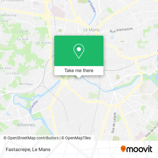
See Fastacrepe, Le Mans, on the map
Public Transit to Fastacrepe in Le Mans
Wondering how to get to Fastacrepe in Le Mans? Moovit helps you find the best way to get to Fastacrepe with step-by-step directions from the nearest public transit station.
Moovit provides free maps and live directions to help you navigate through your city. View schedules, routes, timetables, and find out how long does it take to get to Fastacrepe in real time.
Looking for the nearest stop or station to Fastacrepe? Check out this list of stops closest to your destination: Batignolles; Yourcenar; Nelson Mandela; Novaxud; Zola; Lafayette.
Bus: 13, 16, 14, 35, T3, 4, 7, 11, 17, 20.
Want to see if there’s another route that gets you there at an earlier time? Moovit helps you find alternative routes or times. Get directions from and directions to Fastacrepe easily from the Moovit App or Website.
We make riding to Fastacrepe easy, which is why over 1.5 million users, including users in Le Mans, trust Moovit as the best app for public transit. You don’t need to download an individual bus app or train app, Moovit is your all-in-one transit app that helps you find the best bus time or train time available.
For information on prices of bus and light rail, costs and ride fares to Fastacrepe, please check the Moovit app.
Use the app to navigate to popular places including to the airport, hospital, stadium, grocery store, mall, coffee shop, school, college, and university.
Fastacrepe Address: 76 Rue d'Arnage 72100 Le Mans street in Le Mans
- Eternity Relook,
- Billard Club des Batignolles,
- Nexo Productio,
- Brigitte Relax Bo-T,
- La Suite des Batignolles,
- Rue d'Arnage,
- Automobil Center,
- L'Arche de Lucette,
- Rue Roger Salengro 52,
- Bar Tabac Presse Loto Pmu,
- La Boutique de Saëlle,
- Apartment Rue des Batignolles,
- Coquelicots,
- Stéphanie Lechat,
- 10 Rue Arnage,
- Akelio,
- Villaret Decors,
- Vins en Vrac Vins Fins,
- Résidence le Gue de Maulny,
- Chambre Chez l'Habitant au Calme Dans une Impasse
Places Near Fastacrepe (Le Mans)
- Clinique Pôle Santé Sud, Le Mans,
- Clinique Du Pré, Le Mans,
- Hôpital, Le Mans,
- Camp du 2e RIMa, Champagné,
- Place des Jacobins (le Mans), Le Mans,
- Maison D'Arrêt Le Mans - Les Croisettes, Coulaines,
- E.Leclerc, Le Mans,
- Parc Des Expositions, Le Mans,
- Centre Hospitalier Du Mans, Le Mans,
- La Chapelle-Saint-Aubin, La Chapelle-Saint-Aubin,
- Gare SNCF du Mans, Le Mans,
- Changé, Changé,
- Avenue Bollée, Le Mans,
- Family Village, Ruaudin,
- Saint-Saturnin, Saint-Saturnin,
- Pôle Santé Sud-Elsan, Le Mans,
- Auchan le Mans, La Chapelle-Saint-Aubin,
- Université, Le Mans,
- Circuit des 24 Heures du Mans, Le Mans,
- Coulaines, Coulaines
How to get to popular places in Le Mans with public transit
Get around Le Mans by public transit!
Traveling around Le Mans has never been so easy. See step by step directions as you travel to any attraction, street or major public transit station. View bus and train schedules, arrival times, service alerts and detailed routes on a map, so you know exactly how to get to anywhere in Le Mans.
When traveling to any destination around Le Mans use Moovit's Live Directions with Get Off Notifications to know exactly where and how far to walk, how long to wait for your line, and how many stops are left. Moovit will alert you when it's time to get off — no need to constantly re-check whether yours is the next stop.
Wondering how to use public transit in Le Mans or how to pay for public transit in Le Mans? Moovit public transit app can help you navigate your way with public transit easily, and at minimum cost. It includes public transit fees, ticket prices, and costs. Looking for a map of Le Mans public transit lines? Moovit public transit app shows all public transit maps in Le Mans with all Bus and Light Rail routes and stops on an interactive map.
Le Mans has 2 transit type(s), including: Bus and Light Rail, operated by several transit agencies, including SETRAM