How to get to Faster by bus?
Click on the bus route to see step by step directions with maps, line arrival times and updated time schedules.
From Colossus of the Apennines, Vaglia
45 minFrom Chiantigiana Street, Florence
40 minFrom Auditorium of the New Civic Center, Scandicci
67 minFrom Lastra A Signa, Lastra A Signa
79 minFrom Aurora Theater, Scandicci
53 minFrom Gino Bartali Square / Donato Giannotti Avenue, Florence
37 minFrom Signa, Signa
79 minFrom Pratolino Park, Vaglia
45 minFrom Farewell Chapels of Misericordia of Antella, Bagno a Ripoli
53 minFrom Scandicci, Scandicci
67 min
How to get to Faster by train?
Click on the train route to see step by step directions with maps, line arrival times and updated time schedules.
Bus stop near Faster in Florence
- Ponte Alle Mosse Puccini, 2 min walk,VIEW
Light Rail stations near Faster in Florence
- Cascine, 9 min walk,VIEW
Bus lines to Faster in Florence
What are the closest stations to Faster?
The closest stations to Faster are:
- Ponte Alle Mosse Puccini is 121 meters away, 2 min walk.
- Cascine is 618 meters away, 9 min walk.
Which bus lines stop near Faster?
These bus lines stop near Faster: 17, 35, 55.
Which train line stops near Faster?
R (Florence)
What’s the nearest light rail station to Faster in Florence?
The nearest light rail station to Faster in Florence is Cascine. It’s a 9 min walk away.
What’s the nearest bus station to Faster in Florence?
The nearest bus station to Faster in Florence is Ponte Alle Mosse Puccini. It’s a 2 min walk away.
What time is the first light rail to Faster in Florence?
The T2 is the first light rail that goes to Faster in Florence. It stops nearby at 4:47 AM.
What time is the last light rail to Faster in Florence?
The T2 is the last light rail that goes to Faster in Florence. It stops nearby at 12:51 AM.
What time is the first bus to Faster in Florence?
The 30 is the first bus that goes to Faster in Florence. It stops nearby at 5:12 AM.
What time is the last bus to Faster in Florence?
The 35 is the last bus that goes to Faster in Florence. It stops nearby at 1:10 AM.
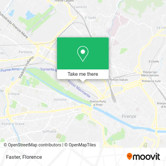
See Faster, Florence, on the map
Public Transit to Faster in Florence
Wondering how to get to Faster in Florence? Moovit helps you find the best way to get to Faster with step-by-step directions from the nearest public transit station.
Moovit provides free maps and live directions to help you navigate through your city. View schedules, routes, timetables, and find out how long does it take to get to Faster in real time.
Looking for the nearest stop or station to Faster? Check out this list of stops closest to your destination: Ponte Alle Mosse Puccini; Cascine.
Bus: 17, 35, 55, 30, 56.Train: R.
Want to see if there’s another route that gets you there at an earlier time? Moovit helps you find alternative routes or times. Get directions from and directions to Faster easily from the Moovit App or Website.
We make riding to Faster easy, which is why over 1.5 million users, including users in Florence, trust Moovit as the best app for public transit. You don’t need to download an individual bus app or train app, Moovit is your all-in-one transit app that helps you find the best bus time or train time available.
For information on prices of bus, light rail and train, costs and ride fares to Faster, please check the Moovit app.
Use the app to navigate to popular places including to the airport, hospital, stadium, grocery store, mall, coffee shop, school, college, and university.
Faster Address: Via Ottavio Rinuccini, 40 50144 Firenze street in Florence
- MDC - The World of Cartridge in Florence,
- Zuccagnoli E.,
- Wolff Shoe Co - Florence,
- Dr. Gianluca Agronomist Galli,
- M-Albatros,
- Rinuccini House,
- Skins Street - Chicaluna and Tattoo Family,
- Architecture Studio,
- Le Botteghe De il Fornaio,
- Stella Simplified Bakery,
- Car Audio Centre by Lucioli M. & C.,
- The Red Lily,
- P.&G. by Porcinai and Giogli,
- Pinkopalline Cultural Association,
- Giulia Bar and Tobacco Shop,
- Beauty and Hygiene Center,
- Segim. Consulting by Cornelli Adriana,
- Shoe Repair Articles,
- Sofi,
- Arina Pan
Places Near Faster (Florence)
- Michelangelo Square, Florence,
- I Gigli, Campi Bisenzio,
- OOO, Florence,
- Mandela Forum (Nelson Mandela Forum), Florence,
- Michelangelo Square, Florence,
- Wanny Palace, Florence,
- Santa Maria Nuova Hospital, Florence,
- IKEA Florence, Sesto Fiorentino,
- Viola Park, Bagno a Ripoli,
- Piero Palagi Hospital Facility-Florence, Florence,
- Cascine Park, Florence,
- Tobacco Manufacture, Florence,
- Artemio Franchi Municipal Stadium, Florence,
- Nelson Mandela Forum, Florence,
- Santa Maria Novella Station, Florence,
- Verdi Theater, Florence,
- Asmana, Campi Bisenzio,
- Torregalli Hospital Scandicci *, Scandicci,
- Field of Mars, Florence,
- Campi Bisenzio, Campi Bisenzio
How to get to popular places in Florence with public transit
Get around Florence by public transit!
Traveling around Florence has never been so easy. See step by step directions as you travel to any attraction, street or major public transit station. View bus and train schedules, arrival times, service alerts and detailed routes on a map, so you know exactly how to get to anywhere in Florence.
When traveling to any destination around Florence use Moovit's Live Directions with Get Off Notifications to know exactly where and how far to walk, how long to wait for your line, and how many stops are left. Moovit will alert you when it's time to get off — no need to constantly re-check whether yours is the next stop.
Wondering how to use public transit in Florence or how to pay for public transit in Florence? Moovit public transit app can help you navigate your way with public transit easily, and at minimum cost. It includes public transit fees, ticket prices, and costs. Looking for a map of Florence public transit lines? Moovit public transit app shows all public transit maps in Florence with all Bus, Train, Light Rail, Ferry and Funicular routes and stops on an interactive map.
Florence has 5 transit type(s), including: Bus, Train, Light Rail, Ferry and Funicular, operated by several transit agencies, including Florence Urban - Tuscan Bus Lines, GEST, Florence and Province - Tuscan Bus Lines, Livorno and Province - Tuscan Bus Lines, Arezzo, Florence and Provinces - Tuscan Bus Lines, Prato and Province - Tuscan Bus Lines, Massa, Carrara and Province - Tuscan Bus Lines, Pisa and Province - Tuscan Bus Lines, Grosseto, Siena and Provinces - Tuscan Bus Lines, Arezzo, Siena and Provinces - Tuscan Bus Lines, Pistoia and Province - Tuscan Bus Lines, Siena and Province - Tuscan Bus Lines, Arezzo and Province - Tuscan Bus Lines, Lucca and Province - Tuscan Bus Lines and Trenitalia