Directions to Fat Rabbit Designs (Charlottesville) with public transportation
The following transit lines have routes that pass near Fat Rabbit Designs
 Bus: 10, AFTON EXPRESS, GREYHOUND US0600, T, 11.
- Train: NORTHEAST REGIONAL, CARDINAL, CRESCENT, FOOTHILLS EXPRESS.
How to get to Fat Rabbit Designs by bus?
Click on the bus route to see step by step directions with maps, line arrival times and updated time schedules.
How to get to Fat Rabbit Designs by train?
Click on the train route to see step by step directions with maps, line arrival times and updated time schedules.
Bus stops near Fat Rabbit Designs in Charlottesville
Train station near Fat Rabbit Designs in Charlottesville
- Charlottesville Amtrak Station, 38 min walk,VIEW
What are the closest stations to Fat Rabbit Designs?
The closest stations to Fat Rabbit Designs are:
- St Clair Ave at Smith St is 933 yards away, 12 min walk.
- Temp E High at Hazel St is 974 yards away, 12 min walk.
- Charlottesville Amtrak Station is 3187 yards away, 38 min walk.
Which bus lines stop near Fat Rabbit Designs?
These bus lines stop near Fat Rabbit Designs: 10, AFTON EXPRESS, GREYHOUND US0600, T.
Which train line stops near Fat Rabbit Designs?
NORTHEAST REGIONAL (Roanoke)
What’s the nearest bus station to Fat Rabbit Designs in Charlottesville?
The nearest bus stations to Fat Rabbit Designs in Charlottesville are St Clair Ave at Smith St and Temp E High at Hazel St. The closest one is a 12 min walk away.
What time is the first train to Fat Rabbit Designs in Charlottesville?
The NORTHEAST REGIONAL is the first train that goes to Fat Rabbit Designs in Charlottesville. It stops nearby at 10:07 AM.
What time is the last train to Fat Rabbit Designs in Charlottesville?
The CRESCENT is the last train that goes to Fat Rabbit Designs in Charlottesville. It stops nearby at 8:52 PM.
What time is the first bus to Fat Rabbit Designs in Charlottesville?
The 11 is the first bus that goes to Fat Rabbit Designs in Charlottesville. It stops nearby at 6:15 AM.
What time is the last bus to Fat Rabbit Designs in Charlottesville?
The 11 is the last bus that goes to Fat Rabbit Designs in Charlottesville. It stops nearby at 10:20 PM.
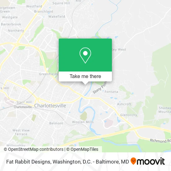
See Fat Rabbit Designs, Charlottesville, on the map
Public Transit to Fat Rabbit Designs in Charlottesville
Wondering how to get to Fat Rabbit Designs in Charlottesville? Moovit helps you find the best way to get to Fat Rabbit Designs with step-by-step directions from the nearest public transit station.
Moovit provides free maps and live directions to help you navigate through your city. View schedules, routes, timetables, and find out how long does it take to get to Fat Rabbit Designs in real time.
Looking for the nearest stop or station to Fat Rabbit Designs? Check out this list of stops closest to your destination: St Clair Ave at Smith St; Temp E High at Hazel St; Charlottesville Amtrak Station.
Bus: 10, AFTON EXPRESS, GREYHOUND US0600, T, 11.Train: NORTHEAST REGIONAL, CARDINAL, CRESCENT, FOOTHILLS EXPRESS.
Want to see if there’s another route that gets you there at an earlier time? Moovit helps you find alternative routes or times. Get directions from and directions to Fat Rabbit Designs easily from the Moovit App or Website.
We make riding to Fat Rabbit Designs easy, which is why over 1.5 million users, including users in Charlottesville, trust Moovit as the best app for public transit. You don’t need to download an individual bus app or train app, Moovit is your all-in-one transit app that helps you find the best bus time or train time available.
For information on prices of bus and train, costs and ride fares to Fat Rabbit Designs, please check the Moovit app.
Use the app to navigate to popular places including to the airport, hospital, stadium, grocery store, mall, coffee shop, school, college, and university.
Fat Rabbit Designs Address: 1145 River Rd Charlottesville, VA 22901 street in Charlottesville
- Kingmill Enterprises,
- CFW Intelos,
- Dudley Fastening,
- Appalachian Home Technologies,
- Nexet Computers,
- Cardboard Safari,
- Lance,
- Evergreen,
- Blue Ridge Event Production,
- Cfa Institute,
- Players Zone,
- Grow Depot,
- Wartime Fitness,
- Quarles,
- Great Outdoors,
- Ray Carr Tires,
- Central Virginia Rental,
- Veterans Of Foreign Wars John C. Culin Post 1827,
- VFW Post 1827 Charlottesville VA,
- Veterans of Foreign Wars
Places Near Fat Rabbit Designs (Charlottesville)
- National Mall, Washington,
- The Anthem, Washington,
- Rock Creek Tennis Center, Washington,
- PG Mall, Prince George's County,
- Camden Yards, Baltimore,
- Washington DC VA Medical Center, Washington,
- Capital One Arena, Washington,
- Warner Theatre, Washington,
- Basilica of the National Shrine, Washington,
- Westfield Montgomery Mall, Montgomery County,
- Amazon Hq2, Arlington County,
- M&T Bank Stadium, Baltimore,
- Washington National Cathedral, Washington,
- Sibley Memorial Hospital, Washington,
- Georgetown, Washington,
- National Museum of African American History and Culture, Washington,
- Museum Of The Bible, Washington,
- Pennsylvania Ave NW (3rd st and pennsylvania), Washington,
- Marriott Marquis Washington, DC, Washington,
- National Zoo, Washington
How to get to popular places in Washington, D.C. - Baltimore, MD with public transit
Get around Charlottesville by public transit!
Traveling around Charlottesville has never been so easy. See step by step directions as you travel to any attraction, street or major public transit station. View bus and train schedules, arrival times, service alerts and detailed routes on a map, so you know exactly how to get to anywhere in Charlottesville.
When traveling to any destination around Charlottesville use Moovit's Live Directions with Get Off Notifications to know exactly where and how far to walk, how long to wait for your line, and how many stops are left. Moovit will alert you when it's time to get off — no need to constantly re-check whether yours is the next stop.
Wondering how to use public transit in Charlottesville or how to pay for public transit in Charlottesville? Moovit public transit app can help you navigate your way with public transit easily, and at minimum cost. It includes public transit fees, ticket prices, and costs. Looking for a map of Charlottesville public transit lines? Moovit public transit app shows all public transit maps in Charlottesville with all Bus, Train, Metro, Light Rail and Ferry routes and stops on an interactive map.
Washington, D.C. - Baltimore, MD has 5 transit type(s), including: Bus, Train, Metro, Light Rail and Ferry, operated by several transit agencies, including WMATA, Montgomery County Ride On, Fairfax Connector, TheBus, PRTC, DASH - Alexandria, Arlington Transit (ART), RTA of Central Maryland, MDOT MTA, MDOT MTA Light RailLink, MDOT MTA Commuter Bus, MDOT MTA Local Bus, FXBGO!, Virginia Railway Express (VRE) and MARC