How to get to Faust by bus?
Click on the bus route to see step by step directions with maps, line arrival times and updated time schedules.
From Alfortville, Alfortville
71 minFrom Bezons, Bezons
67 minFrom Cimetière du Père Lachaise, Paris
46 minFrom Montreuil-Hôpital, Montreuil
72 minFrom Mairie du 19ème, Paris
46 minFrom Bercy Village, Paris
44 minFrom Cachan, Cachan
61 minFrom Meudon-la-Forêt, Meudon
59 minFrom Meudon, Meudon
58 minFrom Parc Floral de Paris, Paris
77 min
How to get to Faust by train?
Click on the train route to see step by step directions with maps, line arrival times and updated time schedules.
How to get to Faust by metro?
Click on the metro route to see step by step directions with maps, line arrival times and updated time schedules.
Bus stops near Faust in Paris
Metro stations near Faust in Paris
Bus lines to Faust in Paris
What are the closest stations to Faust?
The closest stations to Faust are:
- Grand Palais is 71 meters away, 1 min walk.
- Pont Des Invalides - Place de Finlande is 207 meters away, 3 min walk.
- Champs-Élysées - Clemenceau is 229 meters away, 4 min walk.
- Invalides is 267 meters away, 4 min walk.
- Assemblée Nationale is 382 meters away, 6 min walk.
- Pont Alexandre III is 387 meters away, 5 min walk.
- Franklin D. Roosevelt is 557 meters away, 8 min walk.
- La Tour-Maubourg is 713 meters away, 10 min walk.
Which bus lines stop near Faust?
These bus lines stop near Faust: 69, 72, 87, 92, 93.
Which train lines stop near Faust?
These train lines stop near Faust: J, L.
Which metro lines stop near Faust?
These metro lines stop near Faust: 1, 8.
Which RER line stops near Faust?
C (Massy - Palaiseau/ Dourdan - La Forêt/ Saint-Martin-d'Étampes)
What’s the nearest metro station to Faust in Paris?
The nearest metro station to Faust in Paris is Champs-Élysées - Clemenceau. It’s a 4 min walk away.
What’s the nearest bus station to Faust in Paris?
The nearest bus station to Faust in Paris is Grand Palais. It’s a 1 min walk away.
What time is the first metro to Faust in Paris?
The 8 is the first metro that goes to Faust in Paris. It stops nearby at 5:24 AM.
What time is the last metro to Faust in Paris?
The 8 is the last metro that goes to Faust in Paris. It stops nearby at 1:06 AM.
What time is the first bus to Faust in Paris?
The N01 is the first bus that goes to Faust in Paris. It stops nearby at 3:00 AM.
What time is the last bus to Faust in Paris?
The N02 is the last bus that goes to Faust in Paris. It stops nearby at 3:51 AM.
What time is the first RER to Faust in Paris?
The C is the first RER that goes to Faust in Paris. It stops nearby at 5:09 AM.
What time is the last RER to Faust in Paris?
The C is the last RER that goes to Faust in Paris. It stops nearby at 12:26 AM.
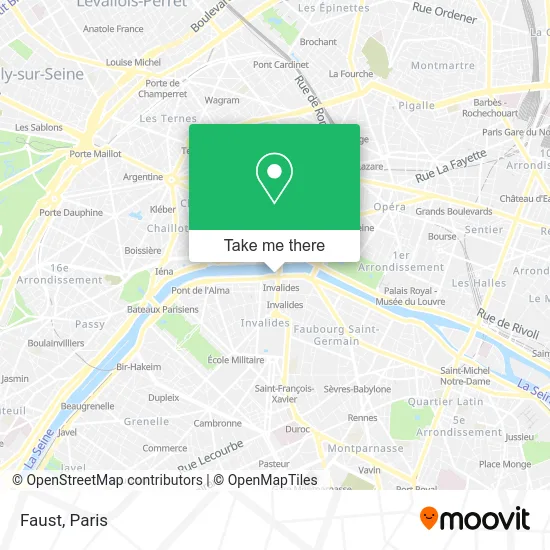
See Faust, Paris, on the map
Public Transit to Faust in Paris
Wondering how to get to Faust in Paris? Moovit helps you find the best way to get to Faust with step-by-step directions from the nearest public transit station.
Moovit provides free maps and live directions to help you navigate through your city. View schedules, routes, timetables, and find out how long does it take to get to Faust in real time.
Looking for the nearest stop or station to Faust? Check out this list of stops closest to your destination: Grand Palais; Pont Des Invalides - Place de Finlande; Champs-Élysées - Clemenceau; Invalides; Assemblée Nationale; Pont Alexandre III; Franklin D. Roosevelt; La Tour-Maubourg.
Bus: 69, 72, 87, 92, 93.Train: J, L.Metro: 1, 8, 13, 12, 9.RER: C.
Want to see if there’s another route that gets you there at an earlier time? Moovit helps you find alternative routes or times. Get directions from and directions to Faust easily from the Moovit App or Website.
We make riding to Faust easy, which is why over 1.5 million users, including users in Paris, trust Moovit as the best app for public transit. You don’t need to download an individual bus app or train app, Moovit is your all-in-one transit app that helps you find the best bus time or train time available.
For information on prices of metro, bus, RER, train and light rail, costs and ride fares to Faust, please check the Moovit app.
Use the app to navigate to popular places including to the airport, hospital, stadium, grocery store, mall, coffee shop, school, college, and university.
Faust Address: Port des Invalides street in Paris
- Pont Alexandre III - Rive Gauche,
- Bistrot Alexandre III,
- Pont Alexandre III - Tribune A Et Tribunes C À H,
- Invalides Station,
- Berges de Seine,
- Berges de Seine – Rive gauche,
- Puente Alejandro III (Pont Alexandre III),
- Arrêt Invalides [63,83,93],
- Ambassade de Finlande,
- uber paris,
- Bonne Journee,
- Place de Finlande,
- Commissariat de police du 7eme arrondissement,
- Commissariat,
- Flow,
- Commissariat central du 7e arrondissement,
- Le Bridge,
- 4 Port des Invalides,
- Métro-Invalides,
- XEX
Places Near Faust (Paris)
- Marché Saint-Pierre, Paris,
- Hôpital de la Pitié-Salpêtrière, Paris,
- Hôpital Pitié Salpêtrière, Paris,
- Hôpital Saint-Joseph, Paris,
- 29 Rue Manin, Paris,
- Gare Routière Flixbus, Paris,
- Galeries Lafayette, Paris,
- Atelier Des Lumieres, Paris,
- Hôpital Cochin, Paris,
- Hopital Foch, Suresnes,
- Créteil Soleil, Creteil,
- Hôpital Necker, Paris,
- Galeries Lafayette Haussmann, Paris,
- Hôpital Henri Mondor, Creteil,
- Fondation Louis Vuitton, Paris,
- Centre Hospitalier des 15/20, Paris,
- Hopital Lariboisière, Paris,
- Hôpital Beaujon, Clichy,
- Beaugrenelle, Paris,
- Théâtre Mogador, Paris
How to get to popular places in Paris with public transit
Get around Paris by public transit!
Traveling around Paris has never been so easy. See step by step directions as you travel to any attraction, street or major public transit station. View bus and train schedules, arrival times, service alerts and detailed routes on a map, so you know exactly how to get to anywhere in Paris.
When traveling to any destination around Paris use Moovit's Live Directions with Get Off Notifications to know exactly where and how far to walk, how long to wait for your line, and how many stops are left. Moovit will alert you when it's time to get off — no need to constantly re-check whether yours is the next stop.
Wondering how to use public transit in Paris or how to pay for public transit in Paris? Moovit public transit app can help you navigate your way with public transit easily, and at minimum cost. It includes public transit fees, ticket prices, and costs. Looking for a map of Paris public transit lines? Moovit public transit app shows all public transit maps in Paris with all Bus, Train, Metro, Light Rail, RER, Funicular and Gondola routes and stops on an interactive map.
Paris has 7 transit type(s), including: Bus, Train, Metro, Light Rail, RER, Funicular and Gondola, operated by several transit agencies, including RATP, RER, RER Bus de remplacement, Train, Train Bus de remplacement, Tramway Bus de remplacement, TER, ADP, Magical Shuttle, Argenteuil - Boucles de Seine, Autocars Dominique, Bièvre, Brie et 2 Morin, Le Bus - C.C. du Clermontois and Cœur d’Essonne