How to get to Faver System by bus?
Click on the bus route to see step by step directions with maps, line arrival times and updated time schedules.
From Le Panteraie Discotheque Montecatini Lidò, Montecatini-Terme
67 minFrom Monsummano Terme, Monsummano Terme
70 minFrom SS. Cosma and Damiano Hospital of Pescia, Pescia
99 minFrom San Luca Hospital, Lucca
51 minFrom Pescia Hospital, Pescia
99 minFrom Castelfranco Di Sotto, Castelfranco Di Sotto
122 minFrom Cesare Battisti Square, Montecatini Terme
44 minFrom Montecatini Terme, Montecatini Terme
47 minFrom Green Area, Capannori
85 min
How to get to Faver System by train?
Click on the train route to see step by step directions with maps, line arrival times and updated time schedules.
Bus stops near Faver System in Altopascio
Train station near Faver System in Altopascio
- Altopascio, 44 min walk,VIEW
Bus lines to Faver System in Altopascio
What are the closest stations to Faver System?
The closest stations to Faver System are:
- Cerbaie St 37 is 351 meters away, 5 min walk.
- Altopascio Benedetto Croce Square is 988 meters away, 13 min walk.
- Via Gavinana Gas Station is 1048 meters away, 14 min walk.
- Altopascio is 3427 meters away, 44 min walk.
Which bus lines stop near Faver System?
These bus lines stop near Faver System: 20, 851, E8.
Which train line stops near Faver System?
R (Pistoia/Pisa)
What’s the nearest bus station to Faver System in Altopascio?
The nearest bus station to Faver System in Altopascio is Cerbaie St 37. It’s a 5 min walk away.
What time is the first train to Faver System in Altopascio?
The R is the first train that goes to Faver System in Altopascio. It stops nearby at 7:09 AM.
What time is the last train to Faver System in Altopascio?
The R is the last train that goes to Faver System in Altopascio. It stops nearby at 11:16 PM.
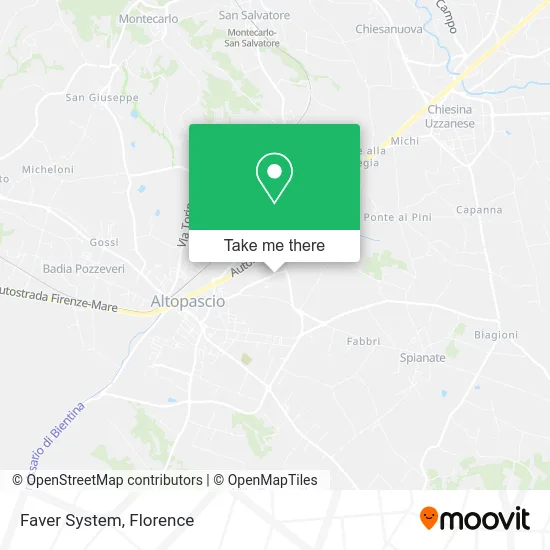
See Faver System, Altopascio, on the map
Public Transit to Faver System in Altopascio
Wondering how to get to Faver System in Altopascio? Moovit helps you find the best way to get to Faver System with step-by-step directions from the nearest public transit station.
Moovit provides free maps and live directions to help you navigate through your city. View schedules, routes, timetables, and find out how long does it take to get to Faver System in real time.
Looking for the nearest stop or station to Faver System? Check out this list of stops closest to your destination: Cerbaie St 37; Altopascio Benedetto Croce Square; Via Gavinana Gas Station; Altopascio.
Bus: 20, 851, E8, E20, E20, E70.Train: R.
Want to see if there’s another route that gets you there at an earlier time? Moovit helps you find alternative routes or times. Get directions from and directions to Faver System easily from the Moovit App or Website.
We make riding to Faver System easy, which is why over 1.5 million users, including users in Altopascio, trust Moovit as the best app for public transit. You don’t need to download an individual bus app or train app, Moovit is your all-in-one transit app that helps you find the best bus time or train time available.
For information on prices of bus and train, costs and ride fares to Faver System, please check the Moovit app.
Use the app to navigate to popular places including to the airport, hospital, stadium, grocery store, mall, coffee shop, school, college, and university.
Faver System Address: 55011 Altopascio street in Altopascio
- Marco Vicini,
- Aerre,
- Mpa. Metalplast Aemblaggi by Barbu Cristina Mihaela & C. Sa.,
- Mya Cafe,
- Fapim,
- Sushi Daily Altopascio Cerbaie,
- Logistica Sivep Limited Liability Company or Logistica Sivip S,
- CONAD Fuel Station,
- Vannucci Painting by Vannucci Sandro & Co.,
- Manhattan Club,
- Ferro29 Special Rider's Store,
- Befast,
- S.A.V.A.S.,
- Orcino Restaurant,
- Piem Assemblies,
- Rovai Cinzia,
- Giuliana Guidi,
- Candre Bijoux & Watch,
- New Land. Altopacio,
- Ci & Di Food
Places Near Faver System (Altopascio)
- Tobacco Manufacture, Florence,
- Cascine Park, Florence,
- Santa Maria Nuova Hospital, Florence,
- Visarno Arena, Florence,
- Michelangelo Square, Florence,
- Asmana, Campi Bisenzio,
- Visarno Hippodrome, Florence,
- Mandela Forum (Nelson Mandela Forum), Florence,
- Santa Maria Novella Station, Florence,
- Field of Mars, Florence,
- I Gigli, Campi Bisenzio,
- Michelangelo Square, Florence,
- Campi Bisenzio, Campi Bisenzio,
- Torregalli Hospital Scandicci *, Scandicci,
- IKEA Florence, Sesto Fiorentino,
- OOO, Florence,
- Piero Palagi Hospital Facility-Florence, Florence,
- Artemio Franchi Municipal Stadium, Florence,
- Nelson Mandela Forum, Florence,
- Verdi Theater, Florence
How to get to popular places in Florence with public transit
Get around Altopascio by public transit!
Traveling around Altopascio has never been so easy. See step by step directions as you travel to any attraction, street or major public transit station. View bus and train schedules, arrival times, service alerts and detailed routes on a map, so you know exactly how to get to anywhere in Altopascio.
When traveling to any destination around Altopascio use Moovit's Live Directions with Get Off Notifications to know exactly where and how far to walk, how long to wait for your line, and how many stops are left. Moovit will alert you when it's time to get off — no need to constantly re-check whether yours is the next stop.
Wondering how to use public transit in Altopascio or how to pay for public transit in Altopascio? Moovit public transit app can help you navigate your way with public transit easily, and at minimum cost. It includes public transit fees, ticket prices, and costs. Looking for a map of Altopascio public transit lines? Moovit public transit app shows all public transit maps in Altopascio with all Bus, Train, Light Rail, Ferry and Funicular routes and stops on an interactive map.
Florence has 5 transit type(s), including: Bus, Train, Light Rail, Ferry and Funicular, operated by several transit agencies, including Florence Urban - Tuscan Bus Lines, GEST, Livorno and Province - Tuscan Bus Lines, Arezzo, Florence and Provinces - Tuscan Bus Lines, Prato and Province - Tuscan Bus Lines, Lucca and Province - Tuscan Bus Lines, Massa, Carrara and Province - Tuscan Bus Lines, Pisa and Province - Tuscan Bus Lines, Grosseto, Siena and Provinces - Tuscan Bus Lines, Arezzo, Siena and Provinces - Tuscan Bus Lines, Florence and Province - Tuscan Bus Lines, Pistoia and Province - Tuscan Bus Lines, Siena and Province - Tuscan Bus Lines, Arezzo and Province - Tuscan Bus Lines and Trenitalia