See Fay School, Boston, on the map
Directions to Fay School (Boston) with public transportation
The following transit lines have routes that pass near Fay School
 Bus:
Bus: - Train:
How to get to Fay School by bus?
Click on the bus route to see step by step directions with maps, line arrival times and updated time schedules.
How to get to Fay School by train?
Click on the train route to see step by step directions with maps, line arrival times and updated time schedules.
Which bus line stops near Fay School?
MLBHLN
Which train line stops near Fay School?
FRAMINGHAM/WORCESTER LINE
See Fay School, Boston, on the map
Public Transit to Fay School in Boston
Wondering how to get to Fay School in Boston, United States? Moovit helps you find the best way to get to Fay School with step-by-step directions from the nearest public transit station.
Moovit provides free maps and live directions to help you navigate through your city. View schedules, routes, timetables, and find out how long does it take to get to Fay School in real time.
Bus:Train:
Want to see if there’s another route that gets you there at an earlier time? Moovit helps you find alternative routes or times. Get directions from and directions to Fay School easily from the Moovit App or Website.
We make riding to Fay School easy, which is why over 1.5 million users, including users in Boston, trust Moovit as the best app for public transit. You don’t need to download an individual bus app or train app, Moovit is your all-in-one transit app that helps you find the best bus time or train time available.
For information on prices of bus and train, costs and ride fares to Fay School, please check the Moovit app.
Use the app to navigate to popular places including to the airport, hospital, stadium, grocery store, mall, coffee shop, school, college, and university.
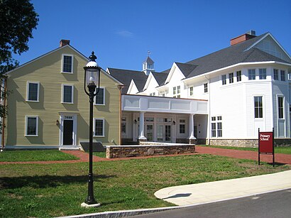
Fay School Address: Main Street street in Boston
Attractions near Fay School
Dining Hall,Sixth Form,Fay,Fay Lounge,St Mark's Episcopal Church Church Office,Fay Theater,Stone Health Ctr,Fay Gym,Saint Marks Episcopal Church,Saint Marks Episcopal Church,1,Fay Health Office,Southborough Town Hall,Southborough Town Hall,RT-30,Southborough Historical Scty,Southborough Health Board,Town Hall,stone health center,Common StHow to get to popular attractions in Boston with public transit
Joe's American Bar & Grill, Boston,The Salty Pig, Boston,Samuel Adams Brewery, Boston,Charlie's Kitchen, Cambridge,Worcester, MA, Worcester,Brown University,Star Market, Waltham,Raising Cane's Chicken Fingers, Boston,BJ's Wholesale Club, Haverhill,Cafeteria Boston, Boston,Hyatt Boston Harbor, Boston,Fajitas & 'Ritas, Boston,East Providence, RI,White Horse Tavern, Boston,FiRE + iCE Boston, Boston,Shabu Zen, Boston,Target,Mike's Food and Spirits, Somerville,Boston Medical Center, Boston,Five Horses Tavern, SomervilleGet around Boston by public transit!
Traveling around Boston has never been so easy. See step by step directions as you travel to any attraction, street or major public transit station. View bus and train schedules, arrival times, service alerts and detailed routes on a map, so you know exactly how to get to anywhere in Boston.
When traveling to any destination around Boston use Moovit's Live Directions with Get Off Notifications to know exactly where and how far to walk, how long to wait for your line, and how many stops are left. Moovit will alert you when it's time to get off — no need to constantly re-check whether yours is the next stop.
Wondering how to use public transit in Boston or how to pay for public transit in Boston? Moovit public transit app can help you navigate your way with public transit easily, and at minimum cost. It includes public transit fees, ticket prices, and costs. Looking for a map of Boston public transit lines? Moovit public transit app shows all public transit maps in Boston with all bus or train routes and stops on an interactive map.
Boston has 2 transit type(s), including: bus or train, operated by several transit agencies, including MBTA, MBTA, MBTA, Southeastern Regional Transit Authority, MetroWest Regional Transit Authority, Rhode Island Public Transit Authority, WRTA, Lowell Regional Transit Authority, Merrimack Valley Transit, Montachusett Regional Transit Authority, Cape Cod Regional Transit Authority, Brockton Area Transit Authority, Cape Cod Regional Transit Authority, Martha's Vineyard Transit Authority and the WAVE - Nantucket Regional Transit Authority