How to get to FedEx by bus?
Click on the bus route to see step by step directions with maps, line arrival times and updated time schedules.
From US-1 / SE Port St Lucie Blvd, Port St. Lucie
121 minFrom Clover Park, Port St. Lucie
94 minFrom CVS Pharmacy - (Lyngate Dr), Port St. Lucie
77 minFrom US-1, Fort Pierce
44 minFrom Stuart, Florida, Stuart
126 minFrom Tradition Park, Port St. Lucie
99 minFrom Suncoast Community High School, Riviera Beach
551 minFrom Suncoast High School, Riviera Beach
549 min
Bus stops near FedEx in Fort Pierce
What are the closest stations to FedEx?
The closest stations to FedEx are:
- Okeechobee Rd & Kaufman Ave is 192 yards away, 3 min walk.
- Soltman Ave & S 25th St is 629 yards away, 8 min walk.
Which bus lines stop near FedEx?
These bus lines stop near FedEx: 1, 3, 8.
What’s the nearest bus station to FedEx in Fort Pierce?
The nearest bus station to FedEx in Fort Pierce is Okeechobee Rd & Kaufman Ave. It’s a 3 min walk away.
What time is the first bus to FedEx in Fort Pierce?
The 3 is the first bus that goes to FedEx in Fort Pierce. It stops nearby at 6:39 AM.
What time is the last bus to FedEx in Fort Pierce?
The 3 is the last bus that goes to FedEx in Fort Pierce. It stops nearby at 7:51 PM.
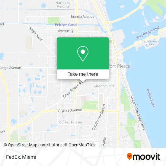
See FedEx, Fort Pierce, on the map
Public Transit to FedEx in Fort Pierce
Wondering how to get to FedEx in Fort Pierce? Moovit helps you find the best way to get to FedEx with step-by-step directions from the nearest public transit station.
Moovit provides free maps and live directions to help you navigate through your city. View schedules, routes, timetables, and find out how long does it take to get to FedEx in real time.
Looking for the nearest stop or station to FedEx? Check out this list of stops closest to your destination: Okeechobee Rd & Kaufman Ave; Soltman Ave & S 25th St.
Bus: 1, 3, 8.
Want to see if there’s another route that gets you there at an earlier time? Moovit helps you find alternative routes or times. Get directions from and directions to FedEx easily from the Moovit App or Website.
We make riding to FedEx easy, which is why over 1.5 million users, including users in Fort Pierce, trust Moovit as the best app for public transit. You don’t need to download an individual bus app or train app, Moovit is your all-in-one transit app that helps you find the best bus time or train time available.
For information on prices of bus, costs and ride fares to FedEx, please check the Moovit app.
Use the app to navigate to popular places including to the airport, hospital, stadium, grocery store, mall, coffee shop, school, college, and university.
FedEx Address: 2211 Okeechobee Rd Fort Pierce, FL 34950 street in Fort Pierce
- Secure Labs,
- M Care Chiropractic Services,
- Tortilleria Laestrella,
- Taqueria El Arriero,
- Sanctuary House School of Martial Arts,
- The UPS Store,
- Costa Azul Mexican Restaurant,
- Angels Little,
- Tete Cleaning Service,
- Dan the Shoe Man Shoe Repair,
- MLB Barber Shop,
- Nouvelle Eglise de Dieu Primitive,
- Lawnwood Physical Rehabilitation Center,
- EZ Pay Auto Brokers,
- VCA,
- Nazarene Church of FP,
- Fort Pierce Philadelphia,
- Edh Church,
- Treasure Coast Barber's United,
- JL Multiservicios
Places Near FedEx (Fort Pierce)
- Port of Miami Cruise Terminal, Miami,
- Keiser University Flagship Campus, West Palm Beach,
- Bayside Marketplace, Miami,
- Hard Rock Stadium, Miami Gardens,
- Little Havana, Miami,
- Sawgrass mall ( FL ), Miami Beach,
- Dolphin Mall Bus, Miami,
- Brickell City Centre, Miami,
- Zoo Miami, Miami,
- Aventura Mall, Miami Beach,
- Aventura Mall, Miami,
- Miami-Dade County Courthouse, Miami,
- Miami VA Hospital, Miami,
- Marlins Park, Miami,
- Miami Freedom Park, Miami,
- Dolphin Mall, Miami,
- Miami Design District, Miami,
- Richard E. Gerstein Justice Building, Miami,
- Sawgrass Mall, Miami,
- Wynwood, Miami
How to get to popular places in Miami with public transit
Get around Fort Pierce by public transit!
Traveling around Fort Pierce has never been so easy. See step by step directions as you travel to any attraction, street or major public transit station. View bus and train schedules, arrival times, service alerts and detailed routes on a map, so you know exactly how to get to anywhere in Fort Pierce.
When traveling to any destination around Fort Pierce use Moovit's Live Directions with Get Off Notifications to know exactly where and how far to walk, how long to wait for your line, and how many stops are left. Moovit will alert you when it's time to get off — no need to constantly re-check whether yours is the next stop.
Wondering how to use public transit in Fort Pierce or how to pay for public transit in Fort Pierce? Moovit public transit app can help you navigate your way with public transit easily, and at minimum cost. It includes public transit fees, ticket prices, and costs. Looking for a map of Fort Pierce public transit lines? Moovit public transit app shows all public transit maps in Fort Pierce with all Bus, Train, Light Rail and Ferry routes and stops on an interactive map.
Miami has 4 transit type(s), including: Bus, Train, Light Rail and Ferry, operated by several transit agencies, including Broward County Transit, Miami-Dade Transit, Metrorail, Palm Tran, Tri-Rail, Brightline, MARTY, City of Homestead Trolley, Key West Transit, Treasure Coast Connector, GoLine IRT, Amtrak, Greyhound-us, FlixBus-us and Aventura Express Shuttle Bus