How to get to FedEx by bus?
Click on the bus route to see step by step directions with maps, line arrival times and updated time schedules.
From Lorton, VA - Amtrak Auto Train Station (LOR), Fairfax County
215 minFrom Rose Gaming Resort, Prince William County
225 minFrom Potomac Mills Mall, Prince William County
200 minFrom Department of State SA 34, Fairfax County
287 minFrom Manassas, VA, Manassas
383 minFrom Lorton, VA, Fairfax County
209 minFrom Woodbridge, VA, Prince William County
144 min
Bus stops near FedEx in Stafford County
What are the closest stations to FedEx?
The closest stations to FedEx are:
- 36 - Aquia Towne Center (Pnc Bank) is 258 yards away, 4 min walk.
- 522 - Greenspring Dr. | Lakewood Dr. is 1306 yards away, 16 min walk.
Which bus lines stop near FedEx?
These bus lines stop near FedEx: 942, ROUTE 22.
What’s the nearest bus station to FedEx in Stafford County?
The nearest bus station to FedEx in Stafford County is 36 - Aquia Towne Center (Pnc Bank). It’s a 4 min walk away.
What time is the first bus to FedEx in Stafford County?
The ROUTE 22 is the first bus that goes to FedEx in Stafford County. It stops nearby at 7:45 AM.
What time is the last bus to FedEx in Stafford County?
The ROUTE 22 is the last bus that goes to FedEx in Stafford County. It stops nearby at 5:50 PM.
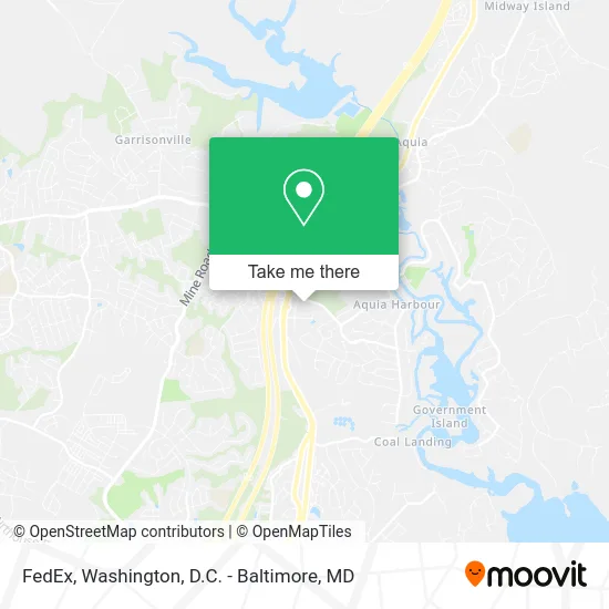
See FedEx, Stafford County, on the map
Public Transit to FedEx in Stafford County
Wondering how to get to FedEx in Stafford County? Moovit helps you find the best way to get to FedEx with step-by-step directions from the nearest public transit station.
Moovit provides free maps and live directions to help you navigate through your city. View schedules, routes, timetables, and find out how long does it take to get to FedEx in real time.
Looking for the nearest stop or station to FedEx? Check out this list of stops closest to your destination: 36 - Aquia Towne Center (Pnc Bank); 522 - Greenspring Dr. | Lakewood Dr..
Bus: 942, ROUTE 22, ROUTE 23.
Want to see if there’s another route that gets you there at an earlier time? Moovit helps you find alternative routes or times. Get directions from and directions to FedEx easily from the Moovit App or Website.
We make riding to FedEx easy, which is why over 1.5 million users, including users in Stafford County, trust Moovit as the best app for public transit. You don’t need to download an individual bus app or train app, Moovit is your all-in-one transit app that helps you find the best bus time or train time available.
For information on prices of bus, metro and train, costs and ride fares to FedEx, please check the Moovit app.
Use the app to navigate to popular places including to the airport, hospital, stadium, grocery store, mall, coffee shop, school, college, and university.
FedEx Address: 475 Aquia Towne Ctr Dr Stafford, VA 22554 street in Stafford County
- Wonder Esthetics,
- Living Water Ame Church,
- A Cut Above Property Service,
- Carlos O'Kelly's Mexican Cafe,
- PNC Mortgage,
- Enterprise,
- Juicy Bucket Seafood & Bar,
- NTB - National Tire & Battery,
- Main Content,
- Prince William County, Stafford, & Fredericksburg Homes,
- Shoppers,
- Front Gate,
- Credit Union 1,
- Aquia Harbour, Virginia,
- Aquia Harbour,
- Becki's Pampered Pups,
- Tobacco Hut,
- Regal Motors,
- 1st Auto Gallery,
- Iowa State U Entomology Univ of
Places Near FedEx (Stafford County)
- Basilica of the National Shrine, Washington,
- National Museum of African American History and Culture, Washington,
- Westfield Montgomery Mall, Montgomery County,
- Marriott Marquis Washington, DC, Washington,
- Amazon Hq2, Arlington County,
- M&T Bank Stadium, Baltimore,
- The Anthem, Washington,
- Washington DC VA Medical Center, Washington,
- National Theatre, Washington,
- Warner Theatre, Washington,
- Sibley Memorial Hospital, Washington,
- PG Mall, Prince George's County,
- Museum Of The Bible, Washington,
- Camden Yards, Baltimore,
- Georgetown, Washington,
- Rock Creek Tennis Center, Washington,
- Pennsylvania Ave NW (3rd st and pennsylvania), Washington,
- Capital One Arena, Washington,
- National Zoo, Washington,
- Washington National Cathedral, Washington
How to get to popular places in Washington, D.C. - Baltimore, MD with public transit
Get around Stafford County by public transit!
Traveling around Stafford County has never been so easy. See step by step directions as you travel to any attraction, street or major public transit station. View bus and train schedules, arrival times, service alerts and detailed routes on a map, so you know exactly how to get to anywhere in Stafford County.
When traveling to any destination around Stafford County use Moovit's Live Directions with Get Off Notifications to know exactly where and how far to walk, how long to wait for your line, and how many stops are left. Moovit will alert you when it's time to get off — no need to constantly re-check whether yours is the next stop.
Wondering how to use public transit in Stafford County or how to pay for public transit in Stafford County? Moovit public transit app can help you navigate your way with public transit easily, and at minimum cost. It includes public transit fees, ticket prices, and costs. Looking for a map of Stafford County public transit lines? Moovit public transit app shows all public transit maps in Stafford County with all Bus, Train, Metro, Light Rail and Ferry routes and stops on an interactive map.
Washington, D.C. - Baltimore, MD has 5 transit type(s), including: Bus, Train, Metro, Light Rail and Ferry, operated by several transit agencies, including WMATA, Montgomery County Ride On, Fairfax Connector, TheBus, PRTC, DASH - Alexandria, Arlington Transit (ART), RTA of Central Maryland, MDOT MTA, MDOT MTA Light RailLink, MDOT MTA Commuter Bus, MDOT MTA Local Bus, FXBGO!, Virginia Railway Express (VRE) and MARC