Directions to Federal Building (Richmond) with public transportation
The following transit lines have routes that pass near Federal Building
 Bus: 14, 78, FLIXBUS N2601, 1, 1A.
- Train: NORTHEAST REGIONAL.
How to get to Federal Building by bus?
Click on the bus route to see step by step directions with maps, line arrival times and updated time schedules.
From Potomac Mills Mall, Prince William County
198 minFrom Lorton, VA, Fairfax County
207 minFrom Lorton, VA - Amtrak Auto Train Station (LOR), Fairfax County
213 minFrom Busch Gardens Williamsburg (Employee Parking Lot), James City County
139 minFrom Hampton University, Hampton
289 minFrom Rose Gaming Resort, Prince William County
223 minFrom UVA Hospital Medical Center, Charlottesville
287 minFrom Amazon Fulfillment Center-Ric3, Richmond
57 minFrom Woodbridge, VA, Prince William County
142 min
How to get to Federal Building by train?
Click on the train route to see step by step directions with maps, line arrival times and updated time schedules.
Bus stops near Federal Building in Richmond
Train station near Federal Building in Richmond
- Pathrichmond Main Street Amtrak Station, 19 min walk,VIEW
Bus lines to Federal Building in Richmond
- 1, Chamberlayne/Azalea,VIEW
- 1A, Midlothian/Hull/Transfer Station,VIEW
- 1B, Hull/Warwick Via Southside Plaza,VIEW
- 2A, Forest Hill/North Ave,VIEW
- 2B, Jahnke/Forest Hill/North Ave,VIEW
- 2C, Semmes/Midlothian/Belt Blvd,VIEW
- 3C, U.S. 1/Harwood,VIEW
- 5, Cary/Main/Whitcomb,VIEW
- 7A, Laburnum/Nine Mile,VIEW
- 7B, Nine Mile,VIEW
- 14, Hermitage/Azalea,VIEW
- 29, Gaskins Express(Hrc),VIEW
- 50, Broad/Downtown,VIEW
- 78, Cary/Colorado/Downtown,VIEW
- 87, Bellemeade/Hopkins/Ss Plaza,VIEW
- 95, 95x Richmond-Petersburg Express (Pbg),VIEW
- 56, South Laburnum,VIEW
- 1C, Elkhart/Hull/Transfer Station,VIEW
What are the closest stations to Federal Building?
The closest stations to Federal Building are:
- 8th + Clay is 33 yards away, 1 min walk.
- 7th + Marshall is 175 yards away, 3 min walk.
- Transfer Station Bay B is 195 yards away, 3 min walk.
- Transfer Station Bay H is 244 yards away, 4 min walk.
- Pathrichmond Main Street Amtrak Station is 1557 yards away, 19 min walk.
Which bus lines stop near Federal Building?
These bus lines stop near Federal Building: 14, 78, FLIXBUS N2601.
Which train line stops near Federal Building?
NORTHEAST REGIONAL (Newport News)
What’s the nearest train station to Federal Building in Richmond?
The nearest train station to Federal Building in Richmond is Pathrichmond Main Street Amtrak Station. It’s a 19 min walk away.
What’s the nearest bus station to Federal Building in Richmond?
The nearest bus station to Federal Building in Richmond is 8th + Clay. It’s a 1 min walk away.
What time is the first train to Federal Building in Richmond?
The NORTHEAST REGIONAL is the first train that goes to Federal Building in Richmond. It stops nearby at 5:19 AM.
What time is the last train to Federal Building in Richmond?
The NORTHEAST REGIONAL is the last train that goes to Federal Building in Richmond. It stops nearby at 6:52 PM.
What time is the first bus to Federal Building in Richmond?
The 50 is the first bus that goes to Federal Building in Richmond. It stops nearby at 5:05 AM.
What time is the last bus to Federal Building in Richmond?
The 2C is the last bus that goes to Federal Building in Richmond. It stops nearby at 1:33 AM.
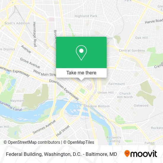
See Federal Building, Richmond, on the map
Public Transit to Federal Building in Richmond
Wondering how to get to Federal Building in Richmond? Moovit helps you find the best way to get to Federal Building with step-by-step directions from the nearest public transit station.
Moovit provides free maps and live directions to help you navigate through your city. View schedules, routes, timetables, and find out how long does it take to get to Federal Building in real time.
Looking for the nearest stop or station to Federal Building? Check out this list of stops closest to your destination: 8th + Clay; 7th + Marshall; Transfer Station Bay B; Transfer Station Bay H; Pathrichmond Main Street Amtrak Station.
Bus: 14, 78, FLIXBUS N2601, 1, 1A, 1B, 2A, 2B, 95, 56, 1C.Train: NORTHEAST REGIONAL.
Want to see if there’s another route that gets you there at an earlier time? Moovit helps you find alternative routes or times. Get directions from and directions to Federal Building easily from the Moovit App or Website.
We make riding to Federal Building easy, which is why over 1.5 million users, including users in Richmond, trust Moovit as the best app for public transit. You don’t need to download an individual bus app or train app, Moovit is your all-in-one transit app that helps you find the best bus time or train time available.
For information on prices of bus and train, costs and ride fares to Federal Building, please check the Moovit app.
Use the app to navigate to popular places including to the airport, hospital, stadium, grocery store, mall, coffee shop, school, college, and university.
Federal Building Address: 400 N 8th St Richmond, VA 23219 street in Richmond
- Partners Financial Federal Credit Union,
- Bob's Cafeteria,
- Congressman Robert Scott,
- Go Army Virginia,
- Employment & Training Admin,
- United States Government,
- Service Corps of Retired Executives,
- Score Mentors,
- ATM,
- Internal Revenue Service,
- Irs Office,
- Small Business Administration,
- US Small Business Adm,
- Nina Abady Festival Park,
- John Marshall Court,
- Hospital Hospitality Hse of Richmnd,
- The Doorways,
- Hospital Hospitality House,
- Commonwealth Of Virginia Parking,
- Lot 22
Places Near Federal Building (Richmond)
- Marriott Marquis Washington, DC, Washington,
- Westfield Montgomery Mall, Montgomery County,
- Camden Yards, Baltimore,
- PG Mall, Prince George's County,
- National Theatre, Washington,
- Rock Creek Tennis Center, Washington,
- Capital One Arena, Washington,
- Georgetown, Washington,
- National Museum of African American History and Culture, Washington,
- Washington DC VA Medical Center, Washington,
- The Anthem, Washington,
- M&T Bank Stadium, Baltimore,
- Basilica of the National Shrine, Washington,
- Warner Theatre, Washington,
- Museum Of The Bible, Washington,
- Washington National Cathedral, Washington,
- Amazon Hq2, Arlington County,
- Sibley Memorial Hospital, Washington,
- National Zoo, Washington,
- Pennsylvania Ave NW (3rd st and pennsylvania), Washington
How to get to popular places in Washington, D.C. - Baltimore, MD with public transit
Get around Richmond by public transit!
Traveling around Richmond has never been so easy. See step by step directions as you travel to any attraction, street or major public transit station. View bus and train schedules, arrival times, service alerts and detailed routes on a map, so you know exactly how to get to anywhere in Richmond.
When traveling to any destination around Richmond use Moovit's Live Directions with Get Off Notifications to know exactly where and how far to walk, how long to wait for your line, and how many stops are left. Moovit will alert you when it's time to get off — no need to constantly re-check whether yours is the next stop.
Wondering how to use public transit in Richmond or how to pay for public transit in Richmond? Moovit public transit app can help you navigate your way with public transit easily, and at minimum cost. It includes public transit fees, ticket prices, and costs. Looking for a map of Richmond public transit lines? Moovit public transit app shows all public transit maps in Richmond with all Bus, Train, Metro, Light Rail and Ferry routes and stops on an interactive map.
Washington, D.C. - Baltimore, MD has 5 transit type(s), including: Bus, Train, Metro, Light Rail and Ferry, operated by several transit agencies, including WMATA, Montgomery County Ride On, Fairfax Connector, TheBus, PRTC, DASH - Alexandria, Arlington Transit (ART), RTA of Central Maryland, MDOT MTA, MDOT MTA Light RailLink, MDOT MTA Commuter Bus, MDOT MTA Local Bus, FXBGO!, Virginia Railway Express (VRE) and MARC