How to get to Federal Voting Assistance Program - Fvap by bus?
Click on the bus route to see step by step directions with maps, line arrival times and updated time schedules.
From 2150 Pennsylvania Ave NW, Washington
82 minFrom Constitution Ave & 14th St, Washington
114 minFrom Hilton Arlington National Landing, Arlington County
42 minFrom Gsa Headquarters, Washington
90 minFrom Washington Passport Agency, Washington
91 minFrom Federal Reserve Board, Washington
93 minFrom Hilton Garden Inn Reagan National Airport, Arlington County
40 minFrom The Westin Alexandria Old Town, Alexandria
42 minFrom Trader Joe's, Washington
87 minFrom East Potomac Park Golf Course, Washington
132 min
Bus stops near Federal Voting Assistance Program - Fvap in Alexandria
- Mark Center Station (Bay 2), 6 min walk,VIEW
- Mark Center, 6 min walk,VIEW
- Mark Center Av+Mark Center Dr, 6 min walk,VIEW
- Mark Center Station (Bay 6), 6 min walk,VIEW
- Mark Center+Bay 4, 6 min walk,VIEW
- Mark Center Station , 7 min walk,VIEW
- Mark Center Transit Station, 7 min walk,VIEW
- N Van Dorn St+Maris Av, 7 min walk,VIEW
Bus lines to Federal Voting Assistance Program - Fvap in Alexandria
- 35, Alexandria City High School (Special),VIEW
- 102, King St-Old Town Station,VIEW
- A29, North To Metro Center,VIEW
- 36A, West Alexandria Transit Center (School Special),VIEW
- 36B, Mark Center Sta Via Valley Dr/Park Place,VIEW
- A76, North To Rosslyn,VIEW
- A90, North To Pentagon,VIEW
- 393, 393 Mark Ctr - Pentagon,VIEW
- A27, Pentagon-Shirlington-Van Dorn St,VIEW
- A28, Pentagon-Holmes Run-Landmark,VIEW
What are the closest stations to Federal Voting Assistance Program - Fvap?
The closest stations to Federal Voting Assistance Program - Fvap are:
- Mark Center Station (Bay 2) is 384 yards away, 6 min walk.
- Mark Center is 387 yards away, 6 min walk.
- Mark Center Av+Mark Center Dr is 399 yards away, 6 min walk.
- Mark Center Station (Bay 6) is 399 yards away, 6 min walk.
- Mark Center+Bay 4 is 447 yards away, 6 min walk.
- Mark Center Station is 469 yards away, 7 min walk.
- Mark Center Transit Station is 476 yards away, 7 min walk.
- N Van Dorn St+Maris Av is 519 yards away, 7 min walk.
Which bus lines stop near Federal Voting Assistance Program - Fvap?
These bus lines stop near Federal Voting Assistance Program - Fvap: A76, A90, F20.
What’s the nearest bus station to Federal Voting Assistance Program - Fvap in Alexandria?
The nearest bus stations to Federal Voting Assistance Program - Fvap in Alexandria are Mark Center Station (Bay 2), Mark Center, Mark Center Av+Mark Center Dr, Mark Center Station (Bay 6) and Mark Center+Bay 4. The closest one is a 6 min walk away.
What time is the first bus to Federal Voting Assistance Program - Fvap in Alexandria?
The 35 is the first bus that goes to Federal Voting Assistance Program - Fvap in Alexandria. It stops nearby at 4:54 AM.
What time is the last bus to Federal Voting Assistance Program - Fvap in Alexandria?
The 35 is the last bus that goes to Federal Voting Assistance Program - Fvap in Alexandria. It stops nearby at 2:35 AM.
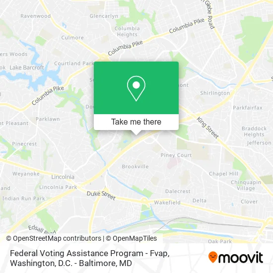
See Federal Voting Assistance Program - Fvap, Alexandria, on the map
Public Transit to Federal Voting Assistance Program - Fvap in Alexandria
Wondering how to get to Federal Voting Assistance Program - Fvap in Alexandria? Moovit helps you find the best way to get to Federal Voting Assistance Program - Fvap with step-by-step directions from the nearest public transit station.
Moovit provides free maps and live directions to help you navigate through your city. View schedules, routes, timetables, and find out how long does it take to get to Federal Voting Assistance Program - Fvap in real time.
Looking for the nearest stop or station to Federal Voting Assistance Program - Fvap? Check out this list of stops closest to your destination: Mark Center Station (Bay 2); Mark Center; Mark Center Av+Mark Center Dr; Mark Center Station (Bay 6); Mark Center+Bay 4; Mark Center Station ; Mark Center Transit Station; N Van Dorn St+Maris Av.
Bus: A76, A90, F20, 35, A29, 102, 36A, 36B, A27, A28.
Want to see if there’s another route that gets you there at an earlier time? Moovit helps you find alternative routes or times. Get directions from and directions to Federal Voting Assistance Program - Fvap easily from the Moovit App or Website.
We make riding to Federal Voting Assistance Program - Fvap easy, which is why over 1.5 million users, including users in Alexandria, trust Moovit as the best app for public transit. You don’t need to download an individual bus app or train app, Moovit is your all-in-one transit app that helps you find the best bus time or train time available.
For information on prices of bus and metro, costs and ride fares to Federal Voting Assistance Program - Fvap, please check the Moovit app.
Use the app to navigate to popular places including to the airport, hospital, stadium, grocery store, mall, coffee shop, school, college, and university.
Federal Voting Assistance Program - Fvap Address: 4800 Mark Center Dr Alexandria, VA 22350 street in Alexandria
- Office of People Analytics,
- Pac- Mark Center,
- Del Pepper Community Resource Center,
- Jeffrey Jackman, MD Facc,
- Office of the Chief Economist,
- Lot 537,
- Department of Defense Education Activity (Dodea),
- The Center for Alexandria's Children, Inc.,
- Ida,
- SNS Wellness,
- Ama Green Cleaning Agency,
- Katzen, MD, PC, Jay E,
- MC Dean,
- Alexandria Car Lock Out Locksmith,
- Sinclaire on Seminary,
- Metrobus Route 8Z, 8W, 8X, 8S,
- Seminary Towers,
- MCR I,
- Illy Coffee Bar,
- Alexandria Mark Hilton - Terrace Room
Places Near Federal Voting Assistance Program - Fvap (Alexandria)
- Westfield Montgomery Mall, Montgomery County,
- Pennsylvania Ave NW (3rd st and pennsylvania), Washington,
- Washington National Cathedral, Washington,
- Amazon Hq2, Arlington County,
- National Theatre, Washington,
- Warner Theatre, Washington,
- PG Mall, Prince George's County,
- The Anthem, Washington,
- M&T Bank Stadium, Baltimore,
- Georgetown, Washington,
- Sibley Memorial Hospital, Washington,
- Rock Creek Tennis Center, Washington,
- Capital One Arena, Washington,
- Camden Yards, Baltimore,
- National Museum of African American History and Culture, Washington,
- Marriott Marquis Washington, DC, Washington,
- Basilica of the National Shrine, Washington,
- Washington DC VA Medical Center, Washington,
- Museum Of The Bible, Washington,
- National Zoo, Washington
How to get to popular places in Washington, D.C. - Baltimore, MD with public transit
Get around Alexandria by public transit!
Traveling around Alexandria has never been so easy. See step by step directions as you travel to any attraction, street or major public transit station. View bus and train schedules, arrival times, service alerts and detailed routes on a map, so you know exactly how to get to anywhere in Alexandria.
When traveling to any destination around Alexandria use Moovit's Live Directions with Get Off Notifications to know exactly where and how far to walk, how long to wait for your line, and how many stops are left. Moovit will alert you when it's time to get off — no need to constantly re-check whether yours is the next stop.
Wondering how to use public transit in Alexandria or how to pay for public transit in Alexandria? Moovit public transit app can help you navigate your way with public transit easily, and at minimum cost. It includes public transit fees, ticket prices, and costs. Looking for a map of Alexandria public transit lines? Moovit public transit app shows all public transit maps in Alexandria with all Bus, Train, Metro, Light Rail and Ferry routes and stops on an interactive map.
Washington, D.C. - Baltimore, MD has 5 transit type(s), including: Bus, Train, Metro, Light Rail and Ferry, operated by several transit agencies, including WMATA, Montgomery County Ride On, Fairfax Connector, TheBus, PRTC, DASH - Alexandria, Arlington Transit (ART), RTA of Central Maryland, MDOT MTA, MDOT MTA Light RailLink, MDOT MTA Commuter Bus, MDOT MTA Local Bus, FXBGO!, Virginia Railway Express (VRE) and MARC